Approximately 400 feet of Ocean Path is closed between Otter Cliff and Otter Point for repairs. Pedestrians should follow detour signs to walk along a portion of Park Loop Road currently closed to vehicles.
Several trails closed for Peregrine falcon nesting season
Until further notice, typically mid-August, Penobscot East Trail, Jordan Cliffs Trail, Precipice Trail, and Valley Cove Trail are closed for Peregrine falcon nesting season. Also, as roads reopen, the Precipice Trail parking lot will remain closed. More
Historic carriage roads closed until further notice for "mud season"
Spring thaw has led to temporary closures to protect Acadia's historic carriage roads during "mud season." Walking, bicycling or riding horses in these wet and soft conditions can cause costly ruts and potholes that channel water and exacerbate erosion. More
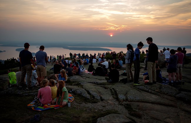
Sunrise is the busiest time to visit Cadillac Mountain
Ashley L. Conti/Friends of Acadia
Visit Cadillac Mountain
Cadillac Mountain is a popular destination for visitors to Acadia National Park. Accessible by car, it is the highest point on the eastern seaboard of the U.S., and offers magnificent views of a glaciated coastal and island landscape. The short, paved Cadillac Summit Loop Trail, interpretive waysides, restrooms, and gift shop are located at the summit.
People have enjoyed the spectacular views from Cadillac Mountain (formerly Green Mountain) for thousands of years, as this area is the homeland of the Wabanaki people. European settlement on Mount Desert Island begin in the 1600s, and soon after the summit was used for mapping the coastline. By the late-1800s, Cadillac Mountain was a popular destination for tourists.
The early 20th century marked a shift towards preservation efforts of the summit. It was purchased by the Hancock County Trustees for Public Reservations in 1908, and became part of the original land acreage of Sieur de Monts National Monument, what later became Acadia National Park.
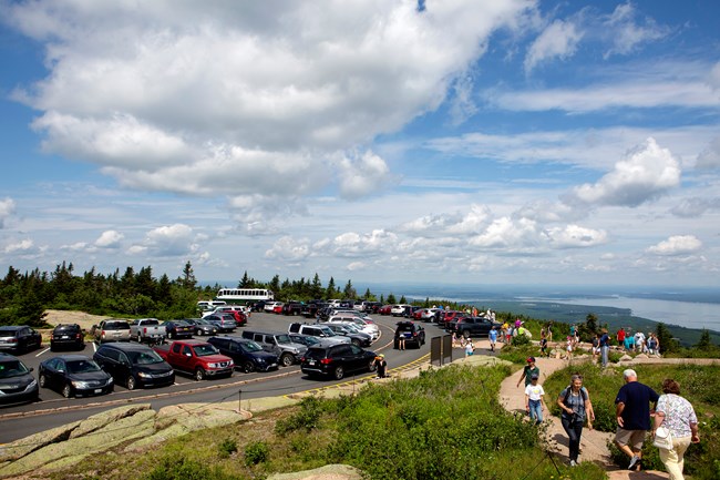
The summit is often congested with vehicles and visitors throughout the day
Photo by Ashley L. Conti, Friends of Acadia, NPS
Getting Around
Cadillac Summit Road is located off the Park Loop Road, and can be accessed at the beginning or end of the loop. It is a windy, paved 3.5 miles up to the summit. Be aware of road cyclists and visitors on and alongside the road. No RVs or trailers are allowed up Cadillac Summit Road.
Parking
The summit parking area becomes congested with autos and tour buses most of the summer, and visitors crowd a short summit walkway and the overlooks. Be cautious of people crossing from every direction when approaching and in the parking lots.
Public Transportation
There is no public transportation up to the summit. If you plan to hike up, you must return back down the trail to an Island Explorer shuttle stop or parking area. It is not advisable to walk down the Cadillac Summit Rd, especially with heavy use by vehicles, bicyclists, and motor coaches.
Cadillac Mountain
This map shows a detailed view of the Cadillac Mountain area. The park boundary is shaded light green and bordered by a darker green line. Trails leading to the summit are highlighted in orange. The road and parking area are shaded grey. A black icon with a white ‘P’ also marks the parking. Each data point and highlighted trail is clickable; when selected, it displays the name.
Accessibility
Trails
Portions of the Cadillac Summit Loop are paved, wide enough for a single wheelchair, and provide scenic views of Frenchman Bay and the Porcupine Islands. Other sections are very steep or contain steps up and down. All other trails to and around Cadillac Mountain are not accessible.
Facilities and Services
Cadillac Mountain Gift Shop has an accessible entrance and restrooms. A limited number of designated accessible parking spaces are marked. These are reserved for vehicles displaying an accessibility placard or license plate.
What Else to Know
How tall is Cadillac Mountain? The summit is 1530 ft (466m).
When was the road constructed? The present road to the summit was constructed from 1924 to 1931.
What is the weather like at the summit? Weather patterns can change rapidly along the coast, and Cadillac Mountain is no exception. Temperatures and conditions can be dramatically different from the Park Loop Road to the summit. Be prepared for wind, rain, fog, and cold—even in the summer months.
Where is the "true" summit? The true summit is near the radio tower behind the gift shop.
Where are the bathrooms? The restrooms are located by the gift shop.
When should I arrive for sunrise? For sunset? Arrive roughly an hour before sunrise or sunset. Note: These times of day are extremely popular at the summit and often parking is full.
What are all the ropes for? Specific areas are roped off for vegetative restoration. Please respect signs and stay on designated trails.
When is it the first place you can see the sunrise? From October 7 to March 6, Cadillac Mountain is the first place in the country you can see the sun rise.
What trails lead up to the summit? Cadillac North Ridge Trail (4.4 miles roundtrip) and Cadillac South Ridge Trail (7.1 miles roundtrip) connect to the parking lot at the summit. The Gorge Path (as part of the Gorge and A Murray Young Paths Route) junctions with the Cadillac Summit Loop Trail. Other trails can be connected together on the east side of Mount Desert Island to reach the summit.
My name is Sara, and I am here with the SCA (Student Conservation Association) as the Raptor Intern at Acadia National Park. I am assisting in the Hawk Watch program and will be providing updates on our 30th season of Hawk Watch as I write the “Riding the Winds” blog.
Cadillac Mountain is a popular destination for visitors to Acadia National Park. Accessible by car, it is the highest point on the eastern seaboard of the U.S., and offers magnificent views of a glaciated coastal and island landscape. The short, paved Cadillac Summit Loop Trail, interpretive waysides, restrooms, and gift shop are located at the summit.
At the overlook off the Cadillac West Parking Lot, the group noted fresh areas of erosion in and around stands of rare alpine blueberry and blooming pin cherry. A popular place for watching the sunset, the bedrock slope is also vulnerable to rain storms of increasing intensity. Once plants are damaged, an inch of rain can easily wash away what took decades or centuries to build.
Large cedar-frame tripod waysides are telling visitors a story about innovative management strategies underway at two prominent destinations in Acadia – the summit of Cadillac Mountain and Great Meadow wetland. This web-based product is intended to make those displays more accessible for people who have mobility, visual, and cognitive impairments. It also documents the project for virtual visitors who may never have opportunity visit Acadia in person.
The National Park Service looks forward to welcoming visitors to Acadia National Park this season! The Park Loop Road, including the Cadillac Summit Road, will open to motor vehicles on April 15. The Hulls Cove Visitor Center opens to visitors on May 6. Campgrounds and other park facilities will open on various dates throughout April and May. Learn more about operating hours and seasons at Acadia.
We expect the 2022 summer season to be BUSY, so make sure to plan ahead and recreate responsibly while you’re here. Prepare for your trip to Acadia National Park by following our list of the top ten tips.