|
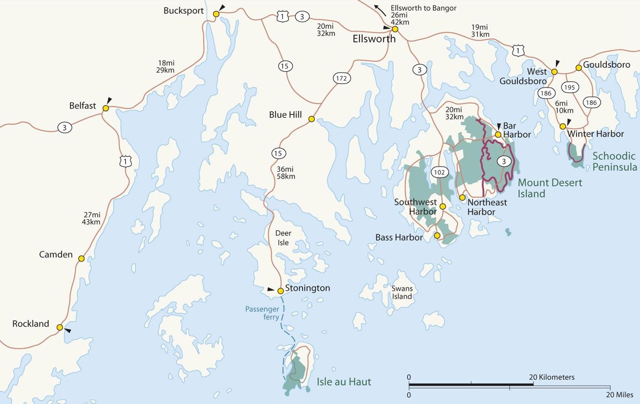
Acadia National Park may appear small on a map, but the park encompasses nearly 50,000 acres along the Atlantic Coastline of Maine — including Mount Desert Island, Schoodic Peninsula, Isle au Haut, and other outer islands. 60 miles of coastline, 33 miles of scenic motor roads, 45 miles of carriage roads, and more than 150 miles of hiking trails provide numerous ways to explore the park. 
Mount Desert IslandAcadia National Park is mostly located on Mount Desert Island, the largest island off the coast of Maine. The park stretches across about half of the island, roughly divided by Somes Sound to create east and west sides. |
|
The east side of Mount Desert Island is the most visited area of Acadia. The 27-mile (43 km) Park Loop Road system offers outstanding views and access to popular spots.
The west side of Mount Desert Island offers quiet, more secluded recreational opportunities and coastal views from the park. Highlights Seawall, Bass Harbor Head Light Station, Acadia Mountain, Beech Mountain, Echo Lake Beach, and Carroll Homestead Visitor Services Seawall Campground, Seawall Ranger Station, and Pretty Marsh Picnic Area Access By car or bus Acadia ElsewhereOutside the park on Mount Desert Island, Acadia manages land on Schoodic Peninsula, Isle au Haut, and 18 other coastal islands.The Schoodic Peninsula offers a wide array of opportunities for discovering Maine's rugged coast on the mainland. Schoodic Point, Blueberry Hill, and Frazer Point
Isle au Haut is translated to "High Island" in English and located off the coast of Stonington, Maine. It is the most remote area of Acadia and accessible by ferry only.
Outer islands include the Cranberry Isles and Baker Island, located south of Mount Desert Island. 
Extend Your Maine AdventureVisit a list of all National Park Service sites across Maine, including –
|
Last updated: January 17, 2023
