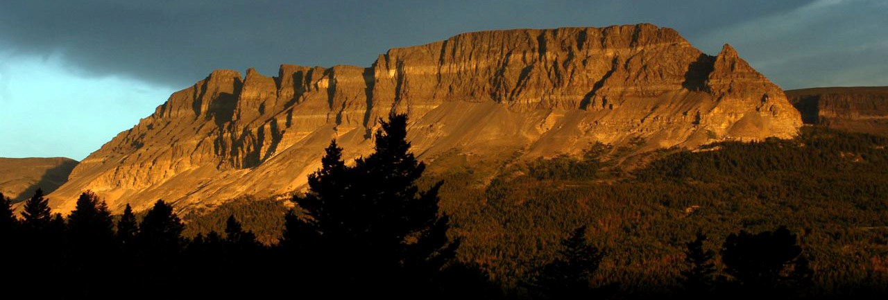
NPS photo. Glacier's landscape of mountains and valleys illustrates millions of years of geologic history. The pictures painted by the park's rainbow of rocks tell stories of an ancient sea, colossal glaciers, and dramatic tectonic shifts. Visible throughout the park, the mountains of Glacier sustain diverse plant and animal populations with unique origin stories. These mountains are also home to the headwaters of three different river systems that travel across North America–supporting life along streams, creeks, and lakes, both here and across the continent. 
NPS photo. What is a continental divide?A continental divide is a naturally occurring boundary separating a continent’s river systems. Each river system feeds into a distinct ocean, basin, bay, or sea. The Continental Divide of the Americas, also known as the Great Divide, runs through Glacier National Park. Raindrops that fall on the east side of the divide flow into the Missouri River, then the Mississippi, then to the Gulf of America. On the west side of the divide, rain flows westward into the Columbia River drainage and to the Pacific Ocean. Rivers in the northeastern part of the park flow toward the Saskatchewan River, eventually reaching Hudson Bay.
NPS photo. Where is Triple Divide Peak?Glacier is home to an unusual triple divide, where three drainages come together at a single point. Triple Divide Peak is within the Lewis Range of the Rocky Mountains along the east side of the park. Aptly named, waters on each side of the mountain start their journey and flow toward three different oceans. Connected to water sources across North America, the health of Glacier’s ecosystems affects communities near and far.
NPS photo. Why are Glacier's mountains important?Wide variations in elevation between Glacier’s high peaks and low valleys contribute to five distinct but overlapping vegetation zones. These different habitats support diverse populations of plants and animals, including rare and threatened species. High mountain areas are rare in many places, but within the park, they create a haven for animals that thrive in an alpine ecosystem. Snow patches that linger late into summer are a necessity for wildlife such as mountain goats, wolverines, pikas, and ptarmigan. Meltwater from these snowfields also provide water to alpine wildflowers that color the mountainsides in spring and summer and waterfalls where rare black swifts live. As global temperatures warm and some species move up in elevation in search of cooler habitats, there is a risk that alpine plants and animals may not be able to adapt quickly enough to these changes and/or compete with encroaching species. Learn more about these impacts on our climate change page.
NPS photo. When were Glacier's mountains made?Mountain building doesn’t happen overnight. Geologic processes over hundreds of millions of years created the park we see today. Glacier’s landscape formed primarily through tectonic activity that uplifted the mountains, and glaciation that carved out the valleys. A major collision of tectonic plates began about 150 million years ago, compressing, folding, and uplifting the mountains that would become the ones we see now.Sixty to seventy million years ago, dramatic movement along the Lewis overthrust pushed the ancient, multicolored sedimentary rocks, which make up the park’s mountains, up and over the younger rocks beneath. This fault can be seen in many places but is most famously photographed from Marias Pass on US Highway 2. Starting about 2 million years ago, during the Pleistocene epoch, massive glaciers filled the valleys and carved craggy ridges, peaks, and amphitheaters on the mountains they moved through. Smaller glaciers, which formed about 7,000 years ago, continue to shape alpine areas. 
NPS photo. How many mountains are there?So many! Three mountain ranges border or cross Glacier: the Lewis Range on the east side of the park, the Livingston Range on the west side of the park, and the Clark Range that dips into the northwestern corner of Glacier. There are more than 150 peaks over 8,000 feet (2,400 m), and six peaks over 10,000 feet (3,050 m). Elevation within the park varies from a low of 3,150 feet (960 m) to the very highest peak, Mt. Cleveland, which reaches 10,466 feet (3,050 m).Learn more about Glacier's geology
|
Last updated: February 18, 2025


