Spring Bicycling on Going-to-the-Sun Road
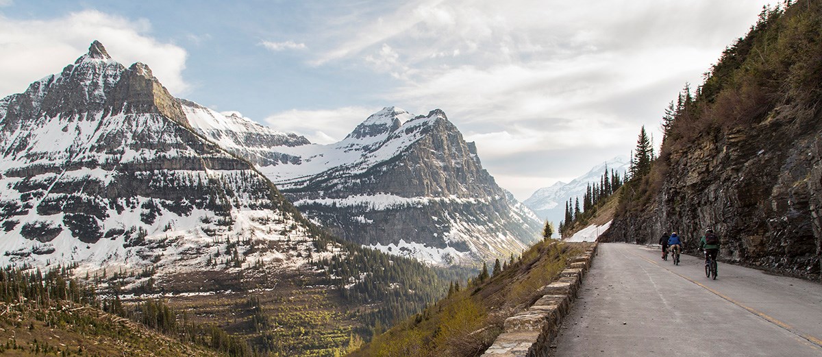
In Spring, portions of Going-to-the-Sun Road are open for hiking and biking, beyond the vehicle closure.
Closures
Road Crew Closures are in place Monday through Thursday during plowing. Visitors may advance to the Avalanche Hazard Closure when road crews are not working. Avalanche Hazard Closures are in place at all times. Progressive closure locations are determined weekly on Thursdays. Visitors are prohibited from going past the hiker/biker closures. Violators are putting their safety and the safety of our park rangers at risk and could face up to a $5,000 fine and up to 6 months in jail. You can find closure information on our Road Status Page.
Shuttles
During hiker-biker season, shuttles are typically available to transport bicyclists and their bicycles from the Apgar Visitor Center to the point where the road is restricted to vehicles. Parking lots fill early at this time of the year, and it may be wise to plan on using a shuttle.
- Bring extra warm layers for when you’re finished riding. Most bicyclists get wet from precipitation and snowmelt along the upper elevations of Going-to-the-Sun Road.
- Bring enough food and water for the full day, as there are typically no services at this time of the year beyond Apgar Village and West Glacier.
Hypothermia
Rangers often must respond to bicyclists with cases of hypothermia from riding downhill in the spring and early summer. Riders often wear t-shirts and shorts heading uphill, as the 6% grade on a bike is heavy aerobic exercise. Downhill bicyclists often wear winter hats, gloves, and coats. While the exercise keeps you warm, zooming down the mountainside at high speeds can rapidly cool you.
-
Temperatures at various elevations can differ significantly. It may feel like summer down below and winter up high.
-
Glacier’s weather is rapidly variable at high elevations. There can be sudden graupel, hail, rain, and snow events. Keep your eyes peeled for incoming weather and check the weather reports for both low elevations on the road and Logan Pass to know what to expect.
-
Windbreakers or rain shells over thin insulated jackets are good layers to bring for possible inclement weather conditions.
-
A thin, neoprene hat will help keep your head warm, and it will fit under a helmet.
-
Gloves and neck gaiters assist greatly with retaining warmth.
-
Bring additional dry and warm layers for after your ride.
Avalanche Danger
Generally, avalanches do not pose a significant threat to areas below The Loop. While the park does monitor avalanche danger and will subsequently restrict access to portions of the road as necessary, bicyclists have been caught between avalanches on the road in years past. You should always keep your eyes and ears peeled for signs and areas of avalanche danger. Check Flathead Avalanche for more information on avalanches and avalanche forecasts.
Rocks and Rockfall
Rocks of all sizes can always be found on the road. While smaller ones pop tires, larger rocks can throw you entirely off course as you’re speeding down the mountainside, leading to potential high-speed crashes and severe injury. Make sure to stay alert, watch where you’re riding, avoid running over rocks, and always wear a helmet.While it’s uncommon, rocks can fall from higher elevations and tumble with force and high velocity down to the road. Know that you are biking at your own risk in a natural, hazardous landscape.
People
Rangers often must respond to uphill-downhill bicyclist collisions. Do your best to stay in the right lane, with slower traffic keeping to the far right. Skilled riders travel downhill at extremely high speeds. Stay alert and look far ahead whenever you have visibility, so that you know when others may be coming around blind corners.Slow down and exercise extreme caution while bicycling through The Loop. It’s a congested area and a popular place for families to rest with younger children.
Wildlife
Pay attention to the “Safety” list above, as animal sightings are common on the road during the hiker-biker season. During a wildlife encounter, you may be in an area with steep cliffs both above and below. Be sure to stop at a distance that allows the animal a clear route to move away from you. Moose and deer are common at lower elevations. Goats, sheep, and marmots are seen at higher elevations, and bears are common at all elevations.
Ride Distances and Elevation Gain
From the road closure on the west side at the Lake McDonald Lodge:
-
Avalanche Creek – 5.5 mi; 219 ft
-
the West Tunnel – 12.7 mi; 1,030 ft
-
the Loop – 13.3 mi; 1,100 ft
-
Big Bend – 18 mi; 2,545 ft
-
Logan Pass – 21 mi; 3,427 ft
From the road closure on the west side at Avalanche Creek:
-
the West Tunnel – 7.2 mi; 811 ft
-
the Loop – 7.8 mi; 881 ft
-
Big Bend – 12.5 mi; 2,326 ft
-
Logan Pass – 15.5 mi; 3,208 ft
From the road closure on the east side at Rising Sun:
-
Sun Point – 3.5 mi; 181 ft
-
Sunrift Gorge – 4.2 mi; 223 ft
-
St. Mary Falls Trailhead – 4.7 mi; 295 ft
-
Jackson Glacier Overlook – 6.9 mi; 846 ft
-
Siyeh Bend – 8.9 mi; 1,421 ft
-
Lunch Creek – 10.9 mi; 2,110 ft
-
Logan Pass – 11.5 mi; 2,313 ft


