|
Visit our keyboard shortcuts docs for details
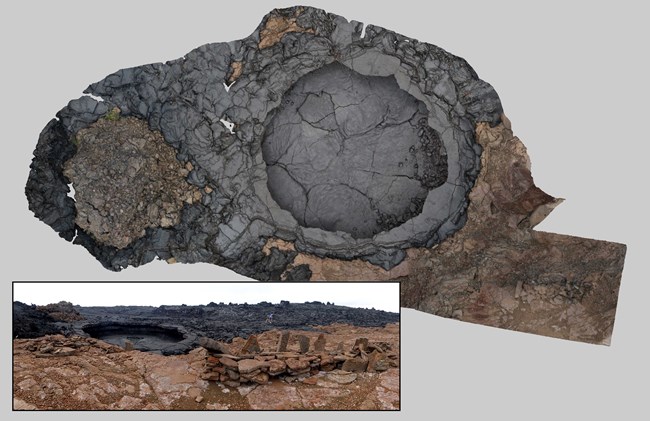
Watch this video to learn about Pahu Manamana o ʻUmi. High on the southwest slopes of Mauna Loa is a significant archaeological site containing a low, dry-stacked pahoehoe platform (paepae) with several upright stones atop it (manamana) and a small stack of rocks in front of the platform (pānānā). This feature has come to be known as Pahu Manamana o ‘Umi. 
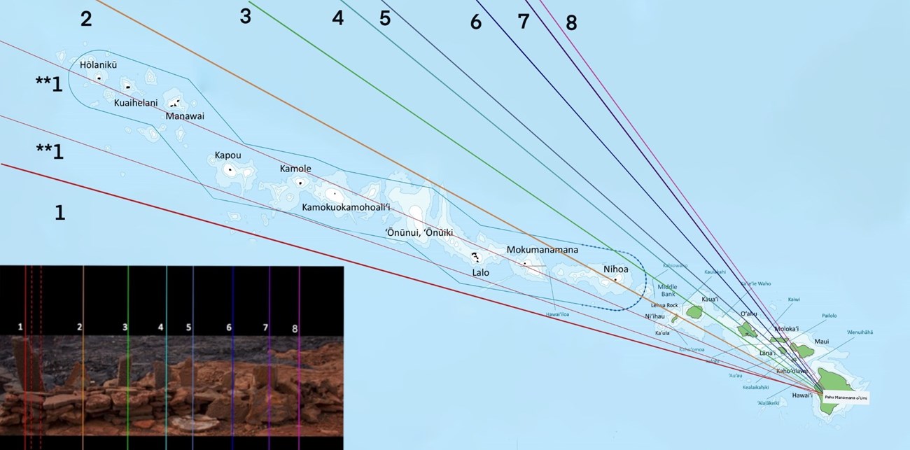
NPS Photo/Edith Kanakaʻole Foundation Using historical chants and traditional ecological knowledge passed down through generations, the Edith Kanakaʻole Foundation (EKF) conducted extensive anthropological and astronomical research on the origin and function of this feature. They associated the site with ʻUmi or ʻUmialīloa, an aliʻi nui (high chief) who ruled the Island of Hawaiʻi around the early 16th century. ‘Umialīloa is credited with creating many similar solar and stellar instruments known as pahu manamana. The researchers utilized a traditional Papakū Makawalu methodology to analyze the structure. Papakū Makawalu divides the universe into three interconnected regions: Papahulilani which relates to the activities of the heavens, Papahulihonua which concerns the elements of the earth, and Papahānaumoku which incorporates the cycles of all living things. Using this method, the researchers theorized that this site once functioned as a stellar instrument with points on the uprights corresponding to the locations of specific stars in the night sky. They also theorized that it functioned as a geographic compass with each upright stone correlating with locations in Hawaiʻi and Polynesia. The researchers concluded that Native Hawaiians may have utilized instruments like this one to track the moving planets, the rising and setting of stars, and the creation of the pae ʻāina (the archipelago of Hawaiʻi) as islands move over the volcanic hotspot. 
NPS map adapted from EKF and NOAA graphics 1. The French Frigate Shoals or Mokumanamana (the first stone has multiple possible orientations); 2. Nihoa; 3. The Kaulakahi Channel; 4. Kauaʻi; 5. Oʻahu; 6. Kahoʻolawe, Lānaʻi & Molokaʻi; 7. Kahoʻolawe & Molokaʻi; 8. Maui & Molokaʻi.
EKF completed the study of Pahu Manamana o ʻUmi in 2018 and utilized their observations a year later on a research voyage to the small, culturally and spiritually significant Northwestern Hawaiian Island of Mokumanamana. The forty-six acre island hosts a dense concentration of pahu manamana similar in construction to the one found on Mauna Loa. In collaboration with Native Hawaiian navigators, part of the research team sailed on a traditional voyaging canoe using a star alignment between Pahu Manamana o ‘Umi and Mokumanamana observed during the 2018 study. Navigating solely with traditional methods, they successfully reached their destination. This practical implementation of the study’s findings supports the theory that pahu manamana could be used as navigational tools (link to news video of the voyage). EKF’s continued research on pahu manamana furthers our understanding of how these historical instruments may have been used in Hawaiian navigational astronomy and how similar sites across the archipelago may be related. The research also helps us better understand connections Native Hawaiians recognized in the environment and how those connections may have influenced aspects of Hawaiian life, including the keeping of time, religious ceremonies, and political governance. 

Left image
Right image

NPS Photo/International Archeology, LLC Learn more about Mokumanamana: Archeology of the “Mystery Islands” Nihoa and Mokumanamana (U.S. National Park Service) (nps.gov) |
Last updated: February 28, 2024
