|
Visit Directions & Transportation for driving directions, and check Operating Hours & Seasons for an up-to-date schedule. Download the NPS AppThe NPS app contains a park map, guided tours, and content to help you learn about the park. Download the NPS app at the Apple Store or on Google Play 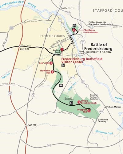
Fredericksburg BattlefieldAddressFredericksburg Battlefield Visitor Center: 1013 Lafayette Boulevard, Fredericksburg, VA 22401 Chatham: 120 Chatham Lane, Fredericksburg, VA 22405 Fredericksburg Driving TourThe Fredericksburg Battlefield driving tour begins at the Fredericksburg Battlefield Visitor Center, located along the Sunken Road portion of the battlefield. Stop 2 takes you across the river to Chatham Manor, a Union headquarters and field hospital. Stops 3-6 are along the Confederate defensive line, including the location of the only Union breakthrough during the battle. 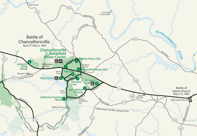
Chancellorsville BattlefieldAddressChancellorsville Battlefield Visitor Center: 9001 Plank Road, Spotsylvania, VA 22553 Chancellorsville Driving TourThe Chancellorsville Battlefield driving tour begins at the Chancellorsville Battlefield Visitor Center, located near where "Stonewall" Jackson was mortally wounded. The following stops weave through the battlefield, stopping at significant home sites and critical points of the battle, like Jackson's Flank Attack and the Hazel Grove-Fairview corridor. Consider driving to partner-owned Day 1 at Chancellorsville, just to the east, or drive the Jackson Trails in the footsteps of Jackson's soldiers on his famous flank march.

Wilderness BattlefieldAddressWilderness Battlefield Exhibit Shelter: 35347 Constitution Highway, Locust Grove, VA 22508 Wilderness Driving TourThe Wilderness Battlefield driving tour begins at Grant's Headquarters, proceeds to Ellwood House used by General Warren as his headquarters, then to the Wilderness Battlefield Exhibit Shelter in Saunders Field, where the battle opened, and continues down the Confederate line to the key corridor of the battlefield, stops 6-8. Ellwood Manor is open seasonally. The grounds at Ellwood are open and accessible via a gravel driveway from dawn to dusk. 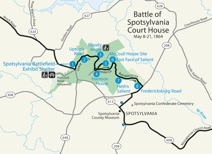
Spotsylvania BattlefieldAddressSpotsylvania Battlefield Exhibit Shelter: 9550 Grant Drive West, Spotsylvania, VA 22553 (Is this address not working for you? Try the following GPS coordinates: 38.219245, -77.614099) Spotsylvania Driving TourThe Spotsylvania Battlefield driving tour begins at the Spotsylvania Battlefield Exhibit Shelter beside Laurel Hill where the battle opened. Follow the remaining tour stops to understand how this two week battle unfolded, with its horrific climax at the Bloody Angle, tour stop 3. As our best-preserved battlefield, Spotsylvania Battlefield also features a 7.5-mile trail that weaves throughout the battlefield. To see a set of reconstructed earthworks, deviate from the driving tour by bearing right before you reach stop 4, the Harrison House. The reconstructed works are at the road's dead end. Retrace your steps to continue on the driving tour. 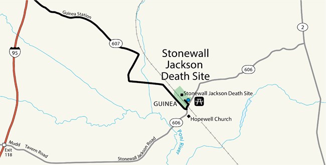
"Stonewall" Jackson Death SiteAddress12019 Stonewall Jackson Road, Woodford, VA 22580 The "Stonewall" Jackson Death Site, where the Confederate general spent the last days of his life, is located south of Fredericksburg in the small community of Guinea Station. The building is open seasonally. Visit the Operating Hours & Seasons page for current scheudle. Tour the Jackson Death Site GroundsThe "Stonewall" Jackson Death Site grounds are always open sunrise to sunset. Explore the grounds to learn about the history of this place and what it means today. 
Trails & Brochures
Download trail maps and discover each battlefield on your own time. |
Last updated: July 17, 2025
