The interior of Chatham will be closed for a planned Maintenance project until further notice. The Chatham gate remains open 9 am-5 pm and the grounds remain open sunrise to sunset. More
Fighting in the Battle of the Wilderness started at Saunders Field and lasted a brief, but harrowing two days.
NPS Photo
Visiting the Battlefield
The Battle of the Wilderness took place over two days in May 1864. After US forces held the two intersections around which the fighting took place, they continued south, only to re-engage Confederate forces at Spotsylvania Court House. The park's visitor services, driving route, and trails provide a variety of options for exploring and connecting with the history of the battle.
Wilderness Exhibit Shelter Open sunrise to sunset 35347 Constitution Highway, Locust Grove, VA 22508
Open-air exhibits to orient visitors to the Battle of the Wilderness. No facilities available.
Ellwood Manor Grounds open sunrise to sunset, building open seasonally 36380 Constitution Highway, Orange, VA 22960
When open, speak with staff about the history of Ellwood Manor and its role in the Chancellorsville and Wilderness Campaigns.
*The Chancellorsville Battlefield Visitor Center includes exhibits covering the Battle of the Wilderness The Wilderness passport stamp is available at Chancellorsville when Ellwood is closed.*
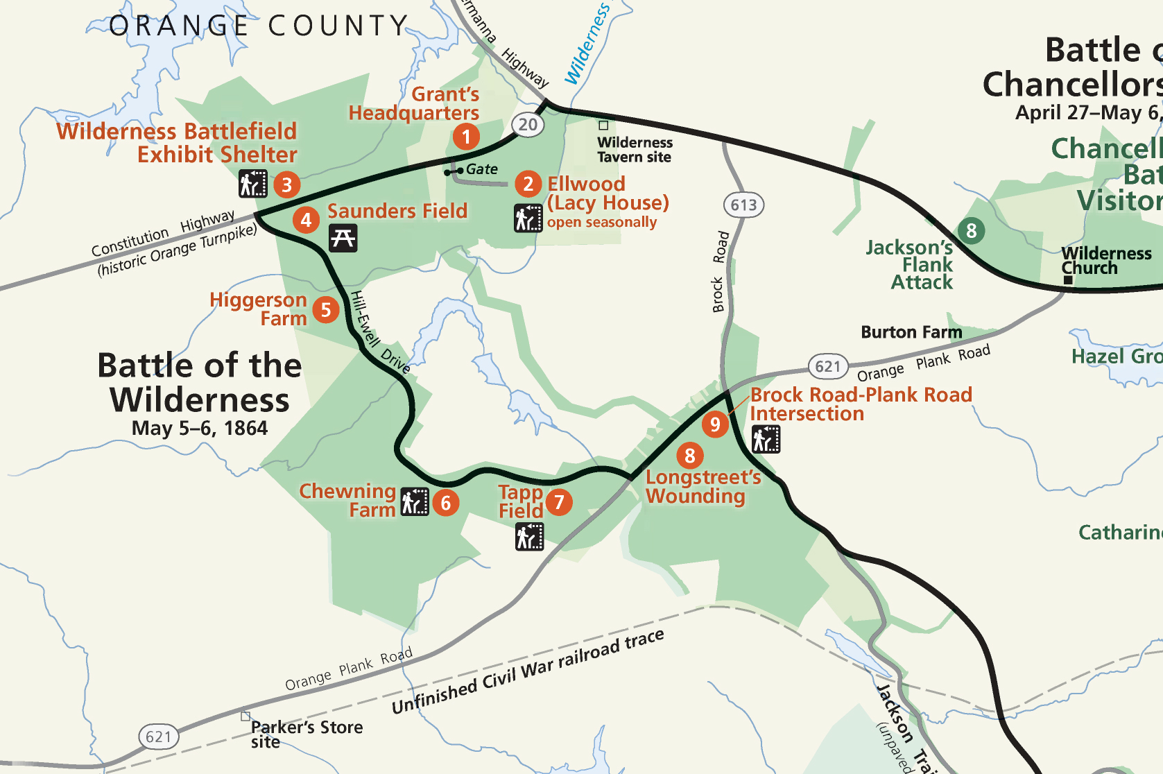
The Wilderness Driving Tour follows the numbered stops on the park map. Below is a summary of the driving tour. Follow the driving tour on the NPS App (best for following the tour onsite, available at the Apple Store and on Google Play, audio is currently in development for this tour)
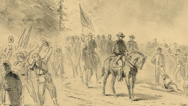
Grant's Headquarters: Recently appointed to command all the US Armies, General Ulysses S. Grant made his headquarters during the Battle of the Wilderness, the first engagement in the Overland Campaign, at this spot.
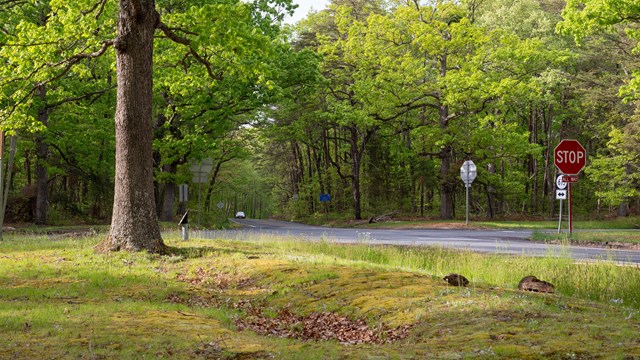
Wilderness Exhibit Shelter: Gain an overview of the battle here and walk Saunders Field, the location of the first and last actions in the Battle of the Wilderness.
Saunders Field: View Saunders Field from the Confederate earthworks located here. US and Confederate forces reached a stalemate here.
Higgerson Farm: Intense fighting occurred in the fields and woods around the Higgerson Farm.
Chewning Farm: Key ground and roads around the Chewning Farm were placed between the Confederates fighting on the Orange Tunrpike and the Orange Plank Road.
Tapp Field: Confederates arrived here on May 5 and, from here, would struggle to take the intersection with the Brock Road, held by US forces for the duration of the battle.
Longstreet's Wounding: Confederate General James Longstreet was wounded by friendly fire after his men helped push back an assault by US forces on the morning of May 6.
Brock Road-Plank Road Intersection: Heavy fighting occurred here on both days of the battle as US and Confederate forces vied for control of the intersection.
Wilderness Crossing Trail (pdf): 1.5 mi (2.4 km) round trip. Start: Ellwood's driveway. Explore the plantation grounds and dusty crossroads that defined this break in the Wilderness. When Ellwood is closed, park at the Ellwood gate, walk .5 mi (.8 km) to the trailhead.
Gordon Flank Attack Trail (pdf): 2.1 mi (3.4 km) loop. Start: Wilderness Battlefield Exhibit Shelter, Tour Stop 2. Follow the historical earthworks remaining from a crushing Confederate flank attack late on May 6, 1864.
Vermont Monument Trail (pdf): 0.4 mi (.7 km) loop. Start: Brock Road-Plank Road Intersection, Tour Stop 8. Walk the same ground as the renowned Vermont Brigade and see the memorial to this unit which bore the brunt of the fighting in this area.
Widow Tapp Farm Trail (pdf): 1 mi (1.6 km) round trip. Start: Tapp Field, Tour Stop 6. As the battle hung in the balance on the edge of this field, Confederate reinforcements arrived here just in time to save the Army of Northern Virginia.
Federal Line Trail (pdf): 7.2 mi (11.6 km) round trip. Start: Picnic area south of Saunders Field, Tour Stop 3. Walk the length of the Union line, featuring remarkable earthworks and artillery positions.
Locations:Fredericksburg & Spotsylvania National Military Park
The open, grassy field besides the main house was the location of the Ellwood service yard. Many buildings where enslaved people once lived and worked once stood here.
Fredericksburg & Spotsylvania National Military Park
Locations:Fredericksburg & Spotsylvania National Military Park
Established in 1807, the Ellwood cemetery contains the remains of fifteen members of the Jones family who owned Ellwood in the 1800s. Today, the cemetery contains one marker, for the amputated arm of Confederate General "Stonewall" Jackson. How did this small family cemetery become intertwined with the history of Jackson and the Lost Cause?
Fredericksburg & Spotsylvania National Military Park
Locations:Fredericksburg & Spotsylvania National Military Park
The Ellwood Brooder Barn was built around 1950 for raising chickens. The owner of Ellwood at the time, Leo Jones, had turned Ellwood into a productive livestock farm. Today the main part of the building is used for storage. Public restrooms are located at the side of the building.
Fredericksburg & Spotsylvania National Military Park
Locations:Fredericksburg & Spotsylvania National Military Park
Ellwood was a slave plantation dating to the 1790s. During the Battle of Chancellorsville, this building was a Confederate field hospital. During the Battle of the Wilderness it was the headquarters for US Generals Warren and Burnside. Though most famous because Confederate General "Stonewall" Jackson's amputated left arm is buried in the family cemetery, the house has many more stories to tell. The house is open seasonally.
Fredericksburg & Spotsylvania National Military Park
Locations:Fredericksburg & Spotsylvania National Military Park
First constructed in the 1700s, Ellwood is best known for its association with the Battles of Chancellorsville and the Wilderness during the Civil War. However, this place has a much wider and more expansive history. Learn about the people who first inhabited this land and the ways that colonial settlement altered the physical landscape.
Fredericksburg & Spotsylvania National Military Park
Locations:Fredericksburg & Spotsylvania National Military Park
This crossroad was the key to the Battle of the Wilderness. Here, United States soldiers repulsed repeated assaults on May 5 and May 6, 1864. With the crossroad secure, the United States Army had a position from which to continue south, marking the end of the first engagement of the Overland Campaign, which would ultimately bring the Army of Northern Virginia to its knees.
Fredericksburg & Spotsylvania National Military Park
Locations:Fredericksburg & Spotsylvania National Military Park
Gain an understanding of the Battle of the Wilderness with the overview provided on the interpretive panels and battle map at this location. Situated in Saunders Field, this was the location of the opening shots of the Overland Campaign, as well as the final action in the 2-day Battle of the Wilderness.
Fredericksburg & Spotsylvania National Military Park
Locations:Fredericksburg & Spotsylvania National Military Park
The farm road here leads to the place where Chewning Farm once stood, a location that was occupied and tactically important to both Confederate and United States forces.