|
To view the park's official brochure map, use the drop-down menu in the upper left corner of the map below to change the selection from "Park Tiles" to "Brochure Map." The "Park Tiles" option displays an interactive map where you can click on points of interest to read more. 
Brochure Maps
Download NPS brochure maps for this park and others! 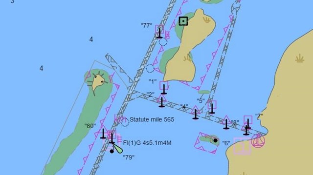
NOAA Electronic Navigational Charts
A seamless display of all NOAA electronic navigational charts using Electronic Chart Display and Information Systems symbology. 
Interactive Maps to Use Offline
Download the free NPS app for access to maps of every national park—that work both online and off! 
NPS Graphic A Tale of Two IslandsPadre Island was once one island —today it is two. Split by an artificial waterway, the once continuous island is now broken in two: Padre Island (sometimes just referred to as North Padre Island), and South Padre Island. Driving Between the Two IslandsIt is not possible to drive from the park, located on [North] Padre Island, directly south to South Padre Island. An artificial waterway, Mansfield Channel, cuts through Padre Island at the southern end of the national park. The only way to drive from [North] Padre Island to South Padre Island is by driving inland to Corpus Christi, down Highway 77, and back out to the south end of the island — a driving trip of 3-4 hours. Feeling Lost?This website and information contained within is about Padre Island National Seashore, the national park. The park is located at the end of Park Road 22, at the northern end of Padre Island in Corpus Christi, Texas. |
Last updated: February 4, 2024