[Site Under Development]

Introduction
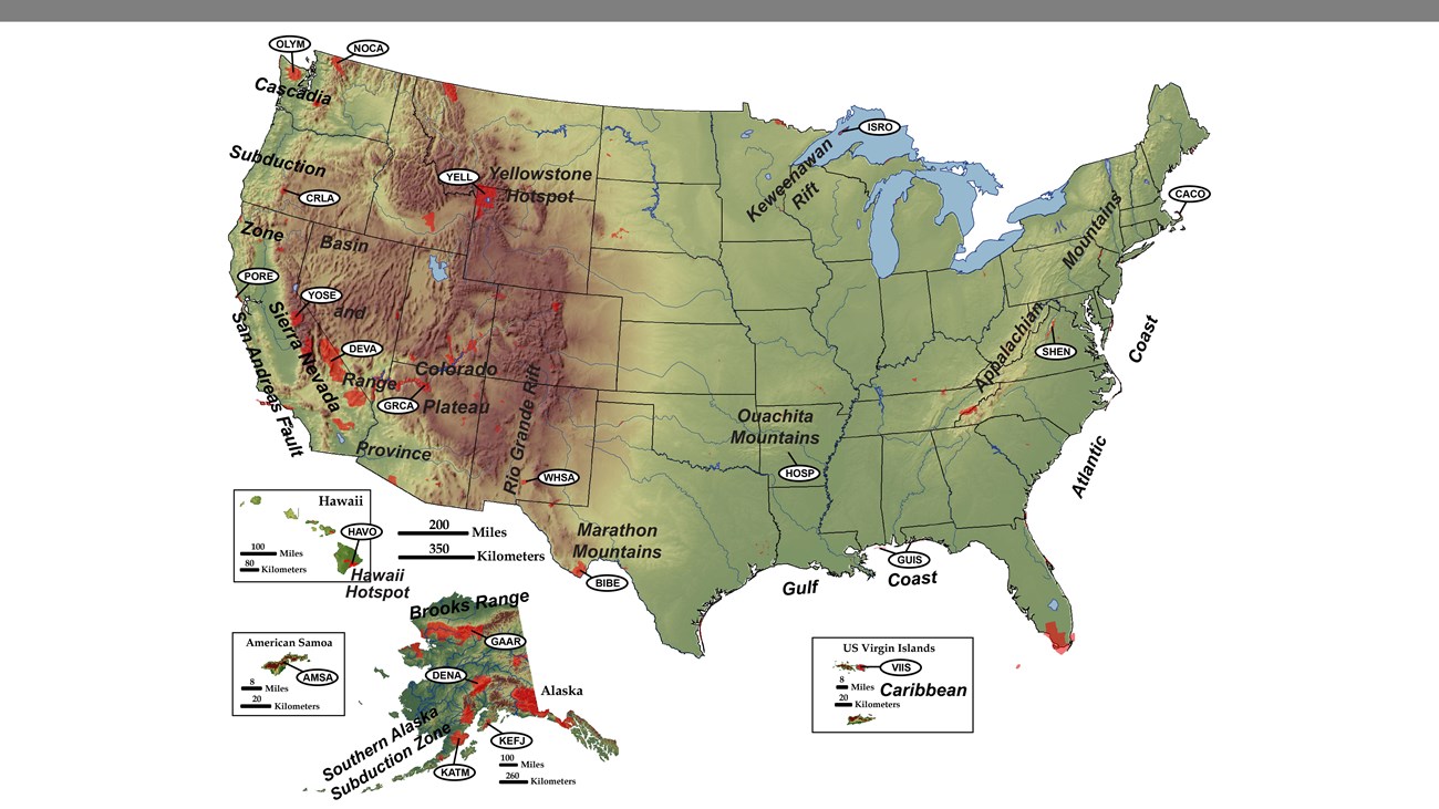
Tectonic processes shape the landscape and form some of the most spectacular structures found in national parks, from the highest peaks in the Rocky Mountains to the faulted mountains and valleys in the Basin and Range Province. Understanding a park's plate tectonic history and setting can help you make sense of the landforms and scenery you see.
For more information on Plate Tectonics, visit:
Tectonic Landforms and Features
The motions of the plates have a tremendous ability to shape and deform rocks through a variety of processes that include faulting, folding, extension, and on a massive scale, mountain building.
Mountain Building—Fault-block Mountains

[Site Under Development]
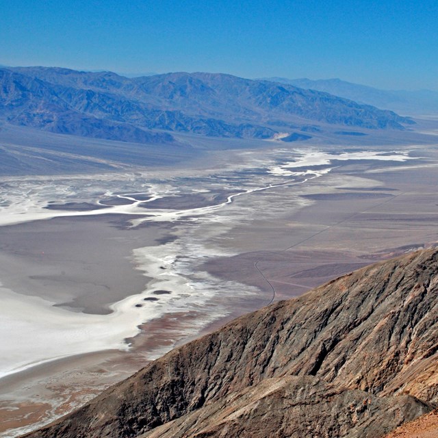
When divergent plate motion occurs beneath a continental crust, rift structures and normal faults form. This continental rifting causes valleys floors to drop down along fault lines. The combination of down dropped basins and adjacent fault-block mountains can produce dramaic range fronts.
Saguaro National Park, Arizona


Left image
Tuscon Basin.
Credit: NPS photo.
Right image
Feature labels.
Example above modified from “Parks and Plates: The Geology of our National Parks, Monuments and Seashores,” by Robert J. Lillie, New York, W. W. Norton and Company, 298 pp., 2005, www.amazon.com/dp/0134905172.
Featured Video—Grand Teton National Park, Wyoming
The requested video is no longer available.
Mountain Building—Fold Mountains

Folded mountains can form at collisional plate boundaries. Structurally, the folds are alternating anticlines and synclinces that run nearly parallel with each other. These long narrow folds are sometimes overturned, overthrust or are plunging folds.
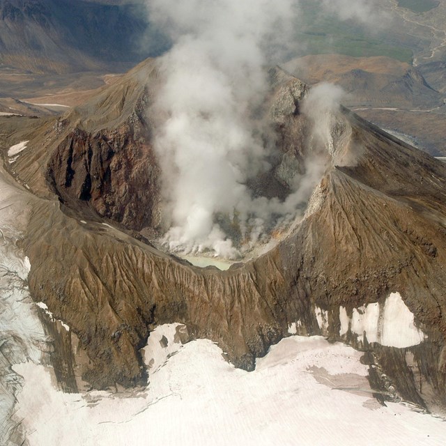
Mountain Building—Volcanic Mountains

[Site Under Development]
A volcanic arc may form in a subduction zone. As the subducting plate reaches depths where it “sweats” hot water, the rising water can melt rock in its path and form a volcanic arc on the overrriding plate. A hot spot is area of concentrated heat in the mantle that produces magma that rises to the Earth’s surface to form volcanic features. The volcanic activity of the Hawaiian Islands is one example. Hot spots may persist for millions of years.
Oregon


Left image
Feature labels. (Click on arrows and slide left and right to see labels.)
Right image
Crater Lake.
Credit: Photo courtesy of Robert J. Lillie.
Tectonic Settings of NPS Sites
In the master list below you will find parks that share in common geologic landforms and features based on similar plate tectonic origins.
Learn More—Plate Tectonics
Parks and Plates Textbook

Parks and Plates: The Geology of Our National Parks, Monuments & Seashores. Lillie, Robert J., 2005.
W.W. Norton and Company.
ISBN 0-393-92407-6
9" x 10.75", paperback, 550 pages, full color throughout
Ever have questions about the fascinating natural dynamics working in our national parks? This book aims to provide answers to some of them. The spectacular geology in our national parks provides the answers to many questions about the Earth. The answers can be appreciated through plate tectonics, an exciting way to understand the ongoing natural processes that sculpt our landscape. Parks and Plates is a visual and scientific voyage of discovery!
Last updated: December 28, 2020