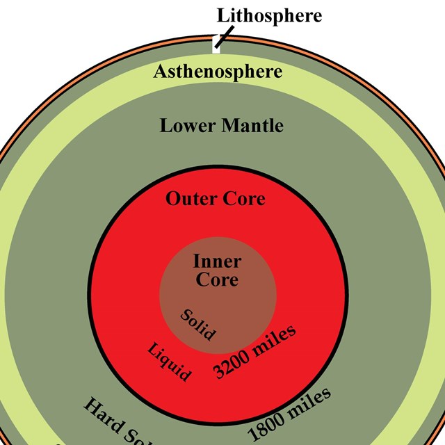
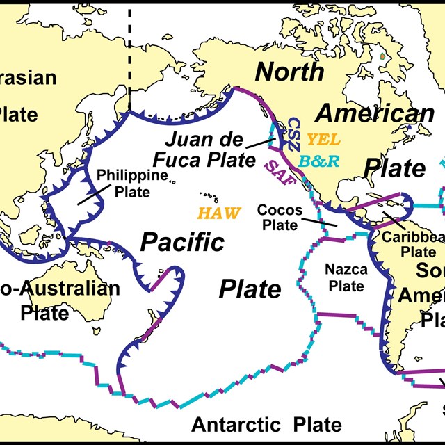
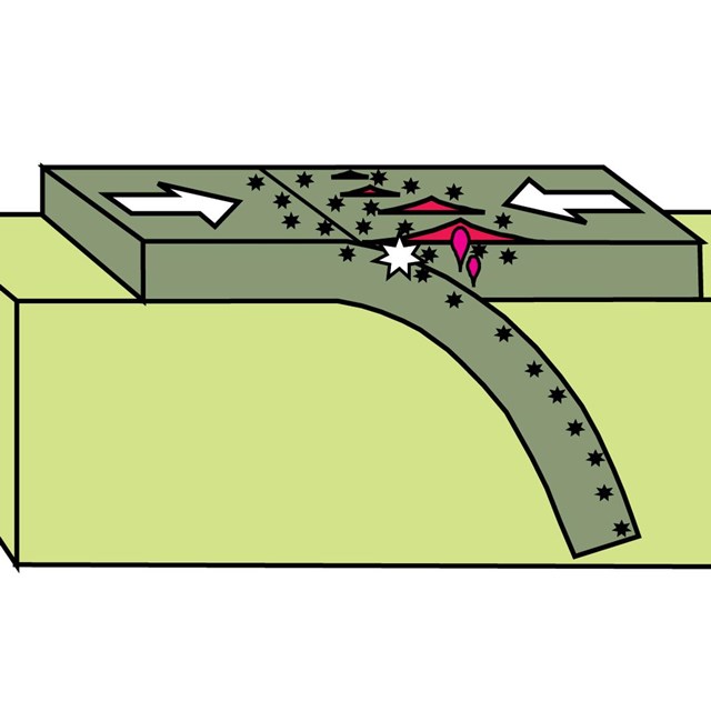
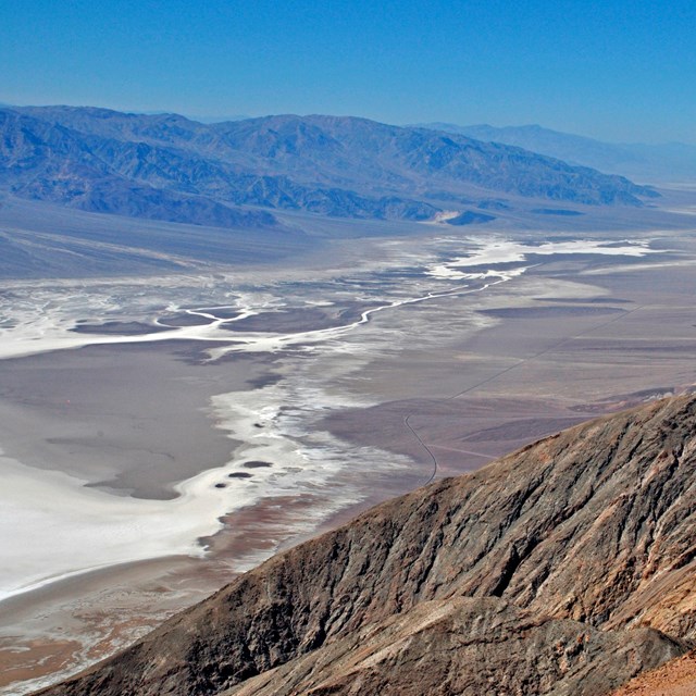
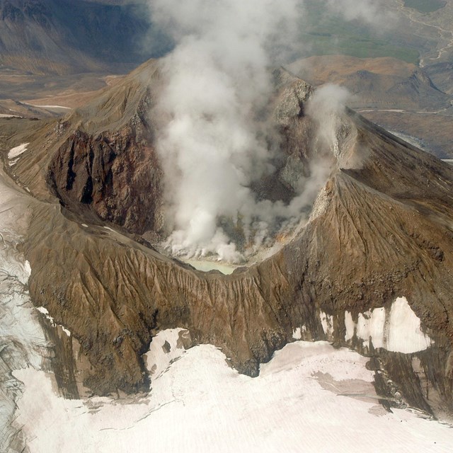
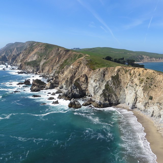
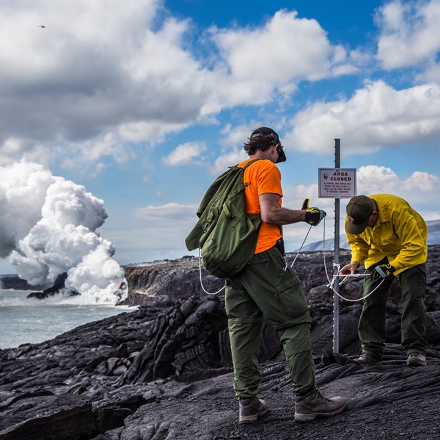
Plate Tectonics & Our National Parks

 
Dante's View in Death Valley National Park
Dante's View in Death Valley National Park, California and Nevada. Death Valley is forming as the North American tectonic plate is ripping apart in the Basin and Range Province. NPS photo by Dale Pate.

Introduction

The inspiring landscapes of the United States captivate with their beauty and power—and sometimes danger! But the same geological forces that threaten our lives with earthquakes and volcanic eruptions also nourish our spirits by forming our country’s spectacular mountains, valleys, and coastlines. National parks, monuments and seashores highlight this scenery and reveal Earth’s processes in action.

An area is established as a national park, monument, seashore, or other unit of the National Park Service because it displays something special about the cultural or natural history of the United States. The role of the National Park Service is to protect those features and make them accessible to the public. Geological features are an important part of this heritage, not only because they help us understand Earth’s history, but also because they are the landscapes upon which our country’s cultural and natural history take place.

Plate Tectonics—The Unifying Theory of Geology

We live on a layer of Earth known as the lithosphere which is a collection of rigid slabs that are shifting and sliding into each other. These slabs are called tectonic plates and fit together like pieces to a puzzle. The shifts and movements of these plates shape our landscape including the spectacular mountain ranges, valleys, and coastlines of our national parks. The theory of plate tectonics was revolutionary in helping us understand how these landscapes formed in the past and how they continue to change during our lifetimes.


Plate Tectonics—Concepts

The story of plate tectonics starts deep within the Earth. Each layer of the Earth has its own unique properties and chemical composition. The thin outer layer, the one we live on, is broken into several plates that move relative to one another. Plate boundary interactions result in earthquakes and volcanoes, and the formation of mountain ranges, continents, and ocean basins.


Patterns of Landforms and Parks

The dramatic topography in the West is due to its youth. Mountains and coastlines are continuously being built and deformed because they are at or near active plate boundaries. Features in the East, such as the Appalachian Mountains and Atlantic Coast, formed at plate boundaries, but that was a long time ago. Now, the nearest plate boundaries are more than a thousand miles away, and the landscapes are wearing away.

In the shaded relief map of the United States, two patterns are apparent:

  • The western U.S. is much more rugged than the East, and
  • there is a lot more National Park System land area in the western U.S. compared to the East.
 
shaded relief map of us w tectonic settings and park labels
Shaded relief map of the U.S. highlighting different tectonic settings. Superimposed in red are the more than 400 National Park System sites. Letter codes are abbreviations for parks on Tectonic Settings pages and the Tectonic Settings—Master List on the Plate Tectonics & Our National Parks page.

Modified from “Parks and Plates: The Geology of our National Parks, Monuments and Seashores,” by Robert J. Lillie, New York, W. W. Norton and Company, 298 pp., 2005, www.amazon.com/dp/0134905172.

The reasons we have more NPS land in the West are historical as well as physical. Mountainous terrain is much less amenable to human settlement, agriculture, industry, and commerce. The Yellowstone region was considered unsuitable for human development, yet it was important that it's amazing geological features not fall into private hands and be exploited. Yellowstone was therefore established as our first national park in 1872, even though the National Park Service was not created until 1916. By the late 1800s most of the land in the East was in private ownership, while much of the land in the West was (and still is) public. It was thus a much easier task to set aside vast regions of incredible scenery in the West.

Tectonic Settings of Our National Parks


Tectonic Settings of NPS Sites—Master List


Be Geohazard Aware

Plate-tectonic processes result in earthquakes, volcanic eruptions, tsunamis, landslides, and other geological hazards that affect our lives and livelihoods. But the same processes also build magnificent landscapes—the Atlantic Coast, Appalachian Mountains, Teton Mountains, Crater Lake and Yellowstone, to name just a few—that humans and a dynamic Earth continually modify. National Park Service sites are magnificent places to witness plate tectonics in action, and to learn strategies to co-exist with a dynamic planet.


Figures Used


Site Index & Credits


Plate Tectonics and Our National Parks (2020)

  • Text and Illustrations by Robert J. Lillie, Emeritus Professor of Geosciences, Oregon State University [E-mail]

  • Produced under a Cooperative Agreement for earth science education between the National Park Service's Geologic Resources Division and the American Geosciences Institute.


[Note: This expanded website replaces the single webpage, Plate Tectonics. For teachers and students using the older website on a web quest, it will remain available through the Fall semester, 2020.]

Last updated: September 22, 2020

Tools

  • Site Index