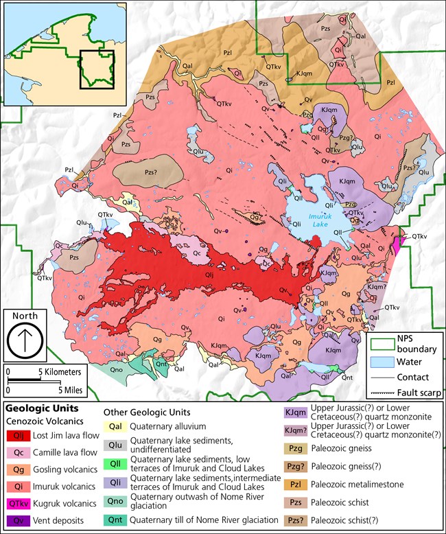
NPS Photo While it may be hard to fathom, Bering Land Bridge National Preserve has a unique and tumultuous volcanic past. Fountains of molten lava, thick clouds of ash, and violent underground explosions created the preserve’s one-of-a-kind volcanic formations that disturb the flat and monotonous landscape. These lively events took place in two separate areas of the preserve and are commonly referred to as the Imuruk lava field and the Devil Mountain volcanic field. Imuruk Lava FieldNear the southeastern boundary of the preserve is Imuruk lava field encompassing 900 square miles of lava flows and approximately 75 volcanic vents or openings in the Earth's surface. Similar to a layered cake, the various flows and volcanoes that erupted in the Imuruk lava field overlap one another with the older eruptions acting as the base for subsequent younger eruptions. 
NPS GIS department Lost Jim Lava FlowRecent Prehistoric, 1,000 to 2,000 years old. The Lost Jim lava flow is the top layer of the cake. It sits above all other flows, except the Kugruk volcanics. It spans 88 square miles and is characterized by pahoehoe lava: basaltic lava forming smooth twisted ropy folds. The thickness of the flow greatly varies, ranging between 10 to 150 feet thick. Its eruptive nature can be divided into an early and late phase with a “quiet” period between the two. The surface of the older flow is more expressive as it contains lava platforms, pressure ridges, intermittent lakes, and pockmark-like depressions. The main portion of the flow begins at the base of the Lost Jim lava cone and extends westward towards Lava Lake following a 12-mile lava tube. Camille VolcanicsLate Wisconsin, 10,000 to 20,000 years old The Camille flow is a large pahoehoe flow, which erupted from Camille cone and flowed westward to the Noxapaga River. The Lost Jim flow buries much of the Camille flow. The Camille flow is generally less than 25 feet thick and its surface is only slightly modified by frost riving: weathering of porous rock from the effects of freezing and thawing water. The wind-blown silt cover is only a few inches thick. Frost-rived rocks form a patchwork of rubble covered in lichen. Higher plants are absent except in low places where there is a relatively thick mantle of silt. 
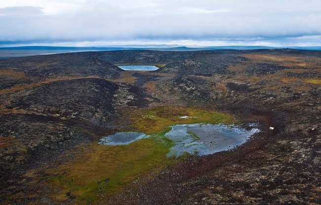
NPS Photo Gosling VolcanicsPleistocene epoch, Calabrian stage (0.9-0.8 million years ago) The Gosling volcanics occur south of Imuruk Lake to Kuzitrin Lake and westward along the headwaters of the Kuzitrin River. Flows erupted from a number of vents, the largest of which is Twin Calderas, a large lava dome with two summit collapse calderas having diameters of 1,700 and 2,500 feet and depths of 50 to 120 feet respectively. Over a period of 100,000 years, these vents erupted lava 10-20 separate times. Eventually, the volcano ran out of lava, leaving it empty and hollow. Having lost their support, the volcanic domes collapsed, creating two calderas or large, bowl-shaped depressions in the ground. Other Gosling vents include Gosling Cone, Hoodoo Hill, Skeleton Butte, and Virginia Butte. Flows reach a thickness of 300 feet near the vents but elsewhere range from 10 to 50 feet thick. Flows are mostly of the pahoehoe type but there are some aa flows. Aa (pronounced ah-ah) is a type of lava flow characterized by is rough, pointy and blocky surface. Basaltic and andesitic lavas are present.Imuruk VolcanicsLatest Miocene to earliest Pliocene (6.1-5.2 million years ago) The Imuruk volcanic field is the largest lava field in Bering Land Bridge National Preserve. It forms a plateau of volcanic rock that is up to 200 feet high and covers 900 square miles. Creating this plateau were 75 volcanic vents that released lava. The vents were mainly found inside volcanic cones. As the flows where emplaced upon the rolling topography, they filled low areas with depths of 200 feet, thereby reducing topographic relief. Many north-draining valleys were wider and shallower than those present today. Much of the flow is covered by a thick layer of eolian (wind-blown) silt 3 to 20 feet thick. The exposed areas have suffered damage (e.g. frost riving) due to exposure of the elements. Kugruk Volcanics Oligocene (28-26 million years ago) The oldest of the volcanic formations is assigned the name Kugruk volcanics for exposures best seen in the canyons of the Kugruk River (also Cottonwood Creek). Most of the Kugruk flows have been buried by the widespread Imuruk lava flows; exposures are small and widely scattered. A weathered zone 15 to 40 feet thick characterizes these early lavas. The intense weathering indicate that when these volcanic rocks formed climate was significantly warmer than present-day conditions. The Kugruk flows lie upon schist or metamorphosed limestone bedrock. The composition of the Kugruk lavas range from olivine basalt to andesite. 
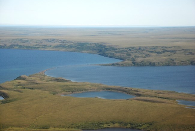
The Devil Mountain Volcanic FieldThe Devil Mountain volcanic field covers more than 400 square miles of the Seward Peninsula coastal plain and sits on the northcentral boundary of the preserve. The field contains five small shield volcanoes and the Espenberg maars – four large lakes produce by phreatomagmatic explosions (interactions between magma and ice), which, when active, erupted large volumes of volcanic ash . These lakes left an outer ring of the ejecta they produced. Devil Mountain Maar LakeApproximately 17,500 years old Devil Mountain Maar Lake is formed by a northern and a southern crater, which are separated by a small spit. It is the youngest of all the Espenberg maars and formed about 17,500 years ago. It is nearly 5 miles long and 3.7 miles wide, and is 328 feet deep. When standing at the water’s edge, a 15-story bedrock cliff surrounds the Devil Mountain Maar. It may be truly hard to imagine the energy it took to create such a large depression.
North and South Killeak LakesApproximately 40,000 years old South Killeak Maar is over 40,000 years old, is just over 3 miles long and has a depth of nearly 200 feet. Its counterpart, North Killeak Maar, is slightly older at 50,000 years old with a diameter of 2.5 miles and a depth of 80 feet Whitefish LakeBetween 100,000 and 200,000 years old Whitefish Maar are the oldest, estimated to be 100,000 – 200,000 years old. It is just over 2.5 miles long. Its depth has not been measured. |
Last updated: January 30, 2023
