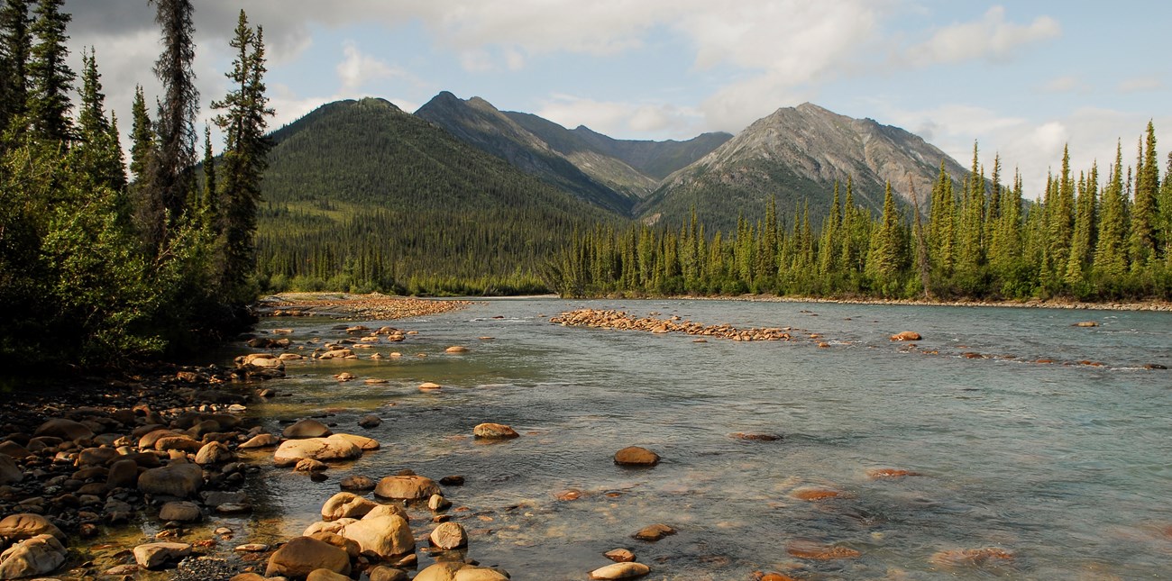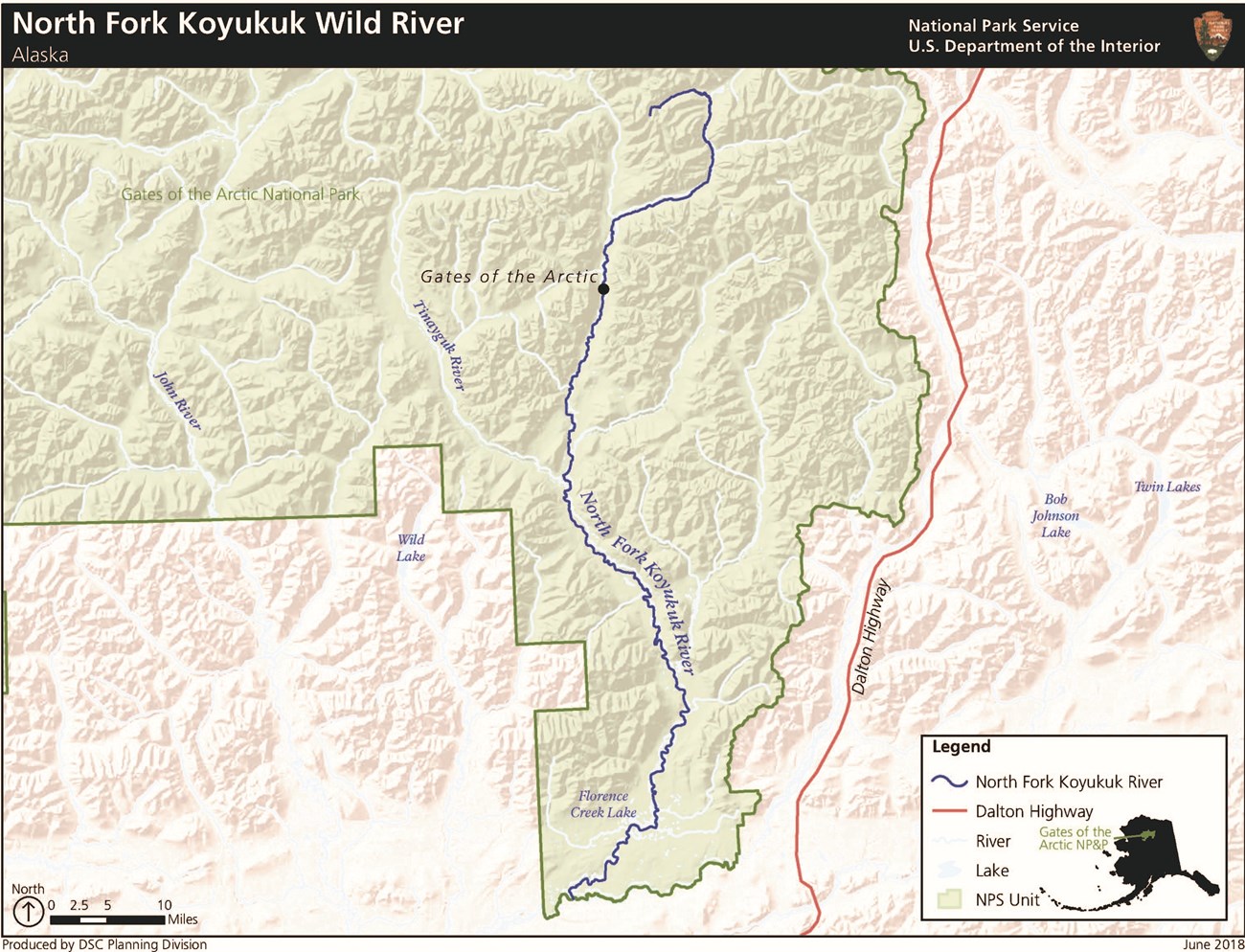
NPS/Josh Spice From the south flank of the Arctic Continental Divide, the North Fork Koyukuk River flows about 100 miles south through the Endicott Mountains where it joins the Middle Fork Koyukuk River.The North Fork of the Koyukuk flows from its headwaters on the south flank of the Arctic Divide through broad, glacially carved valleys in the rugged Endicott Mountains of the Central Brooks Range. The river bisects the iconic Frigid Crags and Boreal Mountain, dubbed the "Gates to the Arctic" by Bob Marshall. The North Fork joins the Middle Fork and can be run all the way to Bettles Field. 
Approximate Length102 mi / 164 km inside Gates of the Arctic National Park & Preserve Scenic QualityThe North Fork Koyukuk River is immersed in some of the most spectacular scenery found in the central Brooks Range, including the iconic Gates of the Arctic. Frigid Crags and Boreal Mountain form the Gates of the Arctic, the iconic passage to the Gates of the Arctic National Park, as described by Robert Marshall. Within the central Brooks Range, the Endicott Mountains’ rugged peaks transition into large glacial valleys. Mount Doonerak, the highest mountain on the North Fork (at 7,610 feet), provides a significant contrast in size to adjacent peaks. Gray Mountain, Blackface Mountain, and Redstar Mountain exemplify the differences in coloration among the mountains in the area. The alpine regions of the North Fork present characteristically impressive views throughout this stretch of river. Recreational OpportunitiesThe North Fork Koyukuk River offers excellent floating conditions, but also has outstanding hiking opportunities, especially along the upper reaches of the watershed. Excellent hiking opportunities and remarkable scenery have made this location a highly desirable wilderness backpacking area within the Brooks Range. Additionally, the limited number of users throughout the North Fork contributes to a wilderness-type experience. The North Fork also provides backpacking access to the Tinayguk River, which allows the visitor to travel between the John River and Wild River drainages. The combination of demanding whitewater in the upper river region and a gradient of vegetation changes—in addition to the river’s clear water—provides an interesting and desirable rafting experience. Although the North Fork is well isolated from human infrastructure and has limited accessibility, the river provides the user with a direct connection to Bettles and its commercial air services. Geologic FeaturesSouth flank of the arctic Continental Divide; broad glacial valleys bordered by Endicott Mountains Natural ResourcesVariety of wildlife; major caribou migration route Cultural Resources - HistoricThe North Fork Koyukuk River is the country Robert Marshall celebrated in his classic writings on Alaska and on the concept of wilderness. The early inspiration for the creation of a vast northern national park can be traced back to a US Forest Service forester named Bob Marshall who arrived in Alaska in 1929 looking for what he called “blank spaces on maps.” When Marshall arrived along the North Fork of the Koyukuk River, he found what he was looking for—what he called the “wild sublimity” of a largely untouched mountain realm. His wilderness philosophy defined such wild places as essential not only for ecological health, but for human happiness. During the 1930s, Marshall returned to Alaska three more times to live in Wiseman and explore the rugged terrain of the Koyukuk watershed and beyond to the continental divide. He used northern forest research as a pretext for mountain climbing, mapping uncharted waterways, and mingling with the Alaska Native people and gold mining sourdoughs of the Koyukuk. In his 1933 book about daily life in the town of Wiseman (titled Arctic Village), Marshall advertised to the world that he had discovered a kind of Arctic utopia. Marshall was no less enthusiastic when describing the mountains, rivers, and valleys of the Brooks Range, particularly the stretch along the North Fork of the Koyukuk, where he named two adjacent peaks the Gates of the Arctic. Marshall’s writings, including Alaska Wilderness (1956) published after his death, inspired later wilderness enthusiasts to push for preservation of a vast section of the Brooks Range as Gates of the Arctic National Park and Preserve. Cultural Resource – ArcheologicalThe North Fork preserves an exceptionally long and substantial record of human occupation. Despite being only cursorily surveyed, the valley contains a high density of archeological sites. At least 86 historic and prehistoric archeological sites are known from the North Fork within Gates of the Arctic National Park and Preserve, and the vast majority are immediately adjacent to the river’s course. One unique aspect of the North Fork is that portions of this valley were unglaciated at the end of the last ice age and the area was thus available to human occupation by the very earliest inhabitants of Beringia. The WIS-076 site exemplifies this phase of human occupation; it is one of the oldest known sites in the park and dates to approximately 11,000 years ago. Paleontological remains of extinct mammals found in the lower reaches of the valley are up to 33,000 years old, thus indicating the area has long been rich in subsistence resources. Following the early Paleoindian occupation were Northern Archaic, Denbigh, and Late Prehistoric occupations, all represented by archeological remains of camps, overlooks, and resourceprocurement locations. The valley was also a major east-west intraregional travel corridor in prehistory, as demonstrated by the frequent occurrence along the North Fork of obsidian that derives from a major source on the Koyukuk’s main stem some 200 miles to the southwest. The North Fork seems to have represented one of the main paths of distribution for this significant prehistoric resource. |
Last updated: August 13, 2020

