Reenactment of walking the Santa Fe Trail with oxen and covered wagon
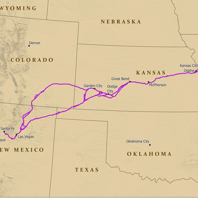
The Santa Fe National Historic Trail spans 900 miles of the Great Plains and traverses five states. Though its course is now located within the United States, it was once an international trade route that brought together a cultural mosaic of peoples. While this lifeline of commerce provided for opportunity and cooperation, it also paved the way to conflict among the individuals it brought together.
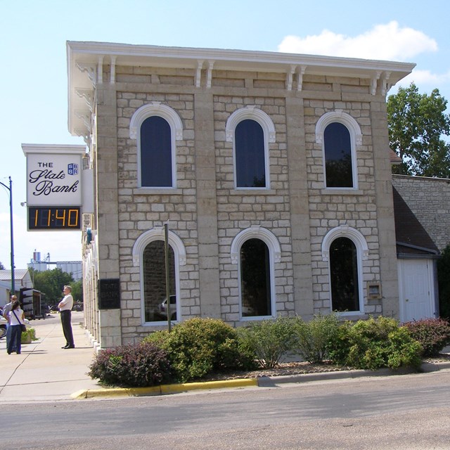
Interested in places along the Trail? Learn more and plan a visit:
Click on the title or picture for site information.
The Santa Fe Plaza has long been the spatial, economic, and social center of New Mexico’s capital city. Accordingly, it is the location of various historic buildings and events throughout New Mexico’s history.
Sites:El Camino Real de Tierra Adentro National Historic Trail, Old Spanish National Historic Trail, Santa Fe National Historic Trail
The iconic building located in Santa Fe, New Mexico is a masterpiece of Spanish Pueblo Revival architecture. The building, known as one of the largest secular adobe buildings in the United States, was constructed in the 1936-1939 by the Civilian Conservation Corps. The structure is listed on the National Register of Historic Places and National Historic Landmark. The building not currently open to the public.
Rabbit Ears Mountain served as a vital landmark for Santa Fe Trail travelers on the Cimarron Route. Located in North Eastern New Mexico, this largely undeveloped area offers a step into the past. Follow in the footsteps of Trail travelers and use Rabbit Ears Mountain to guide your visit to nearby sites where you will see Trail ruts, campsites, and grasslands.
Located at the intersection of Corrumpa Creek and the Santa Fe Trail, McNees Crossing was a welcomed source of necessary resources for travelers on the Cimarron Route. Also the host to a “dreadful catastrophe,” the site warns of the consequences of seeking vengeance.
Visitors can experience the vastness of terrain and trail at this largely undeveloped site. Wagon ruts and the rocky creek bottom where caravans crossed are still visible today.
Locations:California National Historic Trail, Oregon National Historic Trail, Santa Fe National Historic Trail
Though not standing today, the mill once located at this intersection may have served traders involved in international commerce and travelers heading to or returning from the west. The filling station of the 19th century was the grist mill where needed commodities of flour and cornmeal could be procured and would sustain travelers over an 800-2,000 mile journey as they walked along the westward Santa Fe, Oregon and California trails.
Locations:California National Historic Trail, Oregon National Historic Trail, Santa Fe National Historic Trail
The Santa Fe, Oregon, and California national historic trails (NHTs) passed through "New Santa Fe" in the Kansas City, Missouri area. Visit to see rare urban trail ruts and what’s left of a town created by trail traffic.
Locations:California National Historic Trail, Lewis & Clark National Historic Trail, Mormon Pioneer National Historic Trail, Oregon National Historic Trail, Santa Fe National Historic Trail
The historic trails passed through this area in the field that is directly across from the National Frontier Trails Museum. Evidence of the trails can still be seen in the field in the form of swales, which marks the exact route used by emigrants as they traveled westward. The museum is currently temporarily located at 416 W. Maple Ave., Independence, MO 64050.
Locations:California National Historic Trail, Oregon National Historic Trail, Santa Fe National Historic Trail
Historic Truman Courthouse is the official start of the Oregon Trail, where wagons were outfitted through much of the emigration era. The original building on the site went up in 1836 in the Colonial Revival style.
Located North of Independence Square, the Lewis-Webb House was home to John and Susan Lewis who participated in Santa Fe Trail related commerce including outfitting traders and financing a trip to Santa Fe. The home is privately owned, but you can view the home’s exterior and read more about the house on the historic marker in the front yard.
Locations:California National Historic Trail, Oregon National Historic Trail, Santa Fe National Historic Trail
The Riverfront Heritage Trail is a fully accessible 15 mile bicycle and pedestrian pathway that begins at the riverfront and winds through the oldest and most historic parts of bi-state Kansas City. It links communities, parks, and places and ties into the surrounding midtown and suburban trail system. Interpretive waysides and historical markers along the trail create a journey through the early history.
Locations:California National Historic Trail, Oregon National Historic Trail, Santa Fe National Historic Trail
Westport Landing is where many eastern emigrants ended the first leg of their journey via riverboat and began preparations for their long overland journey. This steamboat landing was established in 1834 and a village quickly grew up around it with the name of "Kansas." This village later evolved into the City of Kansas, which is now known as Kansas City.
Locations:California National Historic Trail, Oregon National Historic Trail, Santa Fe National Historic Trail
Wieduwilt Swales are the grassed-over evidence of three historic trails that passed through the area, the Santa Fe, California, and Oregon. Thousands of wagons, carts, livestock, and people traveled on these trails, which created ruts and left deep depressions in the earth. After the traffic stopped, vegetation slowly reclaimed the muddy and barren ground of the trails, creating the swales that are still visible today.
Locations:California National Historic Trail, Oregon National Historic Trail, Santa Fe National Historic Trail
Travelers on the Oregon, California, and Santa Fe trails passed through what is now Schumacher Park as they journeyed through the prairie of the great plains. They passed through the south end of the park in an east to west direction during the mid-1800s. Today, no traces of these trails (no ruts or swales) remain in the park, but the park does provide a good example of how this part of Kansas appeared in the 19th century.
The Santa Fe Spring, also known as Big Spring and Arrow Rock Spring, was an important water source for Santa Fe Trail travelers heading West. Visit the spring while exploring Arrow Rock State Historic Site.
Fort Zarah was established at the junction of the Santa Fe Trail, Walnut Creek, and the Smoky Hill Military Road as the result of congoing conflict between traders and indigenous communities whose lives and land were threatened by encroaching settlement.
Locations:California National Historic Trail, Oregon National Historic Trail, Santa Fe National Historic Trail
The Shawnee Mission was one of many missions established as a manual training school attended by boys and girls from Shawnee, Delaware, and other Indian nations from 1839 to 1862.
Approximately 33 miles of the Cimarron Route of the Santa Fe Trail crosses Morton County. It is the largest number of miles located in any one county across the trail’s five states. The museum introduces you to the trail and things to do in the area, including the Cimarron National Grassland where the public can hike an 18.3-mile long companion trail, a mowed path that parallels the historic route.
The Barton County Historical Society Museum consists of exhibits (including the Santa Fe Trail Interpretive Site), a research library, and an administrative area. Behind the building is a historical village consisting of a church, 1-room school house, windmill, post office building, railroad depot, barn, residences, and other structures.
The north bank of the Arkansas River at the west side of present-day Ellinwood was a popular stop on the Santa Fe Trail because there was water and fuel. In 1862, William Mathewson, a trader, set up a trading post at the Great (Big) Bend of the Arkansas.
In 1855, William Allison and Francis Boothe established a trading post along the imposing Arkansas River. This crossing came to be known as Walnut Creek Crossing, an important milestone on the Santa Fe Trail.
Since the late 1820s, Sapling Grove, located on the headwaters of Turkey Creek, was a significant campsite on the Santa Fe Trail. George Sibley, an Indian agent who was commissioned to survey the trail in 1825-27, included Sapling Grove on his list of campsites. The park has several interpretive historical markers that discuss 19th century trail activities.
Locations:California National Historic Trail, Oregon National Historic Trail, Santa Fe National Historic Trail
Prairie Village Ruts marks the location of the Oregon, California, and Santa Fe Trails in the form of rounded depressions in the ground called swales. These swales were once part of a well-defined path, most equivalent to a modern day dirt road, that was created as thousands of oxen, cattle, and wagons traveled across the land. They eroded and compacted the ground, which created ruts. Over time, the ruts were weathered into the more gently sloping swales visible today.
The Plum Buttes Massacre site is where a deadly conflict occurred between Santa Fe Trail traders and American Indians whose lives were threatened by Trail traffic.
The town of Palmyra was founded along the Santa Fe Trail in 1854, several years before Baldwin City formed. During the post-Civil War years, Baldwin City grew and swallowed up the Palmyra townsite. This well was used by travelers on the Santa Fe Trail.