|
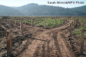
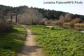
The Giacomini Wetlands can be viewed from several vantage points in the Point Reyes-Inverness area. Download the Public Access Map (1,042 KB PDF). Trails and viewing points include:

Lagunitas Creek spur trail: In the future, this trail will connect to a viewing area at the Dairy Mesa. The Park Service is in the process of improving facilities in this area currently. 
On the south side of Lagunitas Creek, the County of Marin Parks and Open Space District manages a small park on Sir Francis Drake Boulevard (Levee Road) that has a path that winds through riparian habitat as it follows the edge of Lagunitas Creek. Parking may be found at an on-site parking lot. This park provides several locations to view the restoration project area across the creek. 
Tomales Bay Trail: The trailhead is located off State Route 1 just north of Point Reyes Station. There is a small parking lot. The trail is approximately 1 -1.3 miles long. In future years, this spur trail will be extended to provide better views of some of the northern portions of the East Pasture and the shallowly flooded flats that attract hundreds of shorebirds and waterfowl in the fall and winter. Olema Marsh Trail: West Pasture Viewing Area: By Water: 
-- Content for this page was composed by Lorraine Parsons, Project Manager, Giacomini Wetland Restoration Project, Point Reyes National Seashore Adobe® Acrobat Reader® is needed to view PDF documents. |
Last updated: June 27, 2024
