Turquoise Trail

The Turquoise Trail is challenging but with challenge comes reward. Hike Smart. Bring extra water and wear sturdy footwear.
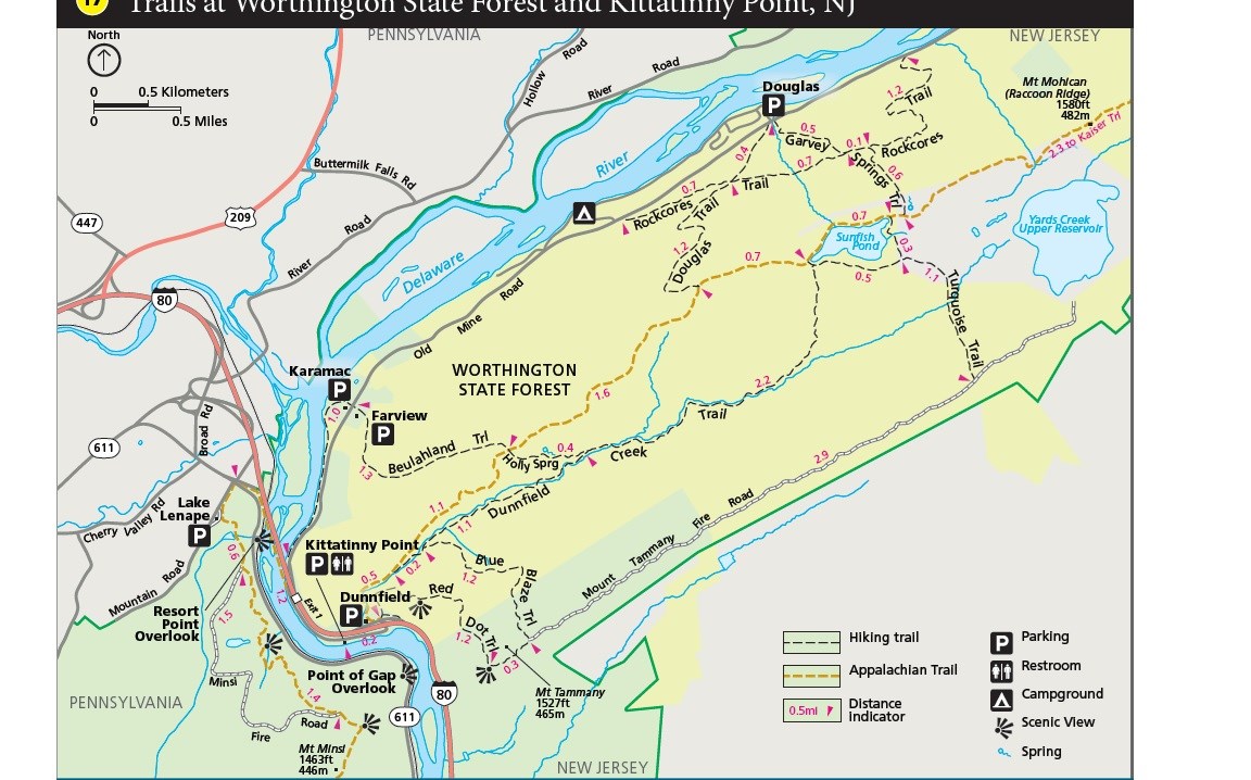
A map of the trails near Kittatinny Point, NJ

NPS Map

Length: 1.1 miles, loop
Difficulty: Easy-moderate
Elevation Change: 166 feet
Trailhead Location: 1.3 miles via Garvey Springs Trail | directions to the Garvey Springs trailhead

This trail connects the Appalachian National Scenic Trail at Sunfish Pond to the Mt. Tammany fire road, where nice views of the valley below can be seen. Over twenty miles of trail can be connected together in the Worthington State Forest area to fill the entire day.

Other Information: restroom located in Worthington State Forest picnic area; more information about Worthington State Forest

Other trails in Worthington State Forest:

Return to list of trails

Last updated: August 17, 2021

Park footer

Contact Info

Mailing Address:

Delaware Water Gap National Recreation Area
P.O. Box 2

Bushkill, PA 18324

Phone:

570 426-2452

Contact Us