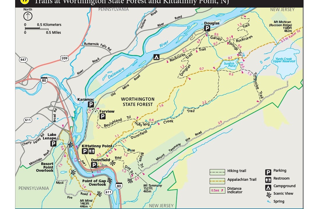
NPS Map Length: 1.2 miles, one-way The Mt. Tammany Trail (Red Dot) is one of two trails that lead to the outstanding view looking into the Delaware Water Gap from Mt. Tammany. This hike is one of the most challenging in the park. Combining the Mt. Tammany Trail (Red Dot) with the Pahaquarry Trail (Blue Blaze) makes a three-mile loop trail. If making a loop hike, consider hiking up the Red Dot Trail and down the Pahaquarry Trail (Blue Blaze), because most people find it to be an easier route. Over twenty miles of trail can be connected together in the Worthington State Forest area to fill the entire day. Other Information: restroom located at trailhead;the trailhead parking lot fills quickly on summer weekends; more information about Worthington State Forest Other trails in Worthington State Forest: |
Last updated: August 17, 2021
