
Jay Fleming Shoshone Lake, the park's second largest lake, is located at the head of the Lewis River southwest of West Thumb. It is possible that fur trapper Jim Bridger visited this lake in 1833, and fellow trapper Osborne Russell certainly reached the lake in 1839. According to James Gemmell, he and Bridger visited the lake in 1846 (in Wheeler, "The Late James Gemmell," pp. 131-136). Gemmell referred to it then as "Snake Lake," a name apparently used by the hunters. Fr. Pierre-Jean DeSmet's 1851 map showed a "DeSmet's L." in the approximate position of present-day Shoshone Lake. In 1863, prospector Walter DeLacy visited the lake and named it "DeLacy's Lake." The lake was also called "Madison Lake" because it was erroneously thought to be the head of the Madison River. Cornelius Hedges of the 1870 Washburn Expedition named the lake after the party's leader, Gen. H.D. Washburn. By 1872, Shoshone Lake had already borne four or five names when Frank Bradley of the second Hayden Survey added a sixth. Bradley wrote: "Upon crossing the divide to the larger lake, we found it to belong to the Snake River drainage, and therefore called it Shoshone Lake, adopting the Indian name of the Snake [River]" (American Journal of Science and Arts, September 1873, p. 201). Bradley's name thus returned in spirit to Gemmell's and the fur trappers' name "Snake Lake." Park Superintendent P.W. Norris thought that the name Shoshone Lake was "a fitting record of the name of the Indians who frequented it" (Fifth Annual Report, p. 44). The Shoshones lived mainly to the west and south of present-day Yellowstone National Park, but there is evidence that they occasionally entered the area and may have visited the lake each summer. Their arrowheads and other artifacts have been found in various places around the park. The meaning of "Shoshone" has long been debated. Some authorities believe that the word represented an uncomplimentary Sioux expression given to the tribe by their Crow neighbors. David Shaul, a University of Arizona linguist, believes that the word literally translates as "those who camp together in wickiups" or "grass house people." Shoshone Lake is 205 feet (62.5 m) at its maximum depth, has an area of 8,050 acres (3,258 ha), and contains lake trout, brown trout, and Utah chubs. Originally, Shoshone Lake was barren of fish owing to waterfalls on the Lewis River. The two types of trout were planted beginning in 1890, and the Utah chub was apparently introduced by bait fishermen. This large lake is the source of the Lewis River, which flows to the Pacific Ocean via the Snake River system. The US Fish and Wildlife Service believes that Shoshone Lake may be the largest lake in the lower 48 states that cannot be reached by road. No motorboats are allowed on the lake. Shoshone PointThis point on the Grand Loop Road is located halfway between West Thumb and Old Faithful. It was named in 1891 because Shoshone Lake could be seen from here. In that year, Hiram M. Chittenden began constructing the first road between Old Faithful and West Thumb, and he probably named the point himself. Shoshone Point was the scene of a stagecoach holdup in 1914. One bandit, armed and masked, stopped the first coaches of a long line of vehicles and robbed the 82 passengers in 15 coaches of $915.35 and about $130 in jewelry. Edward Trafton was convicted of the robbery and sentenced to five years in federal prison at Leavenworth, Kansas. Nearby WaterDeLacy CreekDeLacy Creek flows south from DeLacy Lakes to Shoshone Lake. Park Superintendent P.W. Norris named the creek in 1881 for Walter Washington DeLacy (1819–1892), the leader of a prospecting expedition that passed through the Yellowstone region in 1863. DeLacy, a surveyor and engineer, compiled the first accurate map of the Yellowstone area in 1865. In 1863, DeLacy led a group of prospectors from Jackson Hole across the Pitchstone Plateau and came across Shoshone Lake, which he named "DeLacy's Lake." He was the first to note the "strange" drainage of that lake south to the Snake River rather than west to the Madison River. But he did not publish his discoveries until 1876, which kept him from receiving credit for being the man who discovered Yellowstone and from leaving his name on present-day Shoshone Lake. DeLacy also recognized the importance of Yellowstone's thermal features. In a published letter in 1869, he wrote: "At the head of the South Snake, and also on the south fork of the Madison [present-day Shoshone Lake and Firehole River], there are hundreds of hot springs, many of which are 'geysers'" (Raymond, "Mineral Resources," p. 142). In 1871, Hayden changed the name of "DeLacy's Lake" to "Madison Lake." In 1872, Frank Bradley criticized DeLacy for the "numerous errors" on his map and named the lake Shoshone. Park Superintendent P.W. Norris felt sorry for DeLacy and named the present stream for him in 1881, stating: The...narrative, the high character of its writer [DeLacy], his mainly correct descriptions of the region visited, and the traces which I have found of this party [campsite remains, etc.], proves alike its entire truthfulness, and the injustice of changing the name of De Lacy's Lake [to Shoshone Lake]; and fearing it is now too late to restore the proper name to it, I have, as a small token of deserved justice, named the stream and Park crossed by our trail above the Shoshone Lake after their discoverer (Fifth Annual Report, p. 44). Lewis River This river drains Shoshone and Lewis lakes and is a tributary of the Snake River. In 1872, members of the second Hayden survey called the river "Lake Fork" because it was a fork of the Snake that began in those two lakes. An 1876 map showed the river marked "Lewis Fork" (of the Snake), named from Lewis Lake. 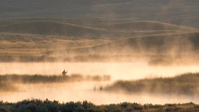
Catch a Fish
Be a responsible angler and understand the regulations before you come. 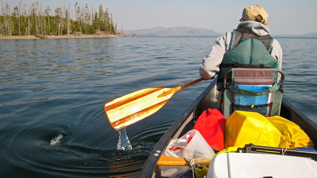
Boat
Take in the view from the water. 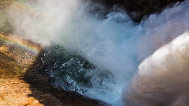
Water
Learn about the role of water in Yellowstone and beyond. |
Last updated: April 18, 2025