|
Visit our keyboard shortcuts docs for details
Water plays an incredible role in the ecosystems of Yellowstone National Park and the surrounding areas. The water flowing through Yellowstone and the Greater Yellowstone Ecosystem (GYE) is a vital national resource. The headwaters of seven great rivers located here flow from the Continental Divide across the nation to the Pacific Ocean, and the gulfs of California and America. Rain and snow in the mountains and plateaus of the Northern Rockies flow through stream and river networks to provide essential moisture to much of the American West. Together, Yellowstone’s streams and rivers support an abundance of fish and wildlife, provide numerous recreational opportunities, and offer a lifeline for downstream agricultural users and municipalities. Water also drives the complex geothermal activity in the region and fuels the largest collection of geysers on Earth. Precipitation and groundwater seep down into geothermal “plumbing” over days, and millennia, to be superheated by the Yellowstone Volcano and rise to the surface in the form of hot springs, geysers, mudpots, and fumaroles. Yellowstone contains some of the most significant, near-pristine aquatic ecosystems found in the United States. More than 600 lakes and ponds comprise approximately 107,000 surface acres in Yellowstone—94 percent of which can be attributed to Yellowstone, Lewis, Shoshone, and Heart lakes. Some 1,000 rivers and streams make up approximately 2,500 miles of running water. Thousands of small wetlands—habitats that are intermittently wet and dry—make up a small (approximately 3%), fraction of the Yellowstone landscape. 
NPS/Yellowstone Spacial Analysis Center LakesYellowstone’s inland lakes are essential aquatic habitat for resident species. They are largely protected from many of the environmental stresses to which waters outside the park boundaries may be victim. These lakes maintain freshwater biodiversity, support elaborate food webs, and underpin plant and animal communities. Understanding the complexities of Yellowstone’s lake ecosystems allows park managers to successfully conserve Yellowstone’s lake resources in the face of nonnative invasive species, climate change, and pollution. Yellowstone LakeYellowstone Lake is the largest high-elevation lake (above 7,000 ft) in North America, covering up to 139 square miles, with an average depth of 138 feet, and just over 12,000,000 acre-feet of water. The lake is covered by ice from mid-December to May or June. Entering Yellowstone Lake are more than 141 tributaries, but only one river. The Yellowstone River, which enters at the south end of the southeast arm, dominates the inflow of water and sediment flows out. The only outlet of the lake is at Fishing Bridge, where the Yellowstone River flows north and discharges 2,000–9,000 cubic feet per second. Powerful geologic processes in Yellowstone National Park have contributed to the unusual shape of Yellowstone Lake, which straddles the southeast margin of the Yellowstone caldera. A smaller caldera forming event about 174,000 years ago, comparable in size to Crater Lake, Oregon, created the West Thumb basin. Several significant glacial advances and recessions continued to shape the lake and overlapped the volcanic events. Glacial scour deepened the central basin of the lake and the faulted south and southeast arms. More recent dynamic processes shaping Yellowstone Lake include currently active fault systems, development of a series of postglacial shoreline terraces, and postglacial hydrothermal explosion events, which created the Mary Bay crater complex and other craters. (See “Yellowstone Lake Geology” in chapter four, for more information.) Many of the area’s 1,000 to 3,000 annual earthquakes occur under Yellowstone Lake, causing uplift and subsidence events which continually reshape the shoreline of the lake. Yellowstone Lake is also the site of one of the most extensive conservation efforts in the National Park Service. Lake trout (Salvelinus namaycush) which were illegally introduced to Yellowstone Lake have jeopardized the survival of the native population of cutthroat trout (Oncorhynchus clarkii bouvieri). 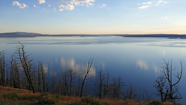
Yellowstone Lake
Delve into facts about North America's largest high-elevation lake. 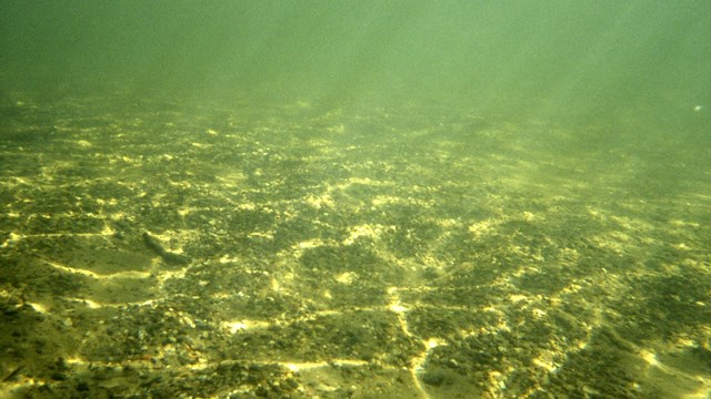
Yellowstone Lake Geology
Discover a bit of what dynamic processes are going on below the lake's surface. 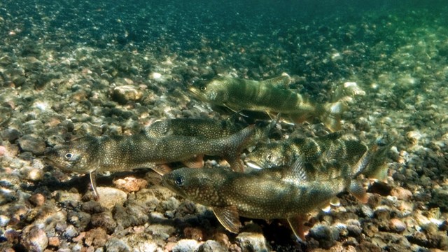
Shoshone Lake
Learn more about Yellowstone's second largest lake. 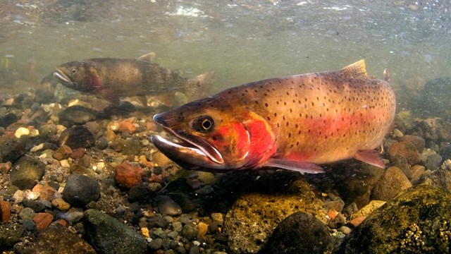
Fish and Aquatic Species
Native fish underpin natural food webs and have great local economic significance. 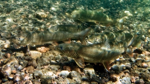
Lake Trout
Lake trout prey on Yellowstone cutthroat trout. Lewis and Shoshone LakesLewis Lake is fed by the Lewis River and other tributaries. Shoshone Lake, the park’s second largest lake, is located at the head of the Lewis River southwest of West Thumb. Shoshone Lake is a valuable wilderness resource. Only accessible by foot, or by boat through the Lewis River Channel, one of the park's amazing geyser basins lies near the northwest shore. Shoshone Lake is 205 feet at its maximum depth, has an area of 8,050 acres, and contains lake trout, brown trout (Salmo trutta), and Utah chub (Gila atraria). Originally, Shoshone Lake was barren of fish owing to waterfalls on the Lewis River. The two types of trout were planted beginning in 1890, and the Utah chub was apparently introduced by bait fishermen. This large lake is the source of the Lewis River, which flows to the Pacific Ocean via the Snake River system. The U.S. Fish and Wildlife Service believes that Shoshone Lake may be the largest lake in the lower 48 states that cannot be reached by road. Heart LakeHeart Lake is located at the south end of the park near the base of Mt. Sheridan. It sits in prime bear habitat, and there are several thermal areas along the northwest shore. 
NPS/Jim Peaco RiversWatersheds, or drainage basins, represent the surface area that contributes runoff to a particular river. The boundaries of a watershed are ridges or elevated areas which determine the direction surface water will flow. Any rain or snow that falls within the watershed will flow downstream to the basin’s mouth, unless it is removed from the flow by evaporation, freezing, absorption as groundwater, or diversion for human use. Yellowstone RiverThe Yellowstone River is 671 miles long. It is the longest undammed river in the lower 48 states. The headwaters of the Yellowstone are outside the southeast park boundary on Younts Peak (Wyoming) and flow into Yellowstone Lake. It leaves the lake The Yellowstone River is among the top recreational river destinations in the US and provides opportunities for boating and fishing enthusiasts, birders, and for other forms of recreation. Additionally, the Yellowstone River serves many downstream communities (e.g., Billings, Montana) and is recognized regionally and nationally for economic importance to agriculture, industry, and municipalities. Lamar RiverThe Lamar River originates on the east side of the park. Park boundaries were adjusted in 1929 to include the entire Lamar watershed in order to protect this major tributary of the Yellowstone River. The Lamar River is joined by Soda Butte Creek as it flows across the northern range to the outflow of Yellowstone Lake. The Lamar River Valley is home to wild pronghorn, bison rutting, bear habitat, the most consistent viewing of wild wolves in the world, and first-rate fly fishing. Gardner RiverThe Gardner River originates in the northwest corner of the park and flows to the Missouri River. The Gardner flows into the Yellowstone first, joining near Rattlesnake Butte at the north entrance to the park. Snake RiverThe Snake River—a major tributary of the Columbia River—originates in Yellowstone National Park, and then turns south, passing through the John D. Rockefeller, Jr., Memorial Parkway into Grand Teton National Park. The river flows through Idaho and joins the Columbia River in Washington. The Snake River is 1,040 miles long (1,674 km); 42 miles (68 km) of it are in Yellowstone National Park. The river feeds Jackson Lake—a natural lake augmented by a dam, resulting in regulated downstream flows since 1907. Visitors enjoy a multitude of recreational opportunities on the river such as rafting, fishing, and photography. The river is home to a wide variety of riparian and aquatic species, including the native Yellowstone cutthroat trout and an endemic variety, the Snake River fine-spotted cutthroat trout (Oncorhynchus clarkii behnkei). The 2009 Snake River Headwaters Legacy Act designated the river above Jackson Lake as a Wild and Scenic River. The Lewis River is a tributary of the Snake River. Firehole RiverHome to several species of trout, the Firehole River is a favored fly fishing spot. Most of the outflow from the park’s geyser basins empties into the Firehole River causing it to be warmer with larger concentrations of dissolved minerals (chemically richer) than other watersheds. The Gibbon and Firehole rivers join to form the Madison River. The Madison flows to Hebgen Lake, joins the Jefferson River and eventually the Missouri River on its way to the Gulf of America. 
Yellowstone River
Yellowstone River is the last major undammed river in the lower 48 states. 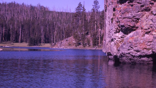
Snake River
The Snake River is a major tributary of the Columbia River. 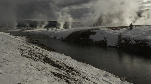
Firehole River in Winter
Videos of hydrothermal features and the Firehole River during winter. 
NPS/Todd Koel Water QualityThe quality of the nation’s waters is protected by laws and policy at local, state, and federal levels. To understand and maintain or improve water quality and aquatic ecosystems, resource managers take inventory and actively monitor water resources throughout the region. Water quality in a national park may reflect activities taking place upstream of the park’s surface waters as well as within the park. The water quality in Grand Teton and Yellowstone national parks, where most of the watersheds originate on federally protected land, is generally very high. However, it is vulnerable to impacts such as road construction, recreational activities, and deposition from atmospheric pollutants. All Yellowstone waters are classified as Outstanding National Resource Waters, which receive the highest level of protection for surface waters under the Clean Water Act. Because of the relatively pristine nature of the park’s surface waters, they are often used to establish reference conditions for the northern Rocky Mountain region. Although most of the park’s watersheds originate within its boundaries and are minimally affected by human activities, they are vulnerable to impacts such as road construction, dewatering, atmospheric deposition, sewage spills, climate change, and runoff from mining activities outside park boundaries Long-term Water Quality MonitoringMonitoring water quality continues to be a high priority for Yellowstone, with standardized data collected at fixed sites since 2002. This long-term data is used to evaluate overall ecosystem health, ascertain impacts of potential stressors (e.g., upstream impacts from legacy mines), identify changes that may be associated with water quality degradation, and guide resource management decisions related to water quality The characteristics of Yellowstone’s surface waters are influenced by season, elevation, precipitation, surrounding vegetation, and wildfire. Some waters are also affected by the park’s geothermal features, generally resulting in warmer temperatures and higher dissolved ion concentrations. Most waters in Yellowstone meet or surpass national and state water quality standards. Geothermal influence on some park waters can result in failure to meet state drinking or recreational water quality standards. For example, arsenic levels in the Madison River at West Yellowstone exceeded the State of Montana’s criteria on most sampling occasions. Arsenic in the Madison River is likely naturally occurring from geothermal geology in the watershed Water Quality Reports are available for Old Faithful, Mammoth, and Lake Village. Park staff also monitor three sites on the park boundary where stream segments in the Yellowstone River drainage have been listed as impaired by the State of Montana. Reese CreekIrrigation by landowners north of the park has often reduced the lowermost reach of the stream during mid-summer and fall. The water flow becomes unsuitable for sustaining native trout and overall biological integrity. The adjudicated water rights stipulate that the creek is to have a minimum flow of 1.306 ft3/ sec from April 15 to October 15. A stakeholder group of federal agencies, private citizens, and conservation organizations are working together on projects to maintain the flows in the main channel. Yellowstone River upstream of Corwin SpringsSimilar to prior years, water samples were collected on the Yellowstone River from mid-April to mid- November 2019 and indicated that samples reqularly exceeded the EPA drinking water standard of 0.01 mg/L total arsenic but not the aquatic life criterion (0.15 mg/L). The higher total arsenic values in this drainage may be due to natural geological or geothermal influences on water chemistry. Soda Butte CreekThe resulting data from recent monitoring also led to a determination in November 2017 by the Montana Department of Environmental Quality (DEQ) that metals conditions in Soda Butte Creek support designated beneficial uses. On November 27, 2018, the Montana DEQ officially removed Soda Butte Creek from the state’s impaired waters [303(d)] list. The reclamation of McLaren Mill and Tailings site and subsequent removal from the 303(d) list represent important milestones in the restoration of Soda Butte Creek. 2024 EPA required Lead Service Line Inventory ResultsYellowstone Water-related ArticlesSource: NPS DataStore Collection 7833. To search for additional information, visit the NPS DataStore. 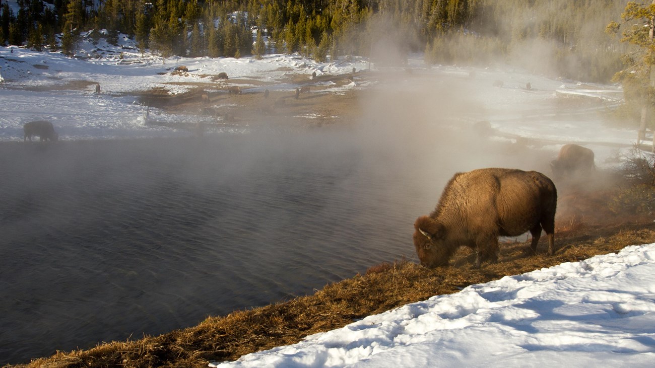
Greater Yellowstone Ecosystem
Yellowstone is the heart of one of the largest, nearly intact temperate-zones on Earth. |
Last updated: December 8, 2025
