Wetlands in National Parks

Wetland

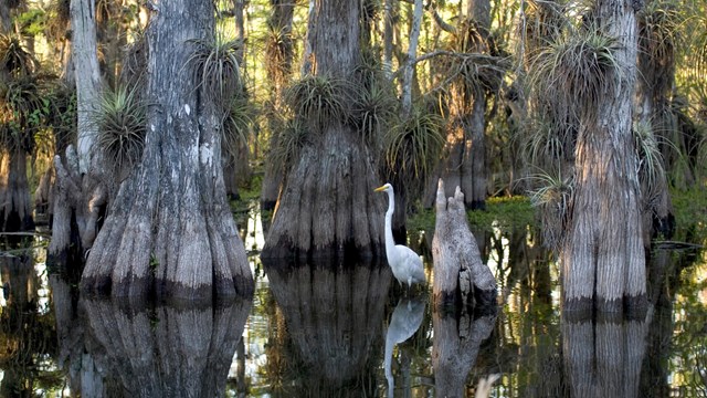
Wetlands are areas where the land is covered by shallow water or the soil is saturated to the surface for at least 14 consecutive days during the growing season. The term wetland includes wet meadows, salt marshes, swamps, bogs and a variety of other aquatic environments. Plants and many animals found in wetlands are specially adapted to live in these wet conditions. Wetlands can be found in virtually every county of every state in the nation, from arctic tundra wetlands in Alaska, to peat bogs in the Appalachians, to salt marshes on the Gulf Coast.

In the past, wetlands were often regarded as wastelands—sources of mosquitoes, flies and unpleasant odors. Most people felt that wetlands were places to be avoided, or better yet, eliminated. It was a widely-accepted practice to drain or fill wetlands for other uses, or to use them as dumping grounds. As a result, more than half of the wetlands that existed in the U.S. at the time of European settlement have vanished.

Today, wetlands are known to provide a variety of valuable functions. They offer critical habitats for fish and wildlife, purify polluted waters, and check the destructive power of floods and storms. Wetlands also provide recreational opportunities such as fishing, hunting, photography, and wildlife observation. They are fast becoming recognized as productive and valuable public resources.

Explore Wetlands:

Everglades National Park Egret
The Importance of Wetlands

Wetlands are highly productive and biologically diverse.

Beaver Dam
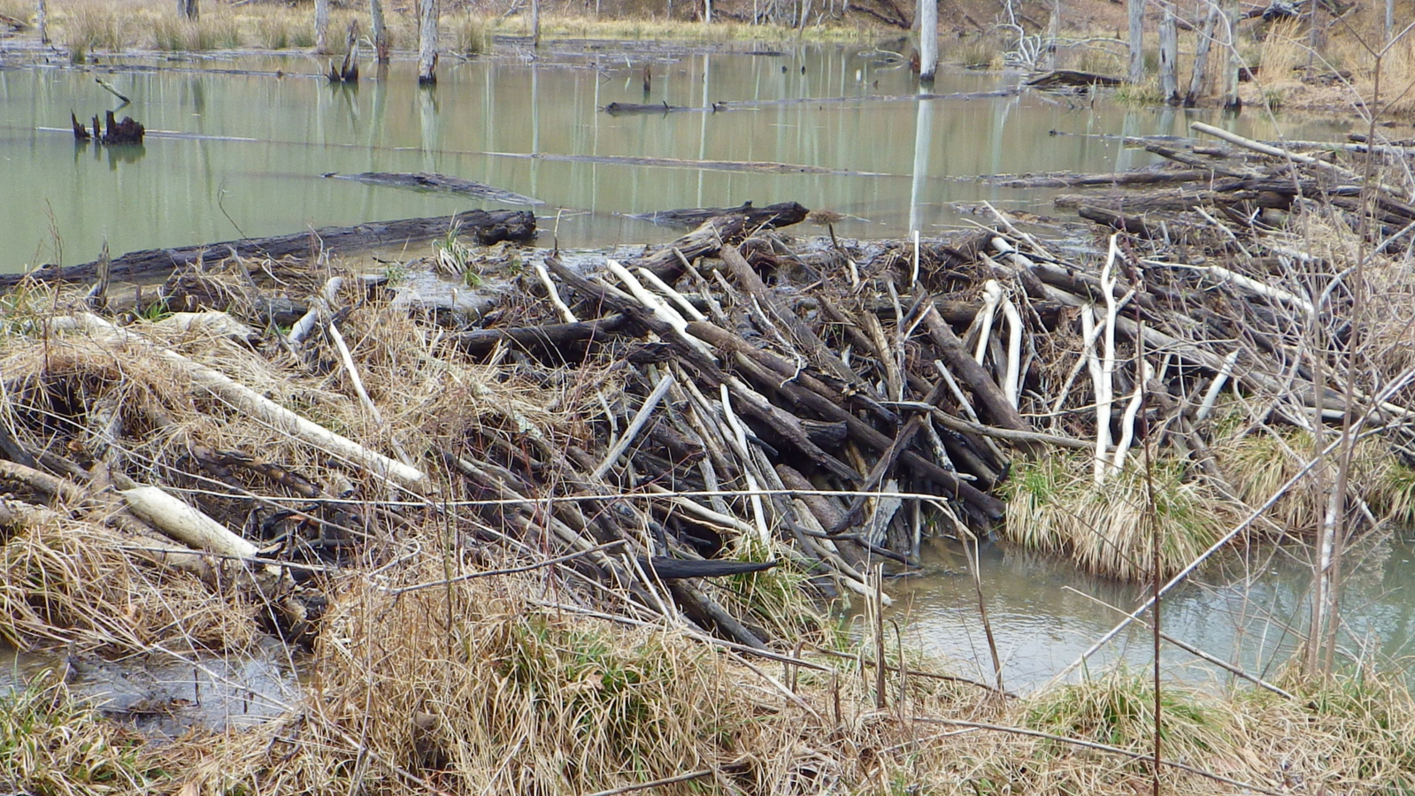
How Wetlands are Formed

Although some of our wetlands have been created in as short a span as a human lifetime, many others took thousands of years to develop.
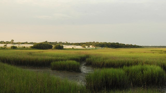
Marsh
Types of Wetlands

A wide variety of wetlands have formed across the country.
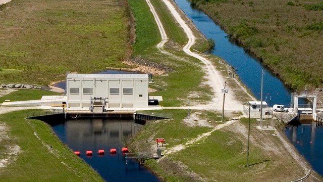
Everglades National Park levee
Threats to Wetlands

Wetlands are threatened by roads to exotic plants.

Learn more about wetlands

Showing results 1-10 of 130

    • Type: Article
    • Locations: Dinosaur National Monument
    • Offices: Inventory and Monitoring Division, Northern Colorado Plateau Inventory & Monitoring Network
    A researcher is taking notes walking along a transect line in a vegetation stand.

    The Inventory and Monitoring Division funded a project to study wetland habitats in Dinosaur National Monument, exploring their locations, conditions, and ecological roles. Data from this project will inform park management decisions and future updates to water rights.

  • Big Thicket National Preserve

    Cattail Marsh

    • Type: Place
    • Locations: Big Thicket National Preserve
    a long wooden boardwalk extends toward the horizon into a wetland marsh area

    Cattail Marsh provides habitat for many kinds of birds. A boardwalk and shaded viewing area provide opportunities for birding and scenic views. Several miles of trails go along the edge of the wetlands.

    • Type: Article
    • Locations: Bandelier National Monument, Valles Caldera National Preserve
    Charred, standing dead trees on the slope of a burned mountainside

    Every time I venture on a new trail, I scan the mountains, looking for burn scars, trying to gauge the extent of the Las Conchas (2011) and Thompson Ridge (2013) fires. It’s one thing to study a color-coded map that shows severity and extent of the burns, it’s another to stand on a hillside among acres and acres of downed trees, then see similar damage miles away caused by the same fire.

    • Type: Article
    • Locations: Acadia National Park
    Three poeple kneeling on wet ground surrounded by green and pink flags and plant plugs.

    Acadia National Park’s largest and much-manipulated wetland is intricately tied to its urban surroundings. Energized by recent federal funding, an ambitious plan seeks to restore it to a more natural state while protecting neighbors from damaging floods.

  • Cuyahoga Valley National Park

    Ira Trailhead Information

    • Type: Place
    • Locations: Cuyahoga Valley National Park
    Two door restrooms (left) and a three sided information kiosk along the driveway with a trail (right

    This trailhead is popular for accessing the Beaver Marsh, located a half mile to the north on the Towpath Trail. The story of the Beaver Marsh has many chapters: a dairy farm, an auto salvage yard, and now a popular spot for viewing the wildlife, plants, and scenery of a recovering marshland.

    • Type: Article
    • Locations: Glacier National Park
    • Offices: Rocky Mountain Inventory & Monitoring Network
    high-elevation stream running across rocky ground with mountains in the background

    In 2007, the Rocky Mountain Inventory and Monitoring Network—a small team of NPS scientists—began monitoring natural resources, called “vital signs,” in Glacier and nearby parks. Vital signs indicate park health and serve as red flags if conditions deteriorate. Results from monitoring these vital signs support park managers’ efforts to make science-based management decisions. Learn about the NPS Inventory and Monitoring Program and its work in Glacier National Park.

    • Type: Article
    • Locations: Cape Hatteras National Seashore, Cape Lookout National Seashore
    • Offices: Inventory and Monitoring Division, Southeast Coast Inventory & Monitoring Network
    A scenic view of saltwater flowing amongst green grasses under a blue sky.

    Eastern black rails serve as valuable health indicators of the salt marshes at Cape Lookout and Cape Hatteras National Seashores (NS). The biggest threat to eastern black rails is rising sea levels since they occupy a narrow window of elevation in the upper zone of marsh habitats. Staff conducted surveys to find out the status of secretive marsh birds at the Seashores.

    • Type: News
    • Locations: Point Reyes National Seashore
    • Date Released: 2021-04-30
    A front end loader, a road grader, an earthmover, and other heavy equipment are parked in a parking lot that is under reconstruction.

    From Monday, May 3, 2021, through Tuesday, August 31, 2021., Drakes Beach Road will be closed due to road work. The road closure is part of the park's two-year Federal Highways Administration and County of Marin road improvement project.

  • Indiana Dunes National Park

    Tolleston Dunes Overlook

    • Type: Place
    • Locations: Indiana Dunes National Park
    An elevated wooden boardwalk zigs through an open woodland.

    This overlook provides a scenic view of the Tolleston Dunes Trail, which winds amid 4,700 year-old sand dunes that were formed when Lake Michigan's water level was 25 feet higher than today. Tolleston is the second youngest of four distinct dune systems found within the national park. Together these dune ridges provide a glimpse into the changing shoreline of Lake Michigan.

  • Marsh - Billings - Rockefeller National Historical Park

    The Belvedere

    • Type: Place
    • Locations: Marsh - Billings - Rockefeller National Historical Park
    white building reminiscent of a Swiss cottage surrounded by flowers

    The Belvedere Complex consists of the Belvedere, the Bowling Alley, the Garden Workshop, the Greenhouse, and the outdoor swimming pool. It was designed in the 1870s by architect Detlef Lienau for the Billings family. In the 1950s, the Rockefellers hired architect Theodor Muller to renovate the Belvedere's interior including the Bowling Alley and soda fountain. A fallout shelter was added in the 1960s. Interior tours are available May-October.

Last updated: March 19, 2018

Tools

  • Site Index