|
Incidents in the park include search-and-rescue, weather hazards like winter storms, flooding, and wildfires, and volcanic hazards like debris flows. Other events that may be of interest to the media include park operations, special events, and large infrastructure projects.

NPS Photo Overview of Mount Rainier National ParkMount Rainier National Park is located in west-central Washington, on the western slope of the Cascade Range and encompasses 236,381 acres within the authorized, legislated park boundary. An additional 140 acres lie outside the current boundary near the Carbon River entrance. The park’s northern boundary is approximately 65 miles southeast of the Seattle-Tacoma metropolitan area and 65 miles west of Yakima. The elevations of the park extend from about 1,700 feet above sea level to 14,410 feet at the summit of Mount Rainier. The focal point of the park is a towering, snow- and ice-covered volcano, which is a prominent landmark in the Pacific Northwest. The base of the volcano spreads over an area of about 100 square miles. The 28 named glaciers on the mountain cover 35 square miles, constituting the largest single-mountain glacial system in the contiguous 48 states. Mount Rainier is also the second most seismically active and the most hazardous volcano in the Cascade Range. The park’s rugged, precipitous topography consists mainly of peaks and valleys. The flanks of the mountain are drained by five major rivers and their tributaries. The mountain’s summit towers 9,000 to 11,000 feet above valley floors only three to six miles away. 97% of the park is designated Wilderness, while the Mount Rainier National Historic Landmark District includes most of the park’s buildings, roads, trails, and other structures. This challenging landscape attracts numerous hikers, climbers, snowshoers, and backpackers, as well as many other visitors. Mount Rainier has a long history of human activity. Indigenous people, including six Associated Tribes, have ties to the mountain going back thousands of years and continue their connection with the mountain to this day. The park maintains a wide variety of partnerships with public, private, and nonprofit groups for education, scientific research, and park stewardship. Learn more about Mount Rainier National Park in the Foundation Document and Foundation Document Overview. Mount Rainier National Park Contact Information
Photos & Video
Additional Mount Rainier National Park Information
Park Management
Management plans, regulations, visitor statistics, and other information about Mount Rainier National Park. 
Park Construction
Park construction includes work to improve roads and visitor areas. Learn how this will impact your travel plans through the park. 
News Releases
Current and past news releases related to events, operational changes, construction projects, and incidents at Mount Rainier. 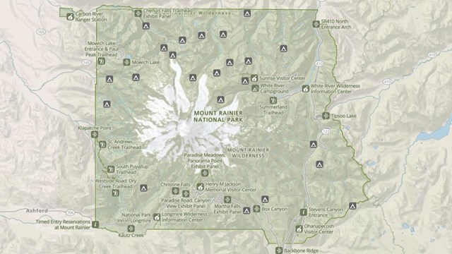
Park Maps
Maps of Mount Rainier National Park, including the Wilderness Trip Planner Map and area trail maps. 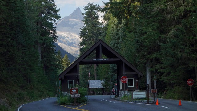
Directions
Need directions to get to different park entrances? Also includes information on driving times to park locations. 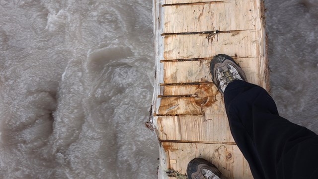
Safety
The secret to a great visit to Mount Rainier? Staying safe! From hiking safety to volcanic geohazards, learn how to keep yourself safe. 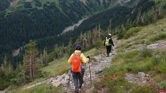
Wilderness Hiking, Camping, & Climbing
Information and permits for exploring Mount Rainier's backcountry. 
Volcanoes
Mount Rainier is a active volcano. Lava flows and eruptions have shaped the landscape in the past, and evidence can still be seen today. 
Glaciers
Glaciers carve through the landscape of Mount Rainier, fuel the park rivers, and are a measuring stick for climate conditions. |
Last updated: January 21, 2025