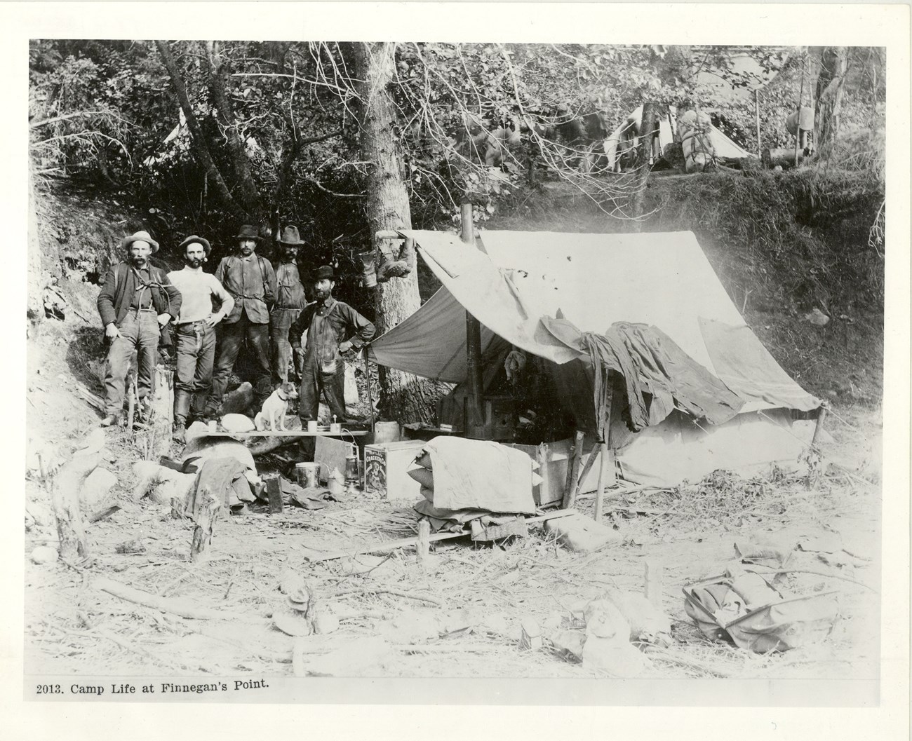
Library of Congress LC-USZ62-47978 Gold Rush CampFinnegan's Point (variously spelled Finnigin's, Finnigan's, or Finigan's) did not exist until the Klondike Gold Rush. Before the gold rush, prospectors usually passed this area on their way to the Canadian Interior. Finnegan's Point was first noted in late August 1897. Tappan Adney, a roving correspondent for Harper's Weekly Magazine, described visiting the camp. At that time, the settlement consisted of "twenty tents, including a blacksmith shop, a saloon and restaurant." A month later, 75 tents sprawled about the site. After the Klondike Gold RushShortly after the turn of the century, the area had a small settlement called Jimtown. It was said to be "near Dyea and opposite Irene Glacier," and was just north of Finnegan's Point. The settlement suffered a fire in the summer of 1901. This fire, and others that may have occurred since then, may have destroyed remains from the gold rush.Since the gold rush, low lying Finnegan's Point has suffered at the hands of both nature and man. The historical remains at Dyea have likely been covered by flood waters. Major floods occurred on the Taiya River in the 1920s, 1944, and early 1950s. Parts of the Taiya River shifted significantly between 1900 and the 1940s. Below the Nourse River, the Taiya has probably moved east, washing away the old trail. People passing through the area may have removed some of the cultural remains. Several hundred hikers crossed over the Chilkoot Trail between 1900 and the 1950s. It is likely some of them collected historic artifacts from this site. More recent hikers may have found other debris from the old camp. A significant impact to the site was the Hosford logging operation (Skagway Lumber Company). This company was active in the Taiya River valley between 1948 and 1956. The owner of the mill, Ed Hosford, directed the construction of a road from Dyea northward. He chose the present site of Finnegan's Point as a temporary terminus of his road. (Later, he took his machinery across the frozen Taiya River and continued operations northwest of this site.) The lumber operation itself probably destroyed some of the extant cultural resources. Several of the company's employees, moreover, may have collected historical artifacts. Despite the ravages of time, scattered cultural resources remain near Finnegan's Point. Two telephone wires and insulator dowels extend north from the campground. These wires may have been next to the 1898 wagon road. Hints of what may have been the wagon road exist southeast of the recreational trail. Nearby, nailed into a cottonwood tree is an insulator. This is an artifact of the gold rush era telephone line that extended from Dyea over Chilkoot Pass. All that remains from the actual settlement is a group of pits. Two foundations and two privy pits are located south of the campground. Further investigations may reveal more artifacts. Heavy undergrowth often obscures all but the largest artifacts. The lack of wooden structures at Finnegan's Point meant few durable cultural remnants. |
Last updated: January 28, 2020
