Webcams

 
  • Grand Canyon Weather Forecast and Road Conditions here

  • Grand Canyon Weather and Climate Data here

Webcam

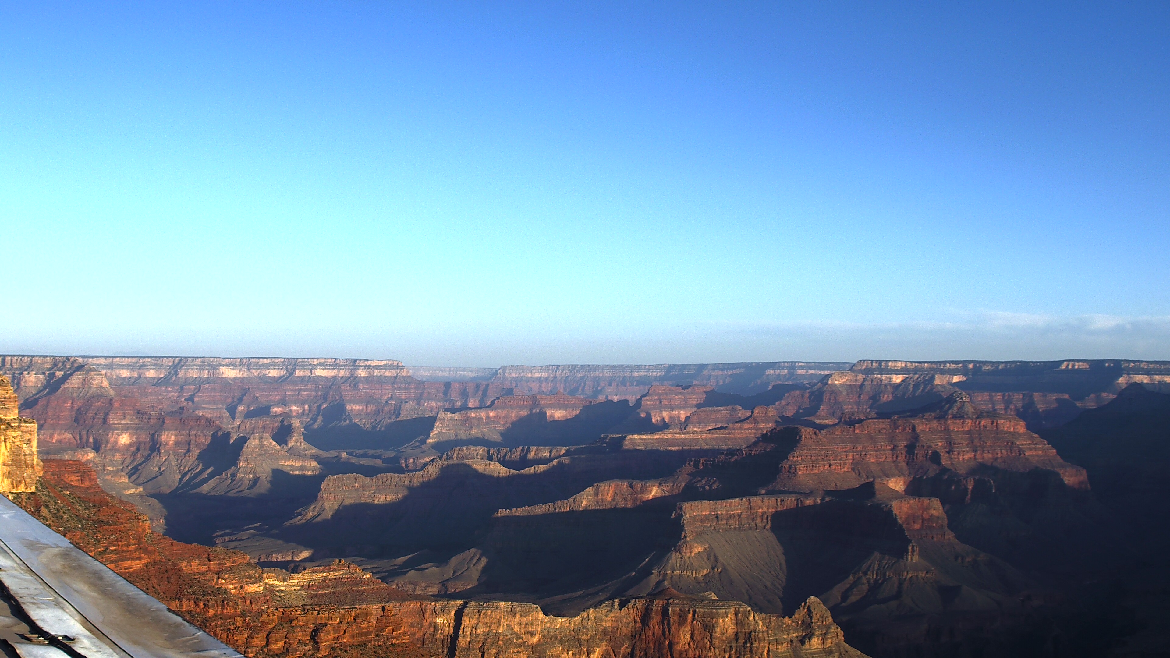
Yavapai Point — Looking NW

The view is from Yavapai Point on the South Rim of the park. The view refreshes every 15 minutes. Grand Canyon National Park's Air Quality Webcam offers a window into the current sights, weather, air quality and seasonal changes that the park is experiencing.

Click on the photo and check the date to be sure the image is current. Additional weather and air quality information will be displayed on the same page.

View Webcam
 
Webcam

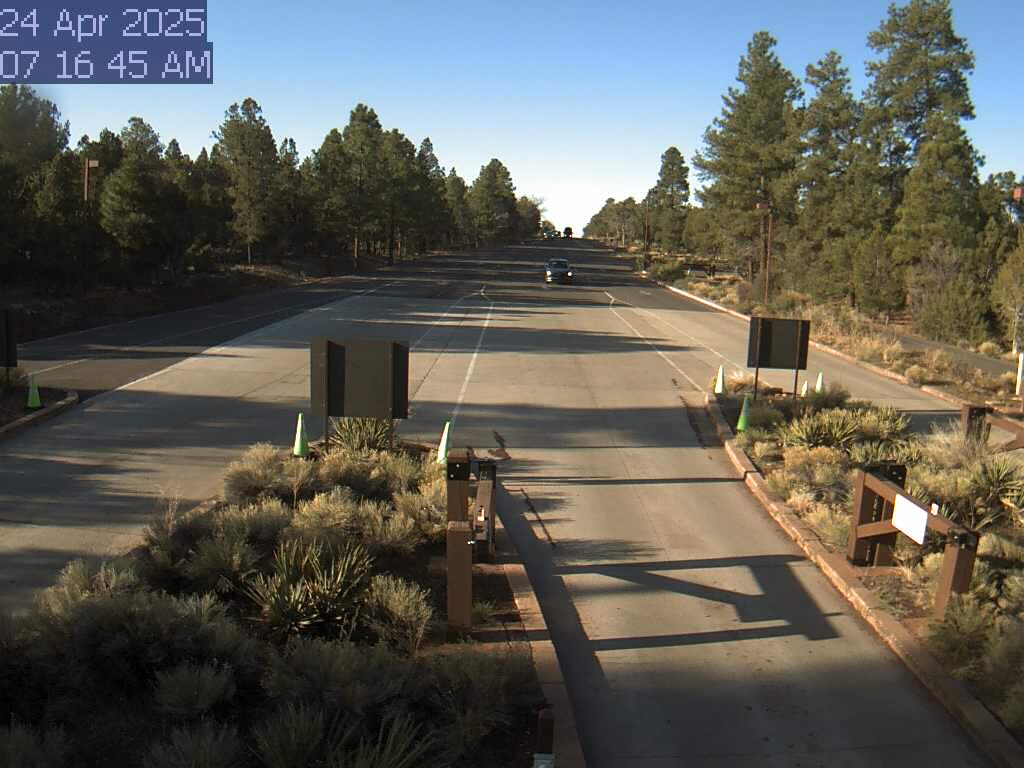
South Entrance Station

Use this webcam to help time your South Rim arrival, and to check winter road conditions. During spring break and summer, there can be long lines and up to two hour wait times between 10 am and 4 pm. This view refreshes every 5 minutes. Be sure to check the time and date in the image, to be sure it is current.

The entrance station is about 1.6 miles (2.5 km) north of the gateway town of Tusayan, Arizona, and 4.9 miles (7.8 km) south of Grand Canyon Visitor Center,

View Webcam
 
 
Webcam

Live View from Kolb Studio

In this north-facing view, the Battleship formation is in the center, and Havasupai Gardens (formerly known as Indian Garden) is visible - lower right, 3000 feet (915 m) below. Kolb Studio was the family home and photography studio of the Kolb Brothers, pioneer photographers at Grand Canyon. Verify that the time and date of the picture is current (upper right in the photo) Camera is hosted by Grand Canyon Conservancy. The image updates every minute.

View Webcam
 
Webcam

Live View - Bright Angel Trailhead

Check this camera for winter trail conditions. Between now and May 14, Bright Angel Trail is open to Havasupai Gardens. The trail is closed from Havasupai Gardens down to and including the Silver Bridge, for waterline replacement. Drinking water stations at Mile-and-a-Half and Three-Mile Resthouses have been turned off for the winter. Water is only available at Havasupai Gardens. Verify that the time and date of the picture is current (upper right in the photo) Camera is hosted by Grand Canyon Conservancy. The image updates every minute.

View Webcam


Additional Northern Arizona Webcams

 
Webcam

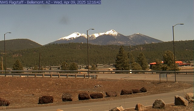
San Francisco Peaks

Webcam courtesy of the National Weather Service office in Bellemont, Arizona. In the distance, the San Francisco Peaks with Mount Humphreys at 12,633 feet (3,850 m) above sea level, the highest point in the state of Arizona. Bellemont is located along Interstate 40, 13.6 miles (22 Km) west of Flagstaff, Arizona.

View Webcam
 
 
Webcam

Flagstaff, Arizona — I-40

This camera shows the current weather, traffic and road conditions at Mile 199.6 of Interstate 40 —one of the main highways travelers use to reach Grand Canyon National Park. Webcam courtesy Arizona Dept. of Transportation 511. The image updates every 15 minutes. Always check the date/time in the image to be sure it is recent.

View Webcam
 
Webcam

State Route 64 (Mile 213.9)

The view is from Valle, Arizona, near the junction of US 180 (from Flagstaff) and SR 64 (from Williams) The location is also called "Grand Canyon Junction". The South Rim of Grand Canyon National Park is 26 miles (41 km) north of this location. This webcam is provided by of Arizona Dept of Transportation 511. The image updates every 15 minutes. Always check the date/time in the image to be sure it is recent.

View Webcam
 
Webcam

State Route 64 (Mile 235.15)

This webcam is located just south of the town of Tusayan, Arizona, at the intersection of Arizona State Route 64 with the north entrance road to Grand Canyon Airport. This intersection is 2.56 miles (4.12 km) from the park's South Entrance Station, or a total of 7.6 miles (12.23 km) from this location to the Grand Canyon Visitor Center, inside the park. This webcam is provided by the Arizona Dept. of Transportation 511. The image updates every 15 minutes. Always check the date/time in the image to be sure it is recent.

View Webcam
 
Webcam

View from Jacob Lake, Arizona

Jacob Lake, Arizona, is located at the junction of U.S. Route 89A and Arizona State Route 67. The entrance to the North Rim of Grand Canyon National Park is located 30 miles south of Jacob Lake on SR 67. The actual rim of the canyon is an additional 14 miles south of the entrance station. The North Rim of the park is open for day use only between October 15 and November 30, 2024. then closes for the winter. Webcam courtesy of Arizona Dept. of Transportation 511.The image updates every 15 minutes. Always check the date/time in the image to be sure it is recent.

View Webcam
 

Regional Road Conditions

Listed below are commercial phone numbers for recorded messages on road conditions and links to state highway websites:

  • Grand Canyon National Park (928) 638-7496


Last updated: November 28, 2024

Park footer

Contact Info

Mailing Address:

PO Box 129
Grand Canyon, AZ 86023

Phone:

928-638-7888

Contact Us