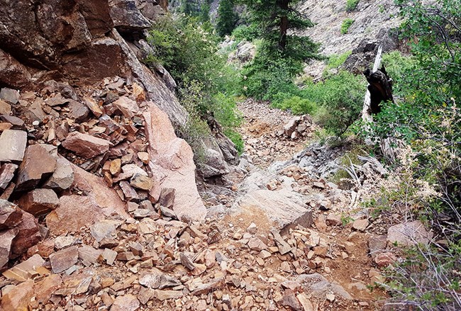
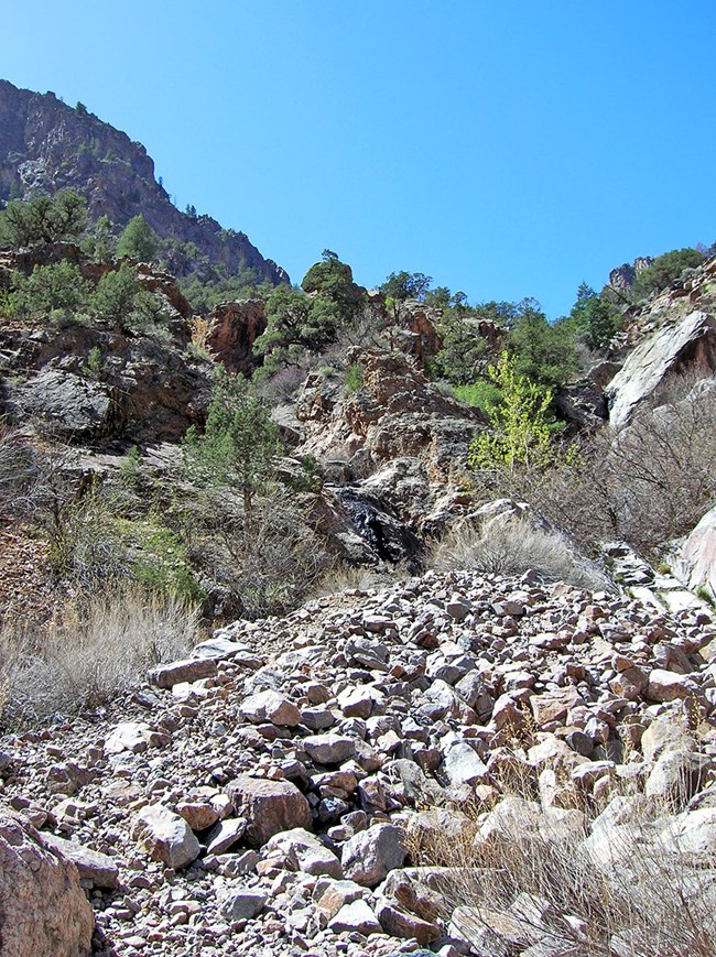
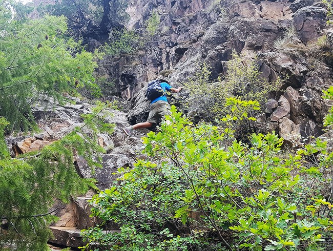
Access to the inner canyon and wilderness routes is limited to the Warner Route (by reserved permit), Red Rock Canyon (by reserved permit), and other routes not burned in the 2025 South Rim Fire. The Gunnison and Tomichi routes are closed until further notice. All North Rim routes remain open. Do not enter closed or burned areas until further notice.Related PagesThere are no maintained or marked trails into the inner canyon. Instead, there are “wilderness routes.” Routes are not recommended for visitors with health conditions, such as heart or lung issues. Wilderness routes are not trails; they are unmarked, physically demanding, very steep scrambles with loose rock. A Black Canyon wilderness route experience should be approached with caution. Hikers are expected to find their own way and be prepared for self-rescue. If a hiker becomes injured, help is not immediate. Any rescue operation within the park is difficult and requires extended periods of time. It will take many hours to over a day for a rescue to be mobilized. Hikers should be prepared for self-rescue and unplanned overnights. DO NOT go beyond your capabilities; TURN BACK if necessary. Poison ivy is nearly impossible to avoid, and can be found growing 5 feet tall along the river. Pets are not allowed in the Black Canyon of the Gunnison Wilderness.
What to BringInner canyon activities are located in remote portions of the Black Canyon of the Gunnison Wilderness. Any rescue operation within the park is difficult and requires extended periods of time. Park visitors should be aware of the challenging nature of the terrain and carry the equipment necessary to endure an unexpected night in the wilderness. Each activity will require different essentials, but a good list to keep in mind in any wilderness area is:
Wilderness CampingYou may camp at the “bottom” of the wilderness routes, by the Gunnison River, for a maximum of three nights per trip/permit. There are established campsites at the bottom of each route. You may also camp in the backcountry along the Devil’s Backbone Route, which leaves from East Portal. Some wilderness camping areas have vault toilets, but wag bags are required elsewhere. We highly recommend you bring a bear-proof canister. Wilderness Use Permits are required. Routes in SummerDue to the elevation difference, inner canyon temperatures can be at least 5-10° F (3-6° C) warmer than the rim. Hot, dry air and the difficulty of the routes often leads to dehydration and heat exhaustion. Hikers should have access to 4 liters of water per person, per day. A water filter or treatment option can help lighten the load. The only water access is at the river, at the bottom of the canyon. Summertime hikers should start their trip as early in the day as possible (with enough daylight to see), taking advantage of cooler temperatures. Heat exhaustion is the most common injury on the routes.
Routes in WinterExploration of the wilderness during the winter is at your own risk. Winter hikers attempting the inner canyon routes should be prepared with snowshoes, crampons, ice axe, and possibly a rope. Most of the South Rim routes are snow covered from November to April. Water is not available at either rim from October to mid-May, so make sure to bring your own. 
NPS photo Gunnison RouteThis route is recommended to persons attempting their first inner-canyon hike; however, it is still very strenuous. Gunnison Route begins at the South Rim Visitor Center. Follow the Oak Flat Trail for 1/3 mile, down the first few switchbacks. You will come to a sign that says, "Wilderness Permit Required." Continue the steep descent to the chain down the drainage. An 80-foot chain is located 1/3 of the way down. Once you reach the river, an outhouse and campsites are located a short distance upstream.

NPS photo Tomichi RouteThis route is considered the steepest South Rim route and is very difficult. The entire length of the route is loose rock and receives full sun exposure. There are several steep inclines near the top of the route that require scrambling. Use extra caution while descending. The bottom of this route brings you to a narrow part of the canyon. Park at Tomichi Point overlook or use the parking area near the South Rim Campground. Take the Rim Rock Trail to a point about 100 yards (100 m) south of the Tomichi Point overlook. This is the start of the Tomichi Route. Descend the route until the junction with another draw is reached. Continue to follow the main drainage down the slope to the river.

NPS Photo Warner RouteThis is the longest route and overnight travel is highly suggested. The bottom of this route takes you to a wider point in the canyon and offers great fishing opportunities. Hike along the Warner Point Nature Trail and walk up the hill past post #13. Look for a small directional sign on the left pointing toward Warner Point. This is the start of the Warner Route. The route leads off to the left of the directional sign. Avoid the first drainage and continue west to the lowest saddle on the ridge before descending.

NPS photo East Portal RoutesDevil's Backbone RouteThis route follows a ridge along the river. Hike downstream on the south side for about 1/2 mile until you reach the ridge that runs down the cliff. The top 30 feet of this 400 foot scramble is airy and a haul rope can be handy. The bare rock can be slippery with gravel at the top, and you are somewhat exposed to the edge of the cliff. The downstream side is more gentle. You can then hike another mile or more downstream with smaller ridge lines to scramble over. Although it is in the canyon, Devil’s Backbone does not require a permit for day hikes. Overnight backpackers do require a permit, available at the South Rim Visitor Center or self-registration box at East Portal. North River RouteThere is a small boat launch at the registration board that provides a good landing for boating across the river for this route. Once across the river you can hike nearly 2 miles down river to the cliff at Flat Rock Rapid. There is only one low ridge to scramble over at Deadhorse Gulch. Boaters and overnight backpackers require a Wilderness Use Permit, available at the South Rim Visitor Center or self-registration box at East Portal. *Walking Along the RiverThe mileages listed as "River Access" are the maximum distance available to a hiker along the river at low water levels (300-350 cubic feet per second). Wading in the cold river (50F / 10C) is hazardous and not recommended, and at levels above 450-500 CFS the combination of high, swift water and cold temperatures increases the danger. Rocks along the shore can be covered in algae and moss, and very slick. Many individuals have been swept to their death in the Gunnison River. Wilderness Videos
|
Last updated: November 13, 2025

