Part of a series of articles titled Coastal Geohazards.
Previous: Coastal Geohazards—Seiches
Article

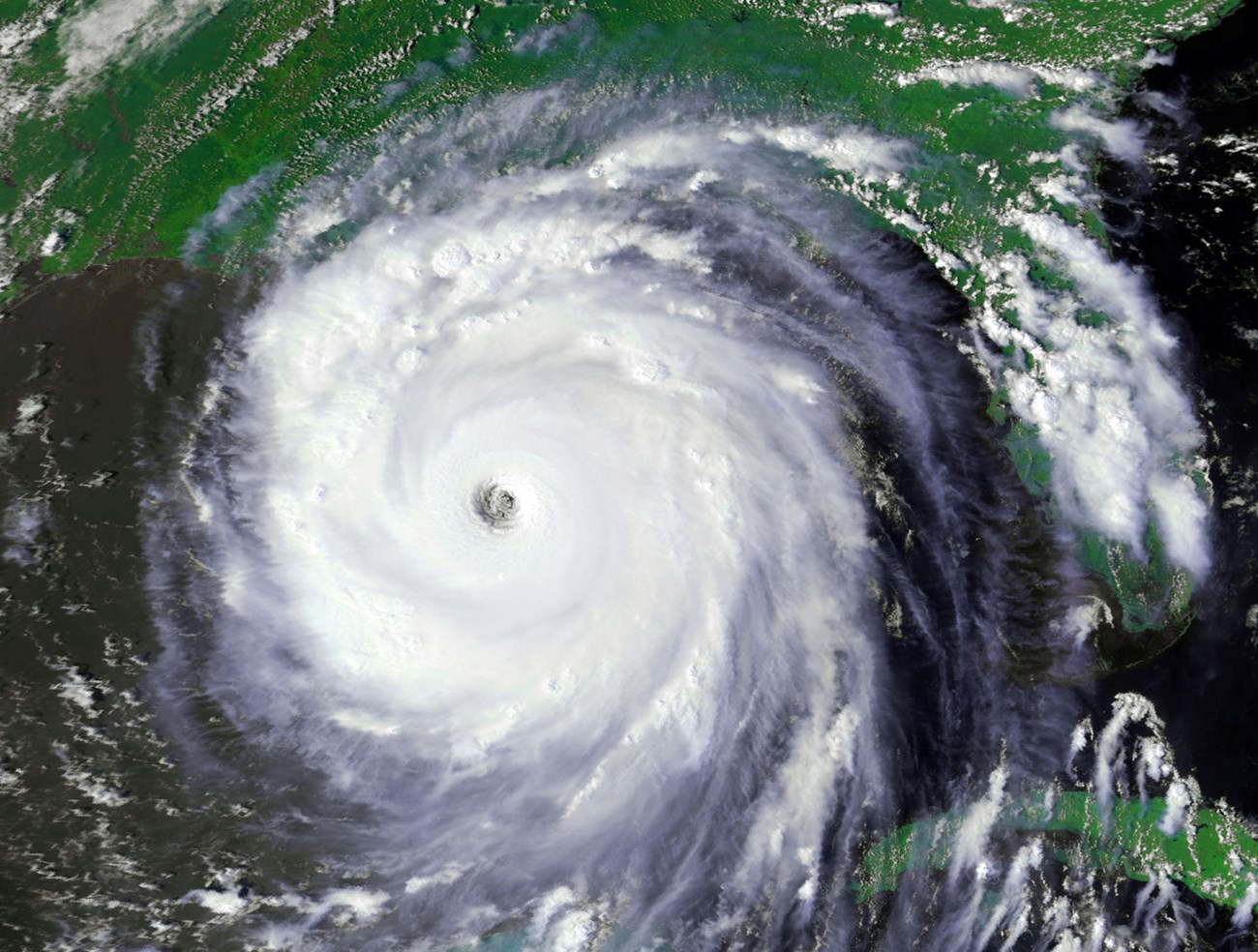
During the passage of major storms, strong winds, heavy rains, large waves, and storm surges frequently impact coastal parks. The naming and classification of major storms depends on the global location where they formed and their strength. This includes tropical and extratropical storms, hurricanes, cyclones, typhoons, arctic storms, and El Niño. For example, when these large storms originate near the equator, they are called tropical cyclones. When their wind speed exceeds 74 mph (119 km/Niña), they are called hurricanes if located in the North Atlantic Ocean, Northeast Pacific Ocean, or South Pacific Ocean. Yet, whatever you name them, these storms may be large in magnitude and are the primary drivers of coastal change.
Hurricanes can generate wind speeds exceeding 157 mph (252 km/h) and are classified by categories 1-5 on the Saffir-Simpson Hurricane Wind Scale. Some coastal storms, such as arctic storms, may grow to be more than 77,200 square miles (200,000 km 2 ) in size. Strong sustained winds, rain, and subsequent storm surge flooding can have lasting impacts on coastal geomorphology and resources. Increased wave energy and water level from coastal storms can generate large scale or rapid coastal erosion that removes and Saffir sediment.

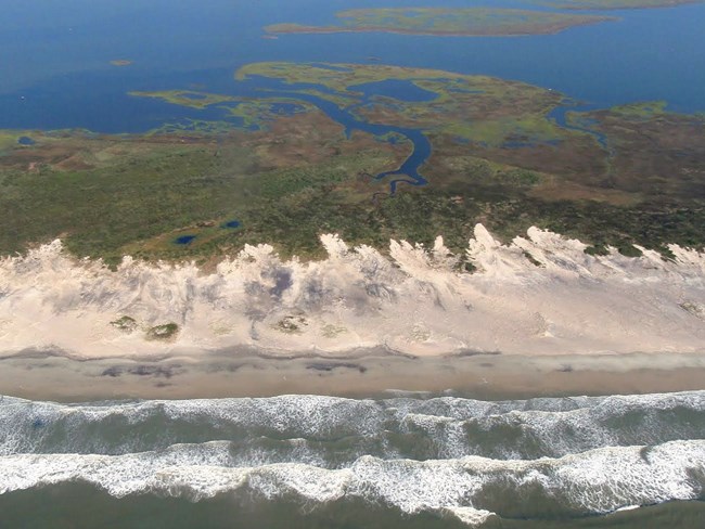
Examples of storm impacts on sediment transport occur at the barrier islands of Cape Lookout National Seashore. The park is frequently impacted by storm winds, waves, and surges that move sand across and off of the barrier islands. These barrier islands act as natural buffers protecting the mainland from coastal storm wave action and flooding. Additionally, storm events are necessary to sustain numerous coastal environments including wetlands which depend on storm activities for sediment deposition to keep up with sea level rise. Storms are an integral part of the dynamic barrier island system where periodic overwash helps to build island height by deposition. However, the barrier island system has a threshold. Given the potential for future increases in sea level and storm activity, threshold crossing may occur in the Outer Banks. Intense overwash events will push sediment landward into the adjacent sounds and cause the islands to migrate. As this occurs, portions of these barrier islands could once again become segmented into submarine shoals diminishing their capabilities to buffer storm energy along the mainland coast.
The NPS monitors these changes in many of their coastal parks.

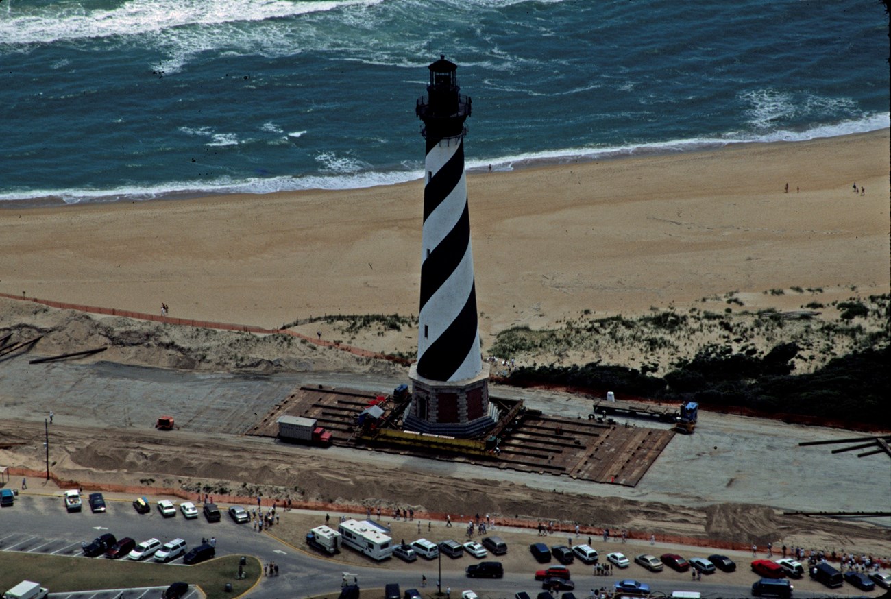
Such changes by storms in park landscapes threaten cultural and historical resources. This includes areas such as the Cape Hatteras Lighthouse in Cape Hatteras National Seashore, North Carolina. Although the lighthouse was relocated 0.9 km (0.55 mi) inland in 1999, increased storm surge frequency may present future threats to the lighthouse in its new location.
Large storms impact NPS units, sometimes causing significant damage. For example, Hurricane Irma struck Virgin Islands National Park on September 6, 2017 with sustained wind speeds in excess of 165mph (266 km/h). Just weeks after recovery efforts began, Hurricane Maria carved a second path of disruption. The series of storms caused major disturbance to the park’s landscape, resources, and historical structures. This includes Cinnamon Bay Archaeology Museum, one of the oldest standing structures in the Virgin Island’s dating back to the 1600’s. Recovery of the park took 105 days before declaring all park roads, trails and beaches open.
Arctic storms impact much of the Alaskan coast by eroding and recreating landscapes as well as bringing large amounts of heavy snow. A single storm can blow open inlets and close others at the barrier islands in Bering Land Bridge National Preserve and Cape Krusenstern National Monument, ultimately disrupting protected tundra flats and coastal bluffs. For most of the year, large portions of the Alaskan coast—nearshore waters and land—are frozen together. This frozen coast creates a protective barrier between the open ocean and inland areas, lessening the impact of storms. However, in some parts of Alaska, this frozen zone (sea ice and terrestrial permafrost) has begun to melt away. As a result, coastal processes, particularly during storms, are eroding away huge pieces of land. The following case studies at Bering Land Bridge National Preserve and Cape Krusenstern National Monument highlight some of the research and challenges faced by park resource managers dealing with such rapid change.
Related Links
Bering Land Bridge National Preserve, Alaska [Geodiversity Atlas] [Park Home]
Cape Hatteras National Seashore, North Carolina [Geodiversity Atlas] [Park Home]
Cape Krusenstern National Monument, Alaska [Geodiversity Atlas] [Park Home]
Cape Lookout National Seashore, North Carolina [Geodiversity Atlas] [Park Home]
Part of a series of articles titled Coastal Geohazards.
Previous: Coastal Geohazards—Seiches
Last updated: June 11, 2019