Last updated: June 14, 2024
Article
NPS Geodiversity Atlas—Cape Hatteras National Seashore, North Carolina
Geodiversity refers to the full variety of natural geologic (rocks, minerals, sediments, fossils, landforms, and physical processes) and soil resources and processes that occur in the park. A product of the Geologic Resources Inventory, the NPS Geodiversity Atlas delivers information in support of education, Geoconservation, and integrated management of living (biotic) and non-living (abiotic) components of the ecosystem.

Geologic Features and Processes
Cape Hatteras National Seashore is part of the North Carolina Outer Banks, a barrier island chain within the Atlantic Coastal Plain physiographic province. It was established to preserve the wild and primitive character of the dynamic barrier islands, to protect diverse plant and animal communities, and to provide for recreation that is compatible with its natural and cultural resources.
Most of the barrier islands are long and narrow, separated from the mainland by wide, shallow sounds. The islands provide diverse barrier island habitats that are controlled and sustained by natural coastal geomorphological processes and human modifications. These habitats support native mammals, reptiles, amphibians, many types of marine invertebrate, and several species listed federally as threatened or endangered. The park provides important avian breeding, migratory, and wintering habitats. The rich and productive estuary includes large areas of marshland and submerged aquatic vegetation, and the inland forests protect freshwater aquifer recharge areas.
The Outer Banks are geologically young. The geologic framework of Cape Hatteras was constructed by the cyclic rise and fall of relative sea level. This framework controls the sediments available to the modern barrier island, and the ways in which the island responds to natural and anthropogenic processes. About 5.3 million years ago, sea level was much higher and marine sediments were deposited across much of what is now the coastal plain. During multiple glacial episodes (ice ages) beginning 2.6 million years ago, sea level rose and fell many times, and rivers incised the previously deposited marine strata, leaving a paleotopography that controls the estuarine geometry and bathymetry and the location of the barrier islands. These paleoriver channelswere then backfilled and buried by Holocene sediments during the last 10,000 years as sea level rose to its present level. As a result, the sediments underlying the modern barrier island are a complex assemblage of marine, coastal, estuarine, riverine, and other Coastal Plain deposits, ranging from compact peat and mud to unconsolidated to semi-consolidated sands, gravels, and shell beds.
Modern coastal processes (storms, waves, tides, sediment transport, inlet dynamics, and sea-level change) shape the landforms and rework the thick Quaternary sediments. Due to the reworking of these older sediments, much of the present Outer Banks is less than 3,000 years old, and some island segments are less than 500 years old. Storms, waves, and winds continue to shape the islands, along with anthropogenic activities such as dune construction, nearshore dredging, inlet and shoreline stabilization, and beach renourishment.
Coastal Features and Processes
Noteworthy geologic and environmental features and processes at Cape Hatteras National Seashore include the following:
- Oceanographic Conditions. The Outer Banks is a storm- and wave-dominated barrier island system with low tidal ranges.
- Sediment Transport Processes. Waves, wind, and storm surge move sediment through the inlets and along and across the islands. The longshore transport rate is very high. The framework geology controls sediment availability and type. New sediment comes from the eroding shoreface, updrift beaches, capeassociated shoals, and inlet deltas.
- Capes and Cape-Associated Shoals. Cape Hatteras and Diamond Shoals separate two major ocean currents and biological regimes. The cold-water Labrador Current flows southward to meet the warm-water Gulf Stream, which flows northward. Their interaction and the resulting oceanographic and atmospheric responses are controlled by the geography of the continental margin, Cape Hatteras and Diamond Shoals, and the underlying geology.
- Inlets. New inlets open during storms, when storm surge breaches the island from the ocean or estuarine side. Tidal currents deposit sediment, building flood and ebb tidal deltas, which are important for the island sediment budget, marsh building, and long-term island evolution. Inlets are dynamic and essential components of barrier islands and associated riverine and estuarine systems. Only three modern inlets are currently present, but up to 30 inlets have opened and closed along the Outer Banks in the last 400 years.
- Estuaries. Pamlico and Roanoke sounds provide fish nursery and foraging habitats, and support several seagrass species. Water quality is good in most areas, but is impacted by septic leachate and other riverine pollutant input. Estuarine sediments are derived from shoreline erosion, continental shelf, and ongoing biogenic production.
- Freshwater Aquifer. The shallow groundwater is recharged through rainfall, and is depleted through anthropogenic withdrawal, evapotranspiration through surface vegetation, and surface drainage from uplands. It can also be affected by impoundments and drought. These influences can, in turn, alter hydrologic processes, wetland function, and vegetation community distribution, composition, diversity, and structure.
-
Barrier Island Evolution and Behavior. The modern coastal geomorphology results from interaction among the underlying geologic framework, fluctuating rates of relative sea-level change, coastal oceanographic processes, and anthropogenic modifications.
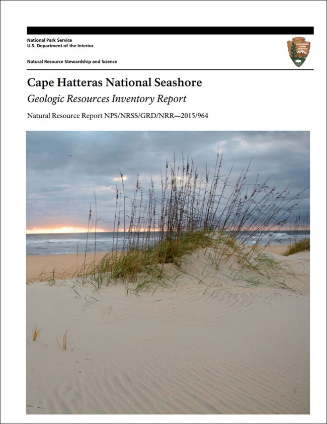
Also see the park Geologic Resources Inventory Report for details on these and other coastal features and process, as well as a discussion of management issues and mapping units in this dynamic coastal setting.
Paleontological Resources
Mixed assemblages of Quaternary marine fossils are abundant on North Carolina beaches and can locally constitute up to 75% of beach shells (Riggs et al. 1995). Landward migration of the barrier islands exposes remnants of forests and swamps that once grew on their back sides. These remnant trees and organic peat deposits are generally hundreds to hundreds of thousands of years old (Dolan and Lins 1986; Tweet et al. 2009). Sediments eroded from relict inlet deposits provide another source of shell fragments and other fossils of pre-Holocene age (Herbert and Heron 1978; Tweet et al. 2009).
The offshore continental shelf produces a variety of fossils that may wash ashore, including those of algae, foraminifera, corals, bryozoans, mollusks, ostracodes, barnacles, and echinoids, as well as polychaete worm tubes (Macintyre and Milliman 1970; Cleary and Thayer 1973; Culver et al. 2008b; Tweet et al. 2009). Vertebrate remains also wash ashore, including an Odobenus rosmarus (walrus) skull, radiocarbon dated to 36,760 ± 570 years before present, that washed up on the beach at Salvo in 1990 (Stover 2002; Tweet et al. 2009).
All NPS fossil resources are protected under the Paleontological Resources Preservation Act of 2009 (Public Law 111-11, Title VI, Subtitle D; 16 U.S.C. §§ 470aaa - 470aaa-11).
Regional Geology
Cape Hatteras National Seashore is a part of the Coastal Plain Physiographic Province and shares its geologic history and some characteristic geologic formations with a region that extends well beyond park boundaries.
- Scoping summaries are records of scoping meetings where NPS staff and local geologists determined the park’s geologic mapping plan and what content should be included in the report.
- Digital geologic maps include files for viewing in GIS software, a guide to using the data, and a document with ancillary map information. Newer products also include data viewable in Google Earth and online map services.
- Reports use the maps to discuss the park’s setting and significance, notable geologic features and processes, geologic resource management issues, and geologic history.
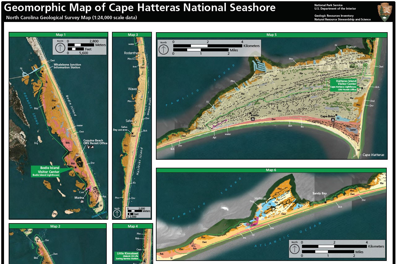
- Posters are a static view of the GIS data in PDF format. Newer posters include aerial imagery or shaded relief and other park information. They are also included with the reports.
- Projects list basic information about the program and all products available for a park.
Source: NPS DataStore Saved Search 2763. To search for additional information, visit the NPS DataStore.
A NPS Soil Resources Inventory project has been completed for Cape Hatteras National Seashore and can be found on the NPS Data Store.
Source: NPS DataStore Saved Search 2745. To search for additional information, visit the NPS DataStore.

Related Links

