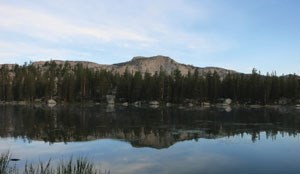
Polly Dome LakesHighlights: Lakes Distance: 6 miles (9.6 km) round trip Elevation Gain: 600 feet (180 m) Permit Demand: Medium Trailhead: Murphy Creek Polly Dome Lakes are located to the north of Tenaya Lake, just past Polly Dome. Starting near the shores of Tenaya Lake, this trail travels through sub-alpine forests until reaching the lakes. There is an unofficial, unmarked spur trail that leads to the lakes. 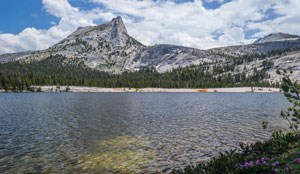
Cathedral LakesHighlights: Lakes, High Country Distance: 7 miles (11.2 km) round trip Elevation Gain: 1,000 feet (300 m) Permit Demand: Very High Trailhead: Cathedral Lakes Cathedral Lakes are nestled at the foot of Cathedral Peak. The trail through this area is the famous John Muir Trail, which sees high traffic all season. The area is popular with rock climbers. Hikers will enjoy views of Cathedral Peak and Echo Peak and access to Long Meadow, Sunrise High Sierra Camp, and Sunrise Lakes. 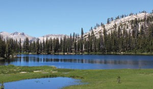
Sunrise LakesHighlights: Lakes, High Country Distance: 6.8 miles (11.2 km) round trip Elevation Gain: 1,100 feet (335 m) Permit Demand: Very High Trailhead: Sunrise Lakes These lakes are located to the south of Tenaya Lake. Views from the nearby ridge showcase Tenaya Canyon and Mt. Hoffmann. This route is often used to access Clouds Rest, which overlooks Half Dome and Tenaya Canyon. 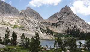
Young LakesHighlights: Lakes, High Country Distance: 13.6 miles (21.9 km) round trip Elevation Gain: 1300 feet (400 m) Permit Demand: Medium Trailhead: Young Lakes via Dog Lake or Glen Aulin This chain of three lakes is north of Tuloumne Meadows and provides wide panoramic views of the Cathedral Range. The trail to the lakes goes through alpine meadows and forests. The official trail ends at the first lake situated below Ragged Peak, but a well-used informal trail continues to the second and third lakes. 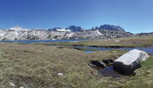
Ireland and Evelyn LakeHighlights: Lakes and High Country Distance: 22.2 miles (35.7 km) loop Elevation Gain: 2,150 feet (655 m) Permit Demand: Very High Trailhead: Lyell Canyon or Rafferty Creek This hike begins in Lyell Canyon but leaves the Canyon at Ireland Creek. Hikers ascend through forests to Ireland and Evelyn Lakes. The return trip follows Rafferty Creek back to Tuolumne Meadows. There are views of various peaks and many lakes to enjoy. 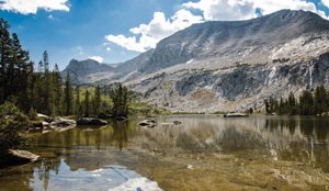
McCabe LakesHighlights: Lakes, High Country Distance: 29.6 miles (47.6 km) round trip Elevation Gain: 1,950 feet (600 m) Permit Demand: Medium Trailhead: Glen Aulin Following the Pacific Crest Trail north from Tuolumne Meadows, this hike descends to Glen Aulin and then ascends through meadows and forests to the remote and alpine McCabe Lakes. Hikers pass by waterfalls of the Tuolumne River and have mountain views at McCabe Lakes. 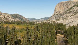
Glen AulinHighlights: Lakes, Waterfalls, High Country Distance: 12.6 miles (20.3 km) round trip Elevation Gain: 750 feet (230 m) Permit Demand: High Trailhead: Glen Aulin Glen Aulin is a popular forested gully to the northwest of Tuolumne Meadows. Several creeks combine here at the mouth of the Grand Canyon of the Tuolumne River. This region is very well travelled, as it sits on the Pacific Crest Trail and provides excellent access to the northern half of Yosemite. 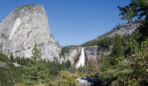
John Muir Trail to Yosemite ValleyHighlights: Waterfalls Distance: 22 miles (35.4 km) one way Elevation Gain: 1750 feet (535 m) Permit Demand: Very High Trailhead: Cathedral Lakes One of the most famous hikes in the world, this classic trek on the John Muir Trail is popular for both its incredible scenery and generally declining elevation. Hiked in reverse requires climbing more than 5,600 feet, but start in Tuolumne Meadows and this beautiful walk is mostly downhill. (Public transportation may be available to help you travel between starting and ending trailheads.) 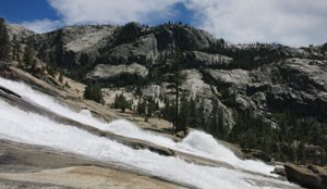
Waterwheel FallsHighlights: Waterfalls Distance: 20.6 miles (33.2 km) round trip Elevation Gain: 1,850 feet (565 m) Permit Demand: High Trailhead: Glen Aulin From Tuolumne Meadows, hike northwest along the Tuolumne Wild and Scenic River until you reach the start of the Grand Canyon of the Tuolumne River and the spectacular Waterwheel Falls, aptly named for the effect created by this cascade in times of peak water flow. 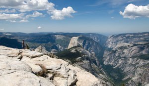
Clouds RestHighlights: Valley Views, Peaks Distance: 14 miles (22.5 km) round trip Elevation Gain: 2,300 feet (700 m) Permit Demand: Very High Trailhead: Sunrise Lakes Leaving from Tenaya Lake, this route ascends through forests towards Sunrise Lakes but continues on to the summit of Clouds Rest. From the summit, there are views of the High Country, Tenaya Canyon, Half Dome, and Yosemite Valley. 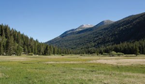
Lyell CanyonHighlights: High Country Distance: 11.4 miles (18.3 km) round trip Elevation Gain: 300 feet (90 m) Permit Demand: Very High Trailhead: Lyell Canyon Lyell Canyon is located to the southeast of Tuolumne Meadows. A major thoroughfare, the John Muir and Pacific Crest Trails combine in this canyon’s open, grassy fields. Hikers have views of the Kuna Crest and Mount Lyell. 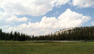
Sunrise High Sierra CampHighlights: High country Distance: 10.4 miles (16.7 km) round trip Elevation Gain: 1,650 feet (500 m) Permit Demand: Very High Trailhead: Sunrise Lakes From Tenaya Lake, cross Tenaya Creek and soon begin climbing up to the Sunrise Lakes. Ascend the final uphill above higher Sunrise Lake and come down on the other side of Sunrise Mountain. Here, the High Sierra Camp, nestled on the mountainside, looks out over gorgeous meadows to the rugged peaks of the Cathedral Range. 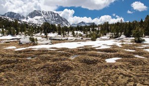
VogelsangHighlights: High Country Distance: 14.4 miles (23.2 km) round trip Elevation Gain: 1,600 feet (490 m) Permit Demand: High Trailhead: Rafferty Creek Vogelsang is a region of high-altitude lakes and peaks. This is a popular area that provides access to various alpine environments in the Cathedral Range. There are views of Rafferty, Fletcher, and Vogelsang Peaks. 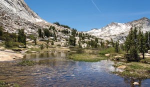
Vogelsang to CathedralHighlights: High Country Distance: 33.3 miles (53.6 m) loop Elevation Gain: 4,550 feet (1,390 m) Permit Demand: High Trailhead: Rafferty Creek or Cathedral Lakes This classic portion of the High Sierra Loop includes visits to the Vogelsang, Merced Lake, and Sunrise High Sierra Camps. 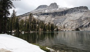
High Sierra Camp LoopHighlights: High Country, Lakes, Waterfalls Distance: 48.2 miles (77.6 km) loop Elevation Gain: 6,450 feet (1,970 m) Permit Demand: High Trailhead: Various possiblities The High Sierra Camp loop follows trails linking Tuolumne Meadows to Vogelsang, Merced Lake, Sunrise, May Lake, and Glen Aulin High Sierra Camps. The hike travels through a range of alpine environments including meadows, forests, and passes. This is a long loop that visits the most popular areas of Yosemite’s high country. 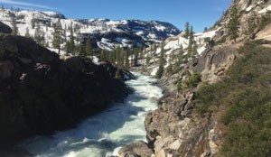
Northern Yosemite LoopHighlights: High Country Distance: 76.4 miles / 123 km Elevation Gain: 13,300 feet (4,055 m) Permit Demand: Medium Trailhead: Glen Aulin (pass-through) Yosemite’s north country is remote and rugged. There are numerous one-way trips and loops of varying mileages that hikers can create. Whatever the destination, hikers should be prepared for long distances, few people, and creek crossings. |
Last updated: January 27, 2022
