



|
|
General Park MapCampsite Interactive MapThe map below displays the following sites which require reservation for camping permits via recreation.gov. Learn more about the different types of camping you can enjoy at Voyageurs National Park here.
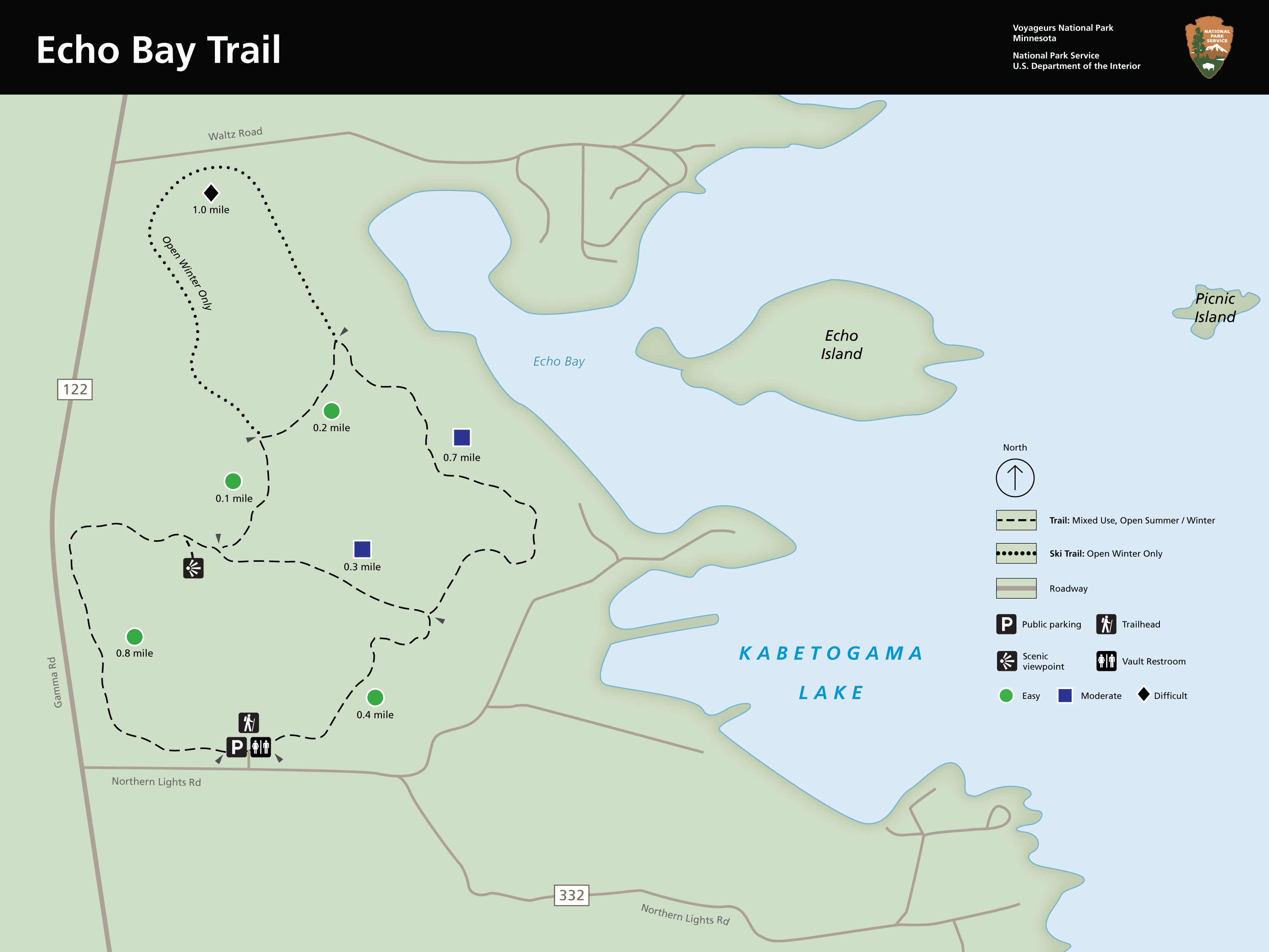
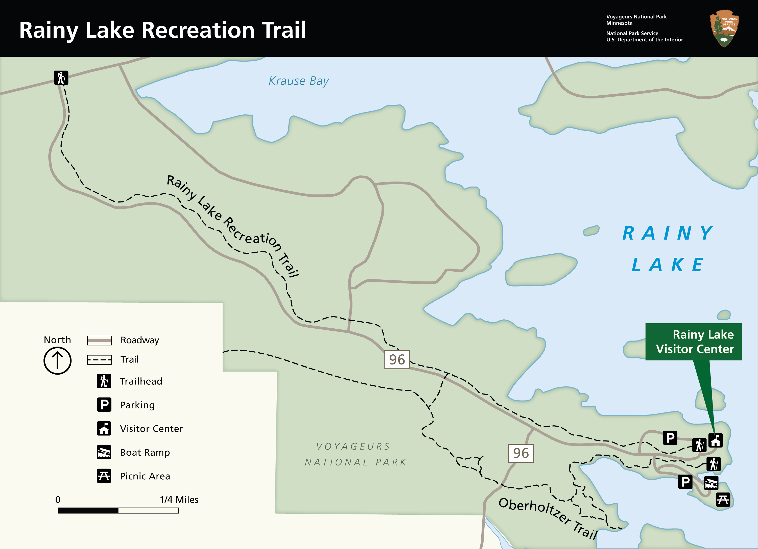
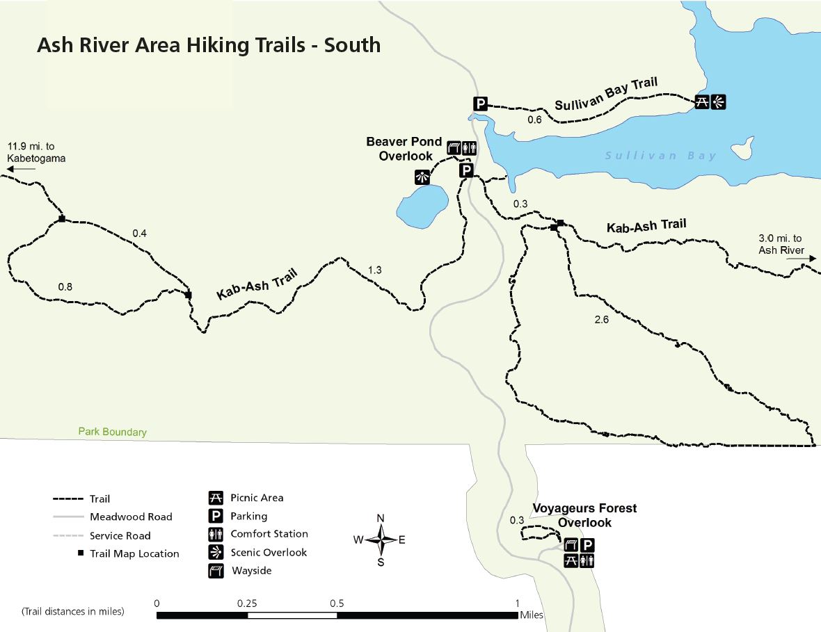
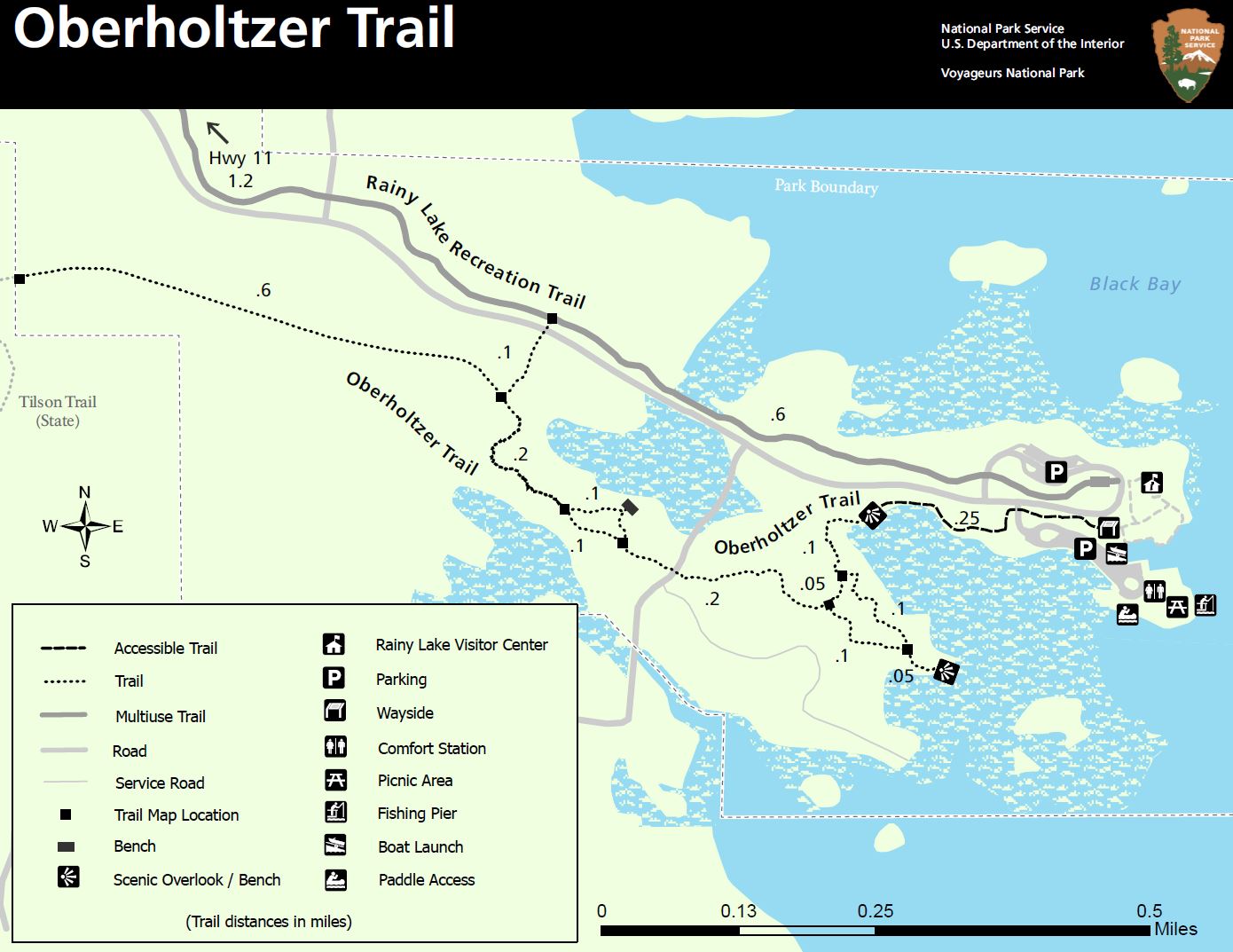
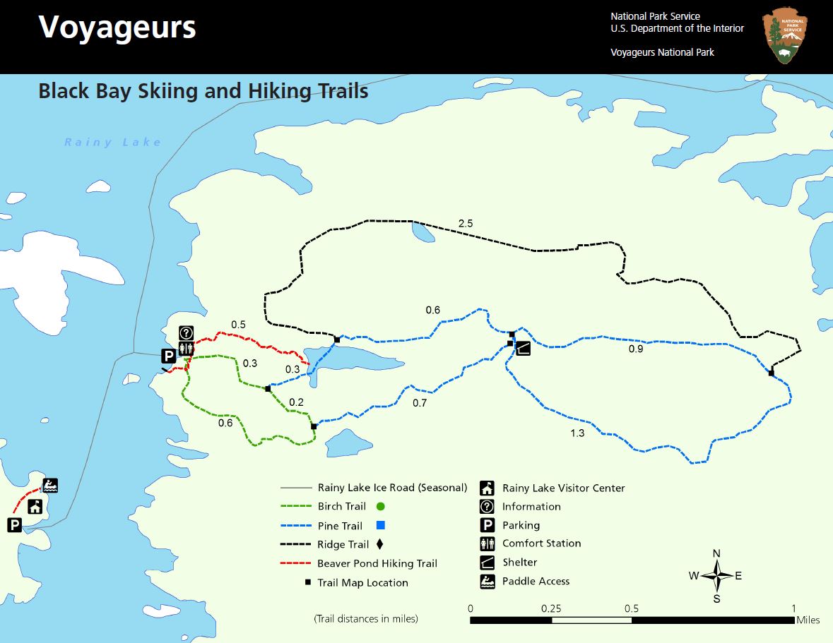
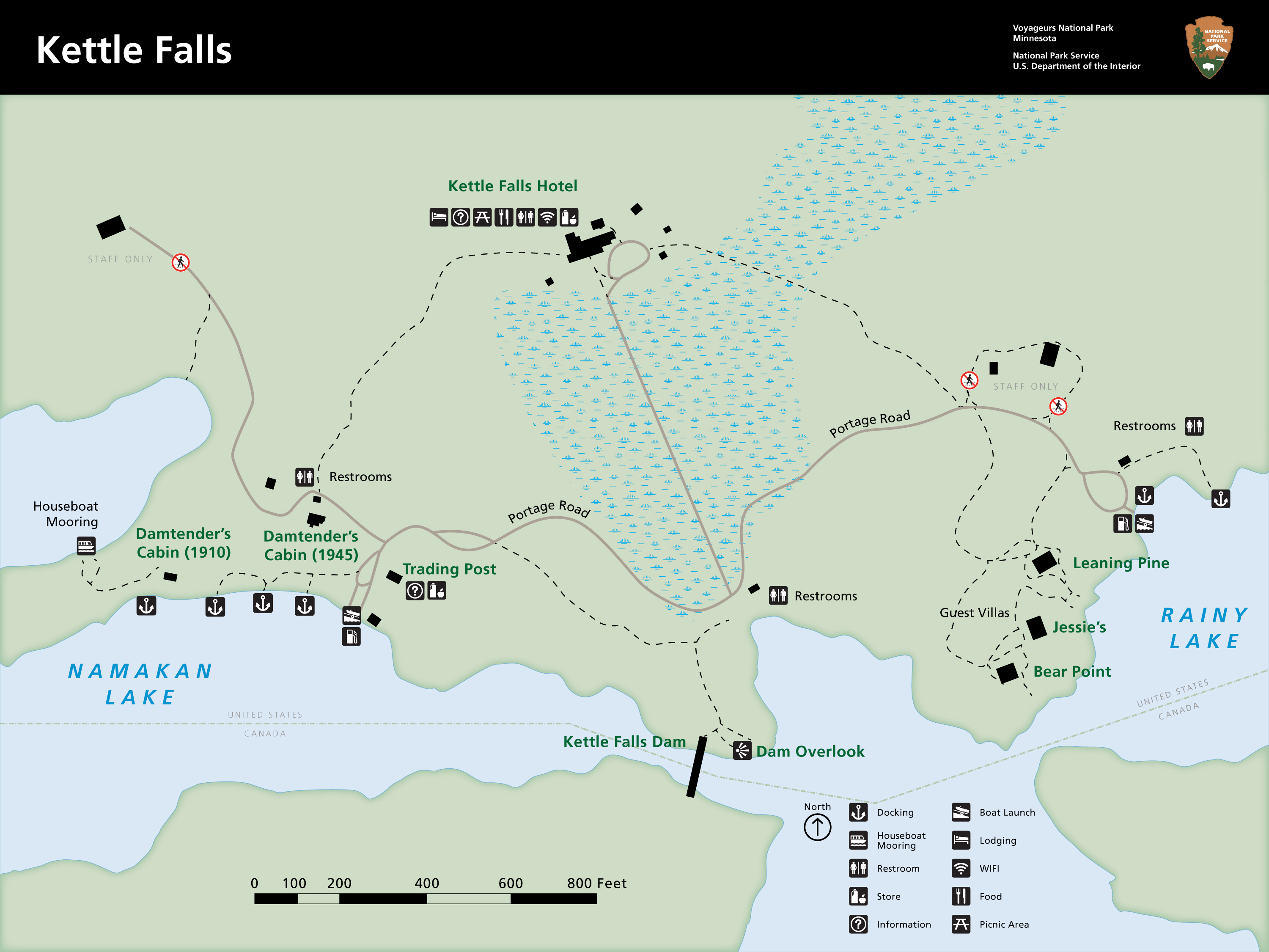
Houseboat Site Interactive MapThe map below displays houseboat sites on Rainy, Kabetogama, Namakan, Sand Point, and Crane Lakes. Houseboat permits for overnight stays in Voyageurs National Park are required and can be reserved at recreation.gov. Learn more about houseboating in Voyageurs National Park here. Day Use Site MapThe map below displays day use sites located on Rainy, Kabetogama, Namakan, Sand Point, and Crane Lakes. These sites have picnic areas and an outdoor privy. They do not require reservations and can be used at any time except for overnight; no camping is allowed at these locations. National Geographic Map for Voyageurs National ParkYou can purchase the phyisical National Geographic Map that has all the campsites, houseboat, and day-use sites located within Voyageurs National Park from the Jefferson National Parks Association website or at any visitor center. Snowmobile Trails and Access in Local CommunitiesSnowmobile Trail Maps are available from the International Falls Chamber of Commerce, various local businesses, the Rainy Lake Visitor Center, and the Voyageurs National Park headquarters building. Hiking Trails MapsThe maps below provide detailed, zoomed‑in views of individual hiking routes and trail areas within Voyageurs National Park. These maps are designed to help you navigate specific trails—not the entire park.If you’re searching for a full list of all hiking trails and more planning information, visit the Hiking Trails page. 
NPS 
NPS 
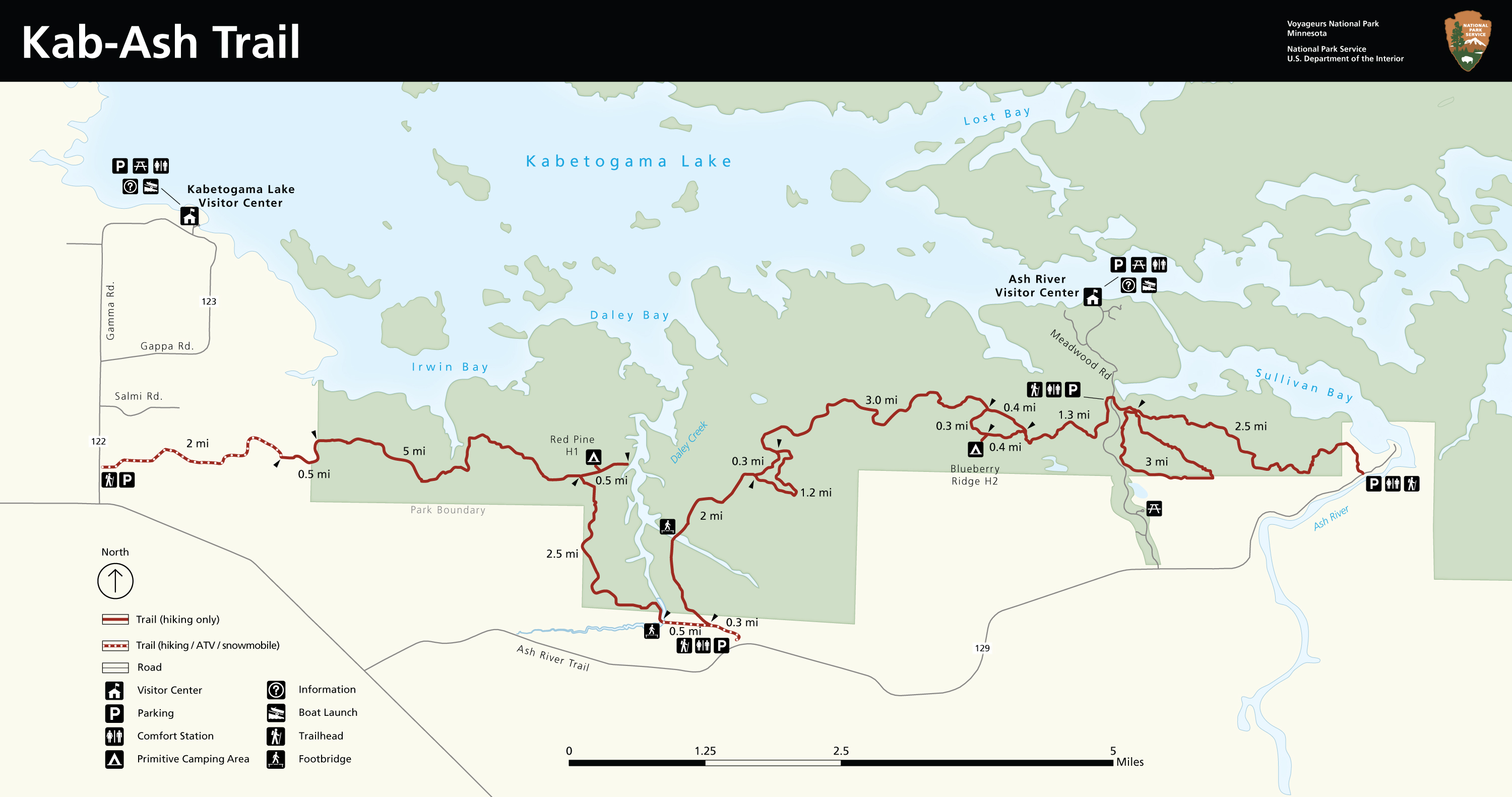
This map of the Kab-Ash trail displays trailhead locations, with those closest to primitive campsites being circled in red. It is recommended that campers and hikers only going in for short distances hike in from these trailheads as these sections can be expected to have better conditions from getting traveled most frequently. Other sections can be more difficult to navigate as they are not traveled as frequently, and areas of thick vegetation can become overgrown quickly. 
NPS 
|
 |



Last updated: August 24, 2026