Anderson Bay

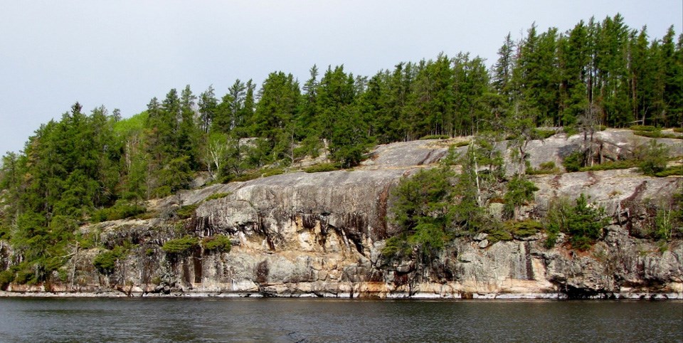
Anderson Bay cliffs
Anderson Bay, on Rainy Lake East, is one of Voyageurs' Visitor Destinations that explores the geology of the park.

Introduction

Voyageurs National Park is situated on the southern tip of what is known as the Canadian Shield, a gigantic dome of volcanic bedrock that forms the heart of the North American Continent. This bedrock dates from the birth of North America. Some 2.8 billion years ago, massive volcanoes erupted through this area and deposited layer after layer of ash and lava, building up the island landmasses. These island arc volcanoes collided forming still larger landmasses. Subsequent uplifting, folding, superheating along with tremendous pressure created igneous and metamorphic rock to form the present day granite and schist of the Kabetogama Peninsula. Eons of erosion then wore down these volcanic mountain ranges to the landscape you see today.


Visiting Anderson Bay

Anderson Bay exemplifies the outstanding scenery for which Voyageurs was established. The exposed white granite cliffs of Anderson Bay rise 80 feet from the water and provide spectacular views of the bay and Rainy Lake. It is one of the most photographed areas of the park. There are picnic tables, fire ring, and privy at this Visitor Destination and Day Use site. Visitors can also hike the 1.75-mile loop trail to see the bluffs from the top. In addition, this is the northern trailhead for the 9.5 mile, one way, Cruiser Lake Trail system that crosses the Kabetogama Peninsula to connect with Lost Bay on Kabetogama Lake.


History

The bedrock that makes up Voyageurs was shaped and carved by at least four periods of glaciation. The most recent continental glaciation in North America ended about 10,000 years ago. The Pleistocene Era began more than 40,000 years ago when Earth's summer temperatures averaged around 27° Fahrenheit and were not warm enough to melt the thick sheets of ice that covered the landscape.

The ever increasing weight of snow compacted down into thick glacial layers of solid ice, which formed a massive continental glacier, known as the Laurentide Ice Sheet. Traveling at a speed of up to 2 feet per day this massive ice sheet began to move south across the northern United States. The force of this ice sheet swept up huge rocks from what is now northern Canada and carried them along like a conveyer belt as it ground its way as far as southern Illinois.

Evidence of glaciers is abundant in Voyageurs National Park. Rocks of various compositions were transported from the north by glaciers and deposited randomly over the landscape as the glaciers melted. These glacial erratics range in size from pebbles to large boulders.

The advance and retreat of these Pleistocene glaciers left an imprint on the rock and shaped the Voyageurs landscape we see today.

 
Two examples of glacial erractics found in Voyageurs National Park
Glacial Erratics near Hoist Bay, Kabetogama Lake (Left) and in Cranberry Bay, Rainy Lake (Right).

Last updated: April 30, 2018

Park footer

Contact Info

Mailing Address:

Voyageurs National Park Headquarters
360 Hwy 11 East

International Falls, MN 56649

Phone:

(218)-283-6600

Contact Us

Tools