|
Are you prepared for what you will encounter on your hike? Read these travel tips to help prepare for your trip. Ten Essentials
Clothing

Map and Compass Magnetic declination: The compass needle does not always point toward the North Pole. Magnetic North is located about a thousand miles south of true north in the Canadian Arctic, and slowly moves its location each year. The difference between true north and magnetic north is called magnetic declination. At Olympic, each year the magnetic declination moves westerly by 7.5 minutes. The current declination is approximately 15.5 degrees east. For any hike off-trail, or when snow obscures the trail, map and compass navigation skills and route-finding skills are a must. An altimeter can be helpful. Please note that Global Positioning System (GPS) units may not receive signals in many of the deep valleys or heavily-vegetated areas of the wilderness. Snow Travel Snow can fall any month of the year in the Olympics and winter accumulations usually linger well into summer. This can make wilderness travel difficult or even hazardous in some areas much of the year. In most areas of the wilderness, snow travel requires good route-finding skills. It is essential to know how to navigate with a map and compass. When hiking over snow, prevent sunburn by wearing sunglasses, a long-sleeved shirt, a hat, and sunscreen.
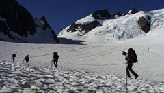
An ice axe, along with knowledge and experience in self-arrest techniques, is necessary to safely cross snow-covered mountain passes and steep snow-covered slopes. Falls on snow slopes can end in rock or talus fields, resulting in injury or death. Before traveling on snow, take time to practice self-arrest techniques in a safe area with an adequate runout. A bridge of snow may form over streams, rocks, or around tree trunks. As snow melts, what appears to be a uniformly safe walking surface can become a serious problem. When carrying a heavy pack, a fall through even a low bridge can result in a broken leg or sprained ankle, or in hypothermia from the cold water. Use your ice axe to probe for a safe area to walk. Listen for moving water. Cornices develop from blowing snow during the winter. They may be particularly unsafe in the spring and summer due to warming temperatures or rain. Cornices may drop spontaneously, or break off with the weight of a person. Travel far away from the edge of cornices. Avoid traveling on slopes beneath large cornices. Traveling on snow eliminates damage to fragile vegetation. However, when snow melts in the spring and early summer, it may be difficult to find the trail when leaving a snowfield. Before leaving the snow, find where the trail tread is exposed. Drop onto the trail, rather than the vegetation, to prevent the creation of multiple paths. In some areas, rangers may flag the routes for you to follow across snowfields. Avalanches present a serious hazard in winter and spring. Forecasting avalanches is complex. It requires the ability to recognize the types of terrain and weather that create avalanche conditions. Obtain formal instruction before heading into the backcountry in winter. 
Glaciers Safe glacier travel requires specialized mountaineering skills, including knowledge in the use of ice axe, climbing rope, helmet, harness, hardware, and crampons. The presence of hidden crevasses is a serious hazard. No one should attempt glacier travel alone. Self evacuation from a deep, steep-walled crevasse is nearly impossible if you are solo. When the snow surface turns icy, the potential for a long fall is an additional danger. Foul weather can also make route-finding a challenge, or trap a party on an exposed mountain. Before traveling on glaciers, seek training in mountaineering skills. River Crossings 
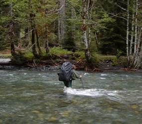
Most river crossings along park trails have bridges. However, bridges can wash out and there are a few trails where the crossings do not have bridges. Some minor creeks must also be waded or forded. Snowmelt becomes rapid with early summer warm weather. During and shortly after warm weather and heavy rain storms, creeks and rivers without bridges can become much more difficult to cross. A creek which you easily crossed in the morning, or when you began your trip, may not be so easily crossed later that day or week. Don’t be afraid to turn back or search for a more suitable crossing. Several hiking routes require you to ford major rivers.
Off-Trail Hiking When traveling cross-country, follow good Leave No Trace practices. Off-trail hiking is permitted throughout the Olympic Wilderness. Before You Go:
| ||||||||||||||||
Last updated: March 19, 2025
