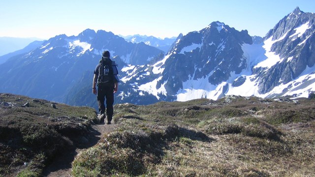
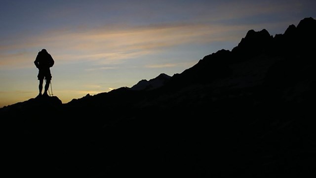
The Stephen Mather Wilderness is at the heart of over two million acres of some of the wildest lands remaining.
Use the resources below to plan your trip and learn how to help preserve and protect the fragile ecosystem.
Backcountry permits are required year-round in North Cascades National Park for all overnight trips
STEP ONE
Research where you want to hike, climb, or boat. Check area regulations and what amenities are provided with the resources below.

Wilderness Trip Planner Map
Locate the backcountry trails and campsites with this map. Use in conjunction with the camp info table below for more information.

Ross Lake Map
Use this map to help plan your overnight boating trip on Ross Lake.
| Camp |
Toilet |
Food Storage |
Sites |
Max. Size |
Notes |
| 39 Mile |
Pit |
Hang |
4,4,4 |
4 |
|
| 39 Mile Stock |
Pit |
Hang |
12 |
12 |
|
| Beaver Pass |
Pit |
Hang |
4,12 |
12 |
|
| Beaver Pass Stock |
Pit |
Hang |
4 |
4 |
|
| Luna |
Pit |
Hang |
4,4 |
4 |
|
| Perry Creek |
Pit |
Hang |
4,4,12 |
12 |
|
| Pumpkin Mountain |
Pit |
Hang |
4,4 |
4 |
|
| Stillwell |
Pit |
Hang |
4,4,4,4 |
4 |
|
| Twin Rocks |
Pit |
Hang |
6,6 |
6 |
|
| Twin Rocks Stock |
Pit |
Hang |
12 |
12 |
|
| Camp |
Toilet |
Food Storage |
Sites |
Max. Size |
Notes |
| Buckner |
Pit |
Wire |
4,4,4 |
4 |
|
| Cosho |
Pit |
Hang |
4,4,4 |
4 |
|
| Fisher |
Pit |
Canister |
4,4,4 |
4 |
No Campfires, Bear Canister Required |
| Five Mile Stock |
Pit |
Wire |
6,6 |
6 |
|
| Fourth of July |
Pit |
Hang |
4,4,4 |
4 |
No Campfires |
| Junction |
Pit |
Hang/Canister |
4,4,4 |
4 |
|
| Junction Stock |
Pit |
Hang |
12 |
12 |
|
| McAllister |
Pit |
Wire |
4,4,4,4 |
4 |
|
| McAllister Group |
Pit |
Wire |
12 |
12 |
|
| McAllister Stock |
Pit |
Hang |
12 |
12 |
|
| Neve |
Pit |
Hang |
4,4,4 |
4 |
|
| Panther |
Pit |
Hang |
12 |
12 |
|
| Skagit Queen |
Pit |
Hang |
4,4,4 |
4 |
|
| Thunder |
Pit |
Hang |
4,4,12 |
12 |
|
| Thunder Basin |
Composter |
Canister |
4,4 |
4 |
No Campfires, Bear Canister Required |
| Thunder Basin Stock |
Pit |
Hang |
4 |
4 |
|
| Tricouni |
Pit |
Hang |
4,4 |
4 |
|
| Two Mile |
Pit |
Wire |
6 |
6 |
|
| Camp |
Toilet |
Food Storage |
Sites |
Max. Size |
Notes |
| Big Beaver |
Vault |
Box |
8,8,8,8,8,8,12 |
12 |
|
| Big Beaver Stock |
Pit |
Box |
12 |
12 |
|
| Boundary Bay |
Vault |
Box |
8,8,12 |
12 |
|
| Buster Brown |
Vault |
Box |
4,4,4 |
4 |
|
| Cat Island |
Vault |
Box |
4,4,4,12 |
12 |
|
| Cougar Island |
Vault |
Box |
6,6 |
6 |
|
| Deerlick Stock |
Pit |
Hang |
6,6 |
6 |
|
| Desolation |
Pit |
Canister |
8 |
8 |
No Campfires, Bear Canisters Required |
| Devil’s Creek |
Pit |
Hang |
4,4,4 |
4 |
|
| Devil’s Creek Stock |
Pit |
Hang |
12 |
12 |
|
| Devil’s Junction |
Vault |
Box |
8 |
8 |
|
| Dry Creek |
Vault |
Box |
4,4,4,12 |
12 |
|
| Green Point |
Vault |
Box |
4,4,8,8,12 |
12 |
|
| Hidden Cove |
Vault |
Box |
4 |
4 |
|
| Hidden Hand Group |
Pit |
Hang |
12 |
12 |
|
| Hidden Hand Stock |
Pit |
Hang |
8 |
8 |
|
| Hozomeen Lake |
Pit |
Hang |
4,4,12 |
12 |
|
| Lightning Creek |
Vault |
Box |
8,8,8,8,12 |
12 |
|
| Lightning Creek Stock |
Vault |
Box |
8,8 |
8 |
|
| Little Beaver |
Vault |
Box |
4,8,8,8,12 |
12 |
|
| Lodgepole |
Vault |
Box |
8,8,8 |
8 |
|
| May Creek |
Vault |
Box |
6 |
6 |
|
| May Creek Stock |
Pit |
Hang |
8 |
8 |
|
| McMillan |
Vault |
Box |
8,8,12 |
12 |
|
| Nightmare Group |
Pit |
Hang |
12 |
12 |
|
| Ponderosa |
Vault |
Box |
12,12 |
12 |
|
| Rainbow Point |
Vault |
Box |
8,8,8 |
8 |
|
| Roland Creek |
Pit |
Hang |
4,4,12 |
12 |
|
| Roland Point |
Vault |
Box |
8 |
8 |
|
| Ruby Pasture |
Pit |
Hang |
6 |
6 |
|
| Silver Creek |
Vault |
Box |
8,12 |
12 |
|
| Spencer’s |
Vault |
Box |
8,8 |
8 |
|
| Ten Mile Island |
Vault |
Box |
4,4,4 |
4 |
|
| Thunder Point |
Vault |
Box |
4,4,4 |
4 |
|
| Willow Lake |
Pit |
Hang |
4 |
4 |
|
| Camp |
Toilet |
Food Storage |
Sites |
Max. Size |
Notes |
| Bench Creek |
Pit |
Hang |
4,12 |
12 |
|
| Bowan |
Pit |
Hang |
6,6 |
6 |
|
| Dagger Lake Group |
Pit |
Wire |
12 |
12 |
|
| Dagger Lake Stock |
Pit |
Wire |
12 |
12 |
|
| Dan’s |
Pit |
Wire |
4 |
4 |
|
| Fireweed |
Pit |
Box |
6,6 |
6 |
|
| Fireweed Stock |
Composter |
Box |
8,12 |
12 |
|
| Grizzly Creek |
Pit |
Wire |
4,4,4 |
4 |
|
| Heaton Stock |
Pit |
Hang/Canister |
12 |
12 |
No Campfires |
| Hidden Meadows Stock |
Pit |
Hang |
12 |
12 |
|
| Hideaway Group |
Pit |
Box |
12 |
12 |
|
| High |
Pit |
Wire |
4 |
4 |
No Campfires |
| McAlester Lake |
Pit |
Wire |
4,8 |
8 |
|
| McAlester Lake Stock |
Pit |
Hang |
8 |
8 |
|
| North Fork |
Pit |
Box |
4,12 |
12 |
|
| Rainbow Bridge |
Pit |
Wire |
4,4 |
4 |
|
| Rainbow Ford |
Pit |
Hang |
4 |
4 |
|
| Rainbow Lake |
Pit |
Hang |
4,4 |
4 |
No Campfires |
| Rainbow Meadows |
Pit |
Hang |
8 |
8 |
|
| Rainbow Meadows Group |
Pit |
Hang |
12 |
12 |
|
| Rainbow Meadows Stock |
Pit |
Hang |
12 |
12 |
|
| Six Mile |
Composter |
Box |
PCTA PERMIT HOLDERS ONLY |
|
| South Fork |
Pit |
Box |
4,4 |
4 |
|
| South Fork Stock |
Pit |
Wire |
12 |
12 |
|
| Walker Park Stock |
Pit |
Wire |
12 |
12 |
|
| Camp |
Toilet |
Food Storage |
Sites |
Max. Size |
Notes |
| Boundary |
Pit |
Box |
4,4,4 |
4 |
No Campfires |
| Copper Creek |
Pit |
Hang |
4,4,4,4,4 |
4 |
|
| Copper Lake |
Composter |
Box |
4,4,4 |
4 |
No Campfires |
| Egg Lake |
Composter |
Box |
4,4,4 |
4 |
No Campfires |
| Graybeal |
Pit |
Hang |
4,4 |
4 |
|
| Graybeal Stock |
Pit |
Hang |
12 |
12 |
|
| Indian Creek |
Pit |
Hang |
4,4,4 |
4 |
|
| Silesia |
Composter |
Box |
4,4 |
4 |
No Campfires |
| U.S. Cabin |
Pit |
Hang |
4,4,4,4 |
4 |
|
| U.S. Cabin Stock |
Pit |
Hang |
12 |
12 |
|
| Whatcom |
Composter |
Hang/Canister |
4,4,4 |
4 |
No Campfires |
| Camp |
Toilet |
Food Storage |
Sites |
Max. Size |
Notes |
| Basin Creek |
Pit |
Box |
4,4,4 |
4 |
No Campfires |
| Cottonwood |
Pit |
Box |
6,12 |
12 |
|
| Johannesburg |
Pit |
Box |
4,4,4 |
4 |
No Campfires |
| Pelton Basin |
Composter |
Box |
4,4,4,12 |
12 |
No Campfires |
| Sahale Glacier |
Composter |
Canister |
4,4,4,4,4,4 |
4 |
No Campfires, Bear Canisters Required |
| Camp |
Toilet |
Food Storage |
Sites |
Max. Size |
Notes |
| Bridge Creek |
Vault |
Box |
4,4,4,4 |
4 |
|
| Bridge Creek Group |
Vault |
Box |
12,12 |
12 |
|
| Bridge Creek Stock |
Vault |
Box |
8 |
8 |
|
| High Bridge |
Vault |
Box |
4,12 |
12 |
|
| Park Creek |
Pit |
Box |
4,4 |
4 |
|
| Shady |
Vault |
Box |
8 |
8 |
|
| Tumwater |
Vault |
Box |
6,6 |
6 |
|
| Camp |
Toilet |
Food Storage |
Sites |
Max. Size |
Notes |
| Hooter |
Pit |
Canister |
4 |
4 |
No Campfires, Bear Canisters Required |
| Juanita Lake |
Composter |
Hang |
4,4 |
4 |
No Campfires |
| Juanita Lake Stock |
Pit |
Hang |
12 |
12 |
No Campfires |
| Rennie |
Pit |
Wire |
4 |
4 |
|
| Reynolds |
Pit |
Hang |
4 |
4 |
|
| Reynolds Stock |
Pit |
Wire |
12 |
12 |
|
| Camp |
Toilet |
Food Storage |
Sites |
Max. Size |
Notes |
| Pierce Mountain |
Pit |
Canister |
4 |
4 |
No Campfires, Bear Canisters Required |
| Sourdough |
Pit |
Canister |
4 |
4 |
No Campfires, Bear Canisters Required |
| Sulphide Creek Group |
Pit |
Hang |
12 |
12 |
|
| Thornton Lake |
Composter |
Canister |
4,4,4 |
4 |
No Campfires, Bear Canisters Required |
| Monogram Lake |
Pit |
Canister |
4,4 |
4 |
No Campfires, Bear Canisters Required |
| Cross Country Zone |
Toilet |
Food Storage |
Sites |
Max. Size |
Notes |
| Price |
None |
Hang/Canister |
12,12,12,12,12,12 |
12 |
No Campfires |
| Sulphide Glacier |
Composter |
Canister |
12,12,12,12,12,12 |
12 |
No Campfires, Bear Canisters Required |
| Tapto Lakes |
None |
Canister |
6,6,6 |
6 |
No Campfires, Bear Canisters Required |
| Triumph |
None |
Hang/Canister |
6,6 |
6 |
No Campfires |
| Boston Basin |
Composter |
Canister |
12,12,12,12,12,12 |
12 |
No Campfires, Bear Canisters Required |
| Eldorado |
Composter |
Canister |
12,12,12,12,12,12 |
12 |
No Campfires, Bear Canisters Required |
| Hidden Lake |
None |
Canister |
12,12,12 |
12 |
No Campfires, Bear Canisters Required |
The diversity of climate and geography creates very different habitats on the west and east side of the Cascade crest, fostering a great array of plants and animals. Cascading water is fed by over 300 glaciers and countless snowfields. Lakes are abundant. Almost 400 miles (644 km) of trails, mostly in major drainages and over high passes, traverse this tremendous landscape. Your path may follow a route used for many centuries by people who have long crossed these mountains or sought food and resources here, or you may venture to an area so wild it feels as if you are the first explorer.

Planning a Climb
Use this page to plan for your mountaineering trip in the North Cascades.
STEP TWO
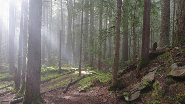
Check the current road and trail conditions. Consider the seasons, weather forecasts, and snow conditions. Be aware of closures related to current or past wildfires.
Trail Conditions
General conditions and a trail-by-trail list of the most recent conditions reports.

Road Status
Find out about current road status in the park complex.

Fire Closures
Learn more about area, trail, and camp closures that are in effect due to current or past fire activity

Webcam
Check out the webcam stationed at the North Cascades Visitor Center for a live look at park conditions.
STEP THREE
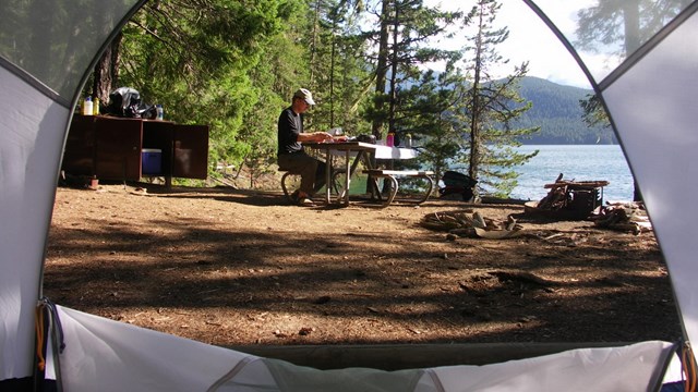
Obtain a backcountry permit for your overnight stay in the park. Make a reservation on recreation.gov and pick up your permit the day before your trip starts.*
Alternatively, visit the Wilderness Information Center to obtain a walk-up permit.
*Visit the backcountry permits page to learn details on when and where to pick up your permit
Backcountry Permits
Backcountry permits are required year-round. Find out where they are required, why they are required, and how to obtain a permit.

Recreation.Gov
Make reservations and view real-time availability of backcountry campsites
STEP FOUR
Check additional resources here for information that may pertain to your trip
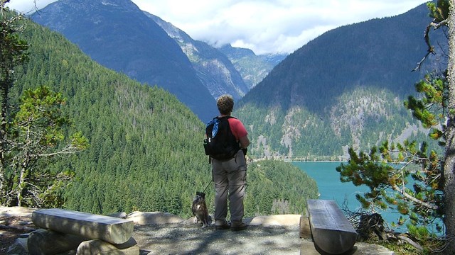
Hiking with pets
Bringing your dog? Pets are only allowed on certain trails under certain conditions.

Pacific Crest Trail
Information for traveling along the Pacific Crest Trail through North Cascades National Park.

Pacific Northwest Trail
Information for traveling along the Pacific Northwest Trail through North Cascades National Park
Still have questions?
Contact the Wilderness Information Center in Marblemount via email (noca_wilderness@nps.gov) or visit us in person!
Check the Operating Hours and Seasons page for current visitor facilities.
|


