|
The best remedy for those who are afraid, lonely or unhappy is to go outside, somewhere where they can be quiet, alone with the heavens, nature and God…I firmly believe that nature brings solace in all troubles.

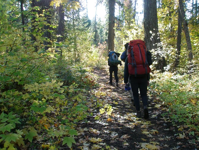
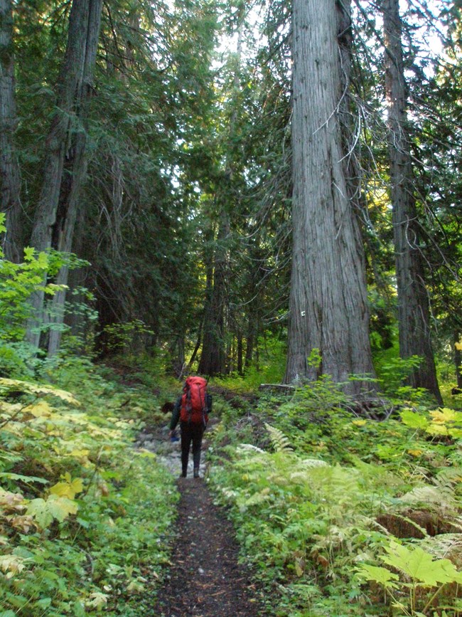
NPS/Rosemary Seifried The Old Wagon Trail, which is also a section of the Pacific Crest Trail as it passes through North Cascades National Park, connects the lower and upper Stehekin Valley. It makes a pleasant outing through varied forest for day hikers or riders, and provides trail access to the upper Stehekin Valley for backpackers, riders, and legions of Pacific Crest Trail thru-hikers in the fall. Since the historic floods of 2003, which removed the Stehekin Valley Road in large sections between Car Wash Falls and a large landslide above Shady Camp, this trail is the only maintained route to Bridge Creek from Stehekin. The trail rolls up and down through a wide variety of forest types, including old growth western red cedars and a forest mosaic created by the Shady Fire of 2005, which burned across about 0.5 mi (0.8 km) of the trail. The trail generally follows the route of a haul road that was constructed in the 1890s, although only the faintest hints of the wagon route remain. See the detailed trail description for more information. Special Concerns:
Backcountry Camping: A backcountry permit is required for all overnight stays. There are camps at either end of this trail at High Bridge and Bridge Creek, and spur trails to two river-side camps at Tumwater and Shady. Permits are limited. Bridge Creek Camp makes an excellent base camp for numerous trail destinations in the upper Stehekin Valley. Access: Access from Stehekin is via the Stehekin Valley Road and Stehekin Shuttle, which runs between Stehekin and High Bridge. The southern end of the Old Wagon Trail begins behind the corral at the historic High Bridge Ranger Station. There is also a spur trail that provides access from the road to the trail between Tumwater Camp and Car Wash Falls (located about 0.5 mi (0.8 km) downstream of Car Wash Falls). The northern end of the trail can be accessed via the Bridge Creek (Pacific Crest) Trail and the Upper Stehekin Valley Trail. 
NPS/Rosemary Seifried Detailed Trail Description (From High Bridge) This trail is a pleasant wooded walk over gently rolling terrain. The first 1.3 mi (2.1 km) of the trail from High Bridge is also known as the Howard Lake Trail (see link for detailed description of this section) and is frequently used for day use access of Howard Lake and as access to the McGregor Mountain Trail. In the first mile beyond the McGregor Mountain Trail junction the trail meanders through a pleasant douglas fir forest with very little elevation change. At 0.9 mi (1.4 km) past the junction, a signed spur trail heads to the west and joins the Stehekin Valley Road ~0.7 mi (1.1 km) upstream of Tumwater Camp, one of two camps set in the inner canyon of the Stehekin River. Soon after passing the spur trail hikers walk through the Shady Burn, a wildfire that occurred in 2005. Here, blackened trees rise dramatically from a vivid purple and pink carpet of fireweed frequented by rufous hummingbirds seeking nectar. Keep an ear open for downy woodpeckers pecking away at standing snags in this area in order to feast on the beetles and ants living in the weakened and dead trees. Observant hikers will notice the forest mosaic--the mixture of open and closed forest canopy--created by the fire. The fire burned with different intensity in different areas, leaving behind a more diverse forest structure that includes more sources of food and habitat to support more types of organisms. Another highlight of the trail is a stand of huge old growth western red cedar trees in which several trees are 6-8' (up to 2.4m) in diameter. Although these trees have not been formally studied, their size indicates that they are hundreds of years old. Take a moment to contemplate the changes that have occurred in the surrounding forest and mountainsides, and all the human history that has played out during their lifetime. There are a couple of small streams and wet areas to jump across in this area during the spring. At 4.5 miles (7.2 km) from High Bridge (0.8 mi (1.3 km) from Bridge Creek Camp), a signed spur trail heads downhill towards the now-audible Stehekin River. This spur trail reaches Shady Camp in ~0.5 mi (0.8 km) and includes some walking on sections of the old Stehekin Valley Road. Bridge Creek Camp is at the northern end of the Old Wagon Trail. The flat benches surrounding the camp are a geologic feature created by sediments laid down over centuries by the meeting of Bridge Creek and the Stehekin River. In the 1890s this area was the site of a settlement to serve the miners and trappers that were exploring the Stehekin drainage and included a post office, general store and boarding house. Some newspaper accounts from those days claim that 1,000 people were living at the site, though historical evidence indicates this claim was probably greatly exaggerated. Regardless, visitors can enjoy the gentle rumble of the nearby Stehekin River while imagining the bustle of a bygone era. The Pacific Crest Trail continues north from Bridge Creek and is clearly signed. Travelers can follow the old road bed--the Upper Stehekin Valley Trail--beyond the camp to the bridge over Bridge Creek. From the bridge there are lovely views of turquoise pools that can be a cool respite on hot summer days. Bridge Creek is a jumping off point to several other trails: Bridge Creek (Pacific Crest) Trail, Goode Ridge Trail, and the Upper Stehekin Valley Trail to Cascade Pass, Park Creek, and Flat Creek. 
|
Last updated: September 1, 2021
