RV Camping

Established Campgrounds


RV visitors are welcome to camp at Mojave National Preserve! There is a 14 day camping limit. The Hole-in-the-Wall Campground is equipped with a dump station, trash bins, and water. Campsites are large enough for a RV of any size. This campground is first come, first serve. The road is fully paved until you reach the campground.

Established Camping Fees and Developed Campground Details


Click here to learn more about camping fees and to learn additional details about the Hole-in-the-Wall and Mid Hills campgrounds. There are no fees to camp at undeveloped sites.
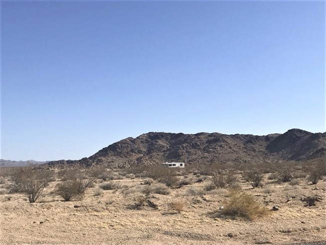
 
A RV camps at a undeveloped campsite surrounded by creosote. Mountains are in the background.
RV camping at the Soda Dry Lake View undeveloped campsite.

David Williams, NPS.

Undeveloped Campsites


Undeveloped campsites are a popular option for RV drivers who want a wilderness experience. In addition, undeveloped campsites are a good backup option when the developed campgrounds are full. Kelso Dunes Mine is the only undeveloped campsite cable of hosting larger groups of RVs. All other sites can accommodate one to several RVs at most. There is a 14 day camping limit. There is no fee to camp at an undeveloped campground.

The list below is a sampling of undeveloped campsites popular with RV visitors. This list is not comprehensive. Many of these sites have limited ability to accommodate multiple RVs or larger RVS. Scope out sites from the paved roads prior to committing to driving there. The National Park Service does not monitor site availability.

Not all RV class size recommendations may apply to the actualities of the undeveloped campsites. Use caution before attempting to drive to any undeveloped campsite.

Additional undeveloped campsites can be found here


Black Canyon Road

Name GPS Miles from the Freeway Class Size Hazard Warnings
Black Canyon North Site 34.9824, -115.3889 15.3 Miles from I-40 A, B, C Large rocks and desert pin stripping. Limited space.
Black Canyon South Site 34.9352, -115.412 13.5 Miles from I-15 A, B, C Narrow with some divits.
 

Cima Road

Name GPS Miles from the Freeway Class Size Hazard Warnings
Sunrise Rocks 35.3152, -115.5508 11.1 Miles from I-15 A, B, C Rocky road and soft sand. 4WD recommned.
 

Kelbaker Road

Name GPS Miles from the Freeway Class Size Hazard Warnings
Soda Dry Lake View 35.2533, -115.8915 11.1 Miles from I-15 A, B, C Soft sand and no turn around beyond GPS point. Soft sand at final right turn into the campsite.
Black Tank Wash 35.2004412, -115.8720195 13.5 Miles from
1-15
A, B, C Camp East of Kelbaker Road;
Soft sand West of Kelbaker Road.
Vulcan Mine Road 34.958053, -115.638608 38.5 Miles from
I-15;
18.9 Miles from I-40
A, B, C No turn around beyond GPS Point. 4WD and High Clearance beyond GPS Point.
Kelso Dunes Mine 34.8881, -115.7166 46.6 Miles from
I-15;
18.5 Miles from I-40
A, B, C Washboard road beyond hiking trailhead.
Hidden Hills 34.7937, -115.6031 6.9 Miles from I-40 Small RVs
B,C
Uneven dirt road.
Van Winkle Mountain 34.7777, -115.6076 6.2 Miles from I-40 Small RVs
B,C
Desert pin striping hazard. May hear gun shots during quail hunting season.
Dharma Tower 34.765977, -115.634573 4.1 Miles from I-40 Small RVs
B,C
Turn on to dirt road at this coordinate. Google Maps will send you the wrong way if you use the tower coordinates. Tower wires may limit taller RVs.
Kelbaker Boulders 34.7457, -115.652 2.5 Miles from
I-40
Small RVs
B,C
Soft sand and 4WD beyond GPS coordinates.


Last updated: November 21, 2024

Park footer

Contact Info

Mailing Address:

2701 Barstow Road
Barstow, CA 92311

Phone:

(760) 252-6100
For emergencies including vehicle breakdowns, dial 911

Contact Us