Filter Your Results
- Arches National Park (12)
- Denali National Park & Preserve (9)
- Wrangell - St Elias National Park & Preserve (8)
- Yellowstone National Park (6)
- Bryce Canyon National Park (4)
- Katmai National Park & Preserve (4)
- Saguaro National Park (4)
- Yukon - Charley Rivers National Preserve (4)
- Canyonlands National Park (3)
- Show More ...
- National Center for Preservation Technology and Training (5)
- Wildland Fire Program (3)
- Youth Programs (3)
- Youth Programs Division (3)
- Central Alaska Inventory & Monitoring Network (2)
- Natural Resource Stewardship and Science Directorate (2)
- Northeast Coastal and Barrier Inventory & Monitoring Network (2)
- Regions 6, 7, and 8 (2)
- Sonoran Desert Inventory & Monitoring Network (2)
- Show More ...
Showing 124 results for Mitigation ...
Glacier National Park
Avalanche Lake Trail
- Type: Place
The Avalanche Lake Trail begins in the same place as the Trail of the Cedars and the Avalanche Campground. The trail climbs steadily through an old growth forest to an alpine like with outstanding waterfalls. Avalanche Lake 2.3 mi (3.7 km), one way Elevation gain: 500 ft (152 m) Trailhead: Avalanche Picnic Area
Manhattan Project National Historical Park
Manhattan Project Scientists: Harry Daghlian
- Type: Article

Harry Daghlian was among the promising young scientists who came to work at Los Alamos as part of the Manhattan Project. Harotune Krikor Daghlian Jr. (1921-1945), known as Harry, was raised in Illinois, attended MIT, and had graduated from Purdue University. He had not yet earned his doctorate in physics when he joined Project Y. Daghlian was assigned to work with Otto Frisch’s Criticality Assembly Group. He helped transport the plutonium core to the Trinity Site.
Death Valley National Park
Harmony Borax Works
- Type: Place
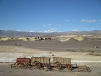
The stories of borax (white gold) and the famous 20-mule teams come to life at this historic borax processing site. Walk: 0.4 mi (0.6km)
- Type: Article

Decades of climate-driven drought, and a consistent imbalance between supply and demand for Colorado River water have led to low reservoir levels in the Colorado River Basin. Low water levels have implications to rivers located both upstream and downstream of the reservoirs, including the introduction of invasive fish. We modeled the probability that smallmouth bass would establish and what we could do to mitigate that threat. Intermountain Park Science, 2024
- Type: Article

To be effective, response to climate change must be applied at the park level. The Climate Change Response Program and partners have developed tools, frameworks, and strategies to help park managers understand, adapt to, mitigate, and communicate about climate change. This article details what these tools are and how parks can access them, using examples from the American Southwest emphasizing drought and its effects. Intermountain Park Science, 2024
Wrangell - St Elias National Park & Preserve
Community-led food security solutions in Alaska’s Copper River Valley
- Type: Article

The National Park Service is supporting community-identified projects in rural Alaska to mitigate the impacts of climate change on subsistence activities and enhance food security resilience.
- Type: Article

Read a summary and abstract for a published paper on the visitor safety risks in parks due to bear baiting. Lafferty, D. J. R., S. M. Trujillo, G. V. Hilderbrand, A. Sears, P. Christian, D. Payer, and M. Hake. 2024. Bear baiting risks and mitigations: An assessment using expert opinion analyses. PLOS ONE 19(11): e0312192.
Mount Rainier National Park
Twin Firs Trailhead
- Type: Place
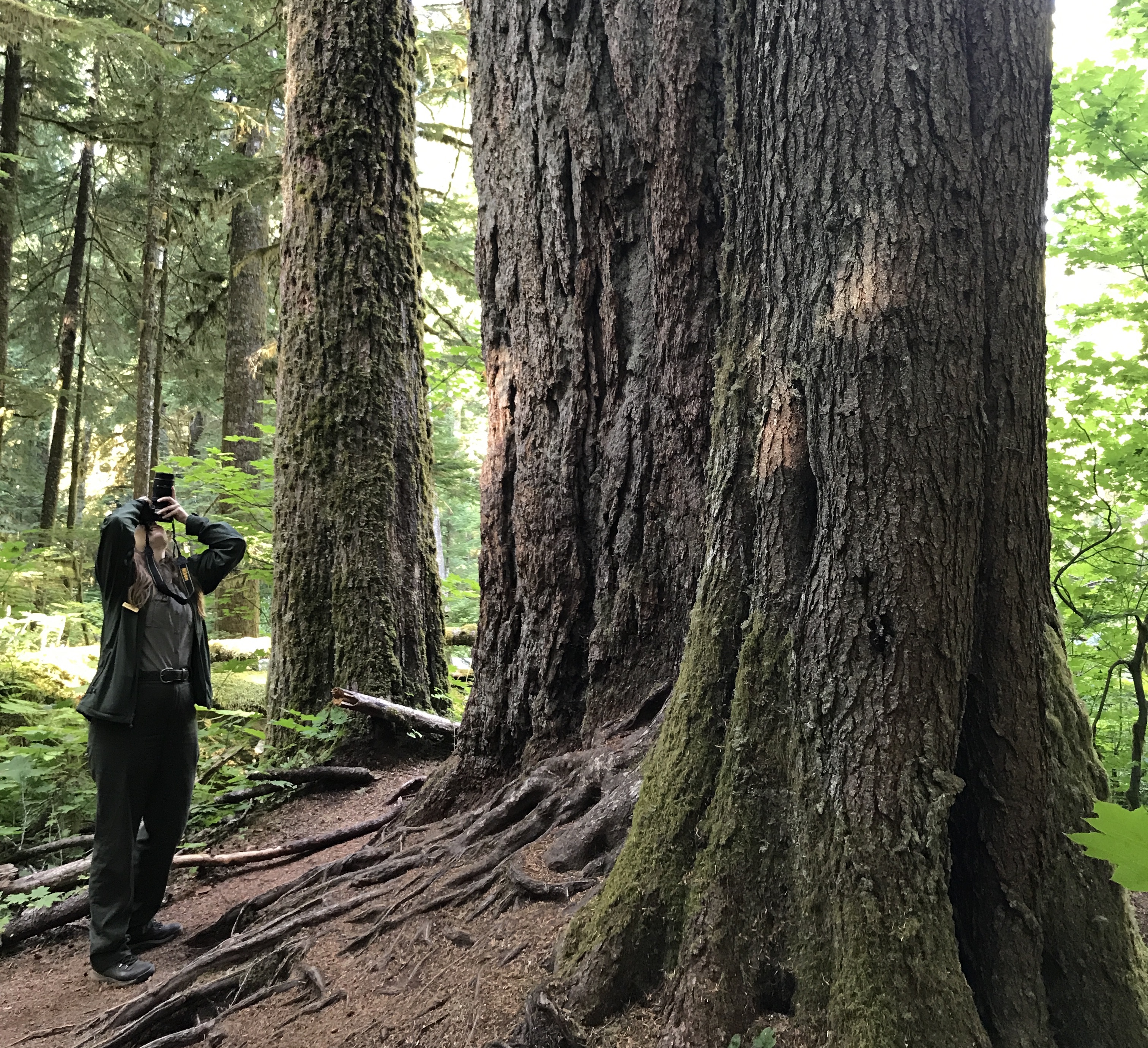
Twin Firs Loop Trail is a 0.4 mi/0.6 km trail that explores old-growth forest. The trailhead is located 2 miles west of Longmire along the road between the Nisqually Entrance and Longmire.
- Type: Article

The National Park Service will restore grassland ecosystems in select national parks in Arizona and Colorado to advance landscape conservation actions, mitigate the overall loss of these systems, and build a strong core of healthy grasslands to benefit the species and communities who rely on them. The process includes collecting and increase native seed for restoration in central grasslands, supporting the National Seed Strategy.
- Type: Article

Chihuahuan Desert Network scientists monitor climate and water at Carlsbad Caverns National Park. Together, climate and hydrology shape ecosystems and the services they provide. Long-term monitoring provides early warning of potential problems, allowing managers to mitigate them before they become worse. This report summarizes climate, weather, and springs data from Water Year 2022.
- Type: Article

Understanding changes in climate, groundwater, and surface water is key to assessing the condition of natural and cultural resources on national parks. At Fort Bowie National Historic Site we conduct long-term monitoring of climate, groundwater, and springs to provide early warning of potential problems, allowing managers to mitigate them before they become worse. In water year 2022, precipitation was boosted by an above average monsoon season.
Blue Ridge Parkway
Project Profile: Mitigate Six Features at Edith Mine
- Type: Article

The National Park Service will close six abandoned mine sites along the Blue Ridge Parkway and restore the altered landscape. The Edith Mine is comprised of a network of tunnels and shafts that were unearthed at the end of the mine life, creating many artificial trenches for flowing water and hiking trails for visitors.
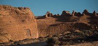
Arches National Park
Tower Arch Trail
- Type: Place

This trail climbs up a rock wall, cuts across a valley, and then meanders through sandstone fins and sand dunes. Reaching this trailhead requires driving 8 mi (14 km) on unpaved roads, which wash out quickly in rainstorms. Roundtrip Distance: 2.6 mi (4.2 km) Time: 2-3 hours Elevation Change: 290 ft (89 m)
Bryce Canyon National Park
Bristlecone Loop Trailhead
- Type: Place

A short path through fir and pine leads to the easy 1.0 mi/1.6 km Bristlecone Loop, as well as the 8.8 mile (14.2 km) backcountry Riggs Spring Loop and 23 mile (37 km) Under-the-Rim Trail. Though the Bristlecone Loop trail only climbs 200 feet (61 m) and is rated as Easy, be sure to carry water, wear ankle-supporting footwear, and postpone your hike if lightning is expected.The Bristlecone Loop reaches elevations over 9,100 feet (2778 m). Here you will pass by bristlecone pin
Arches National Park
Delicate Arch Viewpoint Trails
- Type: Place
See the most famous arch in the park at a distance from one of these viewpoints. Lower Viewpoint is level and wheelchair-accessible; with a roundtrip distance of 200 ft (61 m). Upper Viewpoint is moderately strenuous: Roundtrip Distance: 0.5 mi (0.8 km) Time: 30-45 min Elevation Change: 171 ft (52 m)
Arches National Park
Sand Dune Arch Trail
- Type: Place
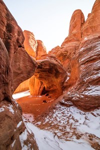
Hike through deep sand to find this hidden arch between tall sandstone walls. You may also choose to continue across a grassland to Broken Arch, returning via the same trail or making a loop through the campground. Roundtrip Distance: 0.4 mi (0.6 km) Time: 15-30 min Elevation Change: 0 ft (0 m)
Arches National Park
Broken Arch Trail
- Type: Place
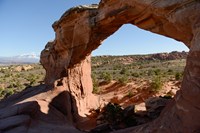
From the trailhead at the Sand Dune Arch parking area, the trail crosses a large meadow to Broken Arch. You can return from there or continue through the arch to the campground, then circle back through fins with sand dunes and some moderate scrambling. Roundtrip Distance: 1.2 mi (1.9 km) Time: 30-60 minutes Elevation Change: 59 ft (18 m)
Bryce Canyon National Park
Bristlecone Loop Trailhead at Rainbow Point
- Type: Place

A short path through fir and pine leads to the easy 1.0 mi/1.6 km Bristlecone Loop, as well as the 8.8 mile (14.2 km) backcountry Riggs Spring Loop and 23 mi/37 km Under-the-Rim Trail.
- Type: Article

The Stream Quantification Tool (SQT) is a spreadsheet that calculates change in stream condition associated with stream restoration or impact activities. Functional improvement is calculated for stream restoration and mitigation projects and functional loss is calculated for permitted stream impacts.
- Type: Article

This summer, nearly 100 interns from National Park Service (NPS) internship programs came together to share and celebrate their accomplishments during the annual NPS Internship Career and Leadership Workshop, which took place at the U.S. Department of the Interior Building in Washington, DC from August 5-9, 2024.