NPS
The Northern Colorado Plateau Network monitors air quality, climate, land surface phenology, landscape dynamics, and uplands at Cedar Breaks National Monument. The results of that monitoring provide park managers with scientific information for decisionmaking.
Cedar Breaks National Monument was established by Presidential Proclamation on August 22, 1933, to preserve "spectacular cliffs, canyons, and features of scenic, scientific, and educational interest contained therein." The park is best known for the geologic spectacle of its multi-colored geologic amphitheater, eroded from the Claron Formation, and located on the western edge of the Markagunt Plateau.
Elevation varies from 3,250 meters (10,662 feet) in the northeastern section above the amphitheater rim, to 2,469 meters (8,100 feet) on Ashdown Creek on the western boundary. Mean monthly minimum temperatures are above 32°F only in June, July, August, and September. The result is long, cold winters, and short, cool summers. Annual cumulative snowfalls can exceed 9 meters (30 feet).
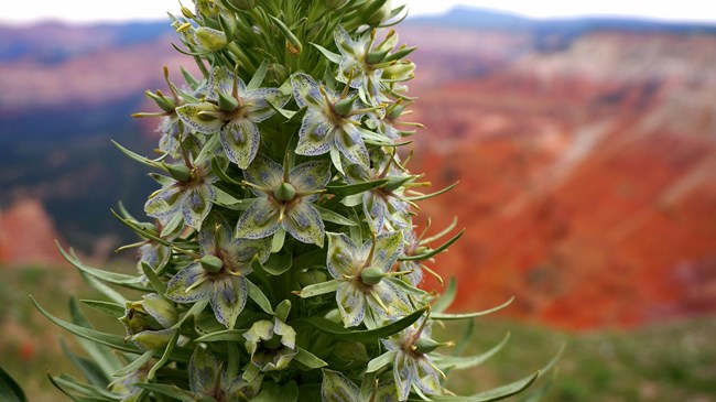
The rim features a mixture of spruce/fir forest and subalpine meadows. Throughout summer, meadows abound in a dazzling profusion of wildflowers, peaking in midsummer. The park is dominated by subalpine fir/Engelmann spruce woodlands at middle and upper elevations. Ponderosa pines occupy nearly every available habitat below the breaks. Shrublands are patchy, and upland dry herbaceous communities are common on the upper plateaus. Wetland and riparian communities are associated with springs, wetlands, and wet meadows.
Increasing recreational use, hazard tree management, and adjacent land-use and vista impacts are the park's main natural resource management concerns.
Quick Reads
- Locations: Acadia National Park, Agate Fossil Beds National Monument, Alibates Flint Quarries National Monument, Amistad National Recreation Area, Antietam National Battlefield, more »
- Offices: Appalachian Highlands Inventory & Monitoring Network, Chihuahuan Desert Inventory & Monitoring Network, Cumberland Piedmont Inventory & Monitoring Network, Eastern Rivers and Mountains Inventory & Monitoring Network, Great Lakes Inventory & Monitoring Network, more »
Across the US, changes in water availability are altering which plants grow where. These changes are evident at a broad scale. But not all areas experience the same climate in the same way, even within the boundaries of a single national park. A new dataset gives park managers a valuable tool for understanding why vegetation has changed and how it might change in the future under different climate-change scenarios.
- Locations: Arches National Park, Black Canyon Of The Gunnison National Park, Bryce Canyon National Park, Canyonlands National Park, Capitol Reef National Park, more »
- Offices: Inventory and Monitoring Division, Northern Colorado Plateau Inventory & Monitoring Network
Scientists from the Northern Colorado Plateau Network travel thousands of miles each year to collect data on plants, soils, and water across network parks. But it would be impossible to cover every square inch of the Northern Colorado Plateau with boots on the ground. Instead, we simultaneously monitor the parks with boots in space—satellite data that provide information at a much broader scale.
- Locations: Arches National Park, Aztec Ruins National Monument, Bandelier National Monument, Bent's Old Fort National Historic Site, Big Bend National Park, more »
- Offices: Chihuahuan Desert Inventory & Monitoring Network, Climate Change, Climate Change Response Program, Inventory and Monitoring Division, Mediterranean Coast Inventory & Monitoring Network, more »
When the climate changes enough, the vegetation communities growing in any given place will also change. Under an expanded bimodal climate zone, some plant communities in western national parks are more likely to change than others. National Park Service ecologists and partners investigated the future conditions that may force some of this change. Having this information can help park managers decide whether to resist, direct, or accept the change.
- Locations: Alibates Flint Quarries National Monument, Amistad National Recreation Area, Arches National Park, Aztec Ruins National Monument, Bandelier National Monument, more »
- Offices: Chihuahuan Desert Inventory & Monitoring Network, Greater Yellowstone Inventory & Monitoring Network, Inventory and Monitoring Division, Natural Resource Stewardship and Science Directorate, Northern Colorado Plateau Inventory & Monitoring Network, more »
Across the Intermountain Region, Inventory & Monitoring Division ecologists are helping to track the effects of climate change, provide baseline information for resource management, evaluate new technologies, and inspire the next generation of park stewards. This article highlights accomplishments achieved during fiscal year 2021.
- Locations: Arches National Park, Black Canyon Of The Gunnison National Park, Bryce Canyon National Park, Canyonlands National Park, Capitol Reef National Park, more »
- Offices: Inventory and Monitoring Division, Northern Colorado Plateau Inventory & Monitoring Network
Knowing which key natural resources are found in the national parks, and whether they're stable or changing, helps decisionmakers make sound choices. The Northern Colorado Plateau Network is building that knowledge. After more than ten years of monitoring, we've learned a lot about park ecosystems, how they're changing, and what they may look like in the days to come. Find out what we’ve learned and how it’s being used to help managers plan for the future.
Publications
Source: Data Store Saved Search 3767. To search for additional information, visit the Data Store.
Source: Data Store Saved Search 3768. To search for additional information, visit the Data Store.
Last updated: November 1, 2021