Ken Hill
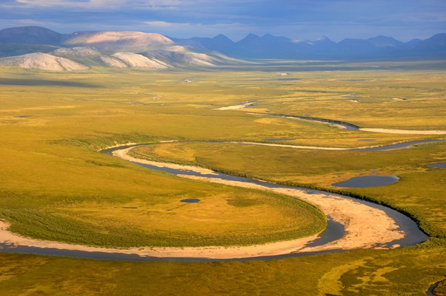
The 6.6-million-acre Noatak National Preserve covers most of the Noatak River watershed and has been home to people for over 11,000 years.
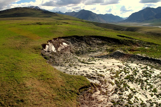
The Noatak Valley has many large icings (aufeis). Aufeis forms in places where the water is forced to the surface in the winter and it freezes layer-upon-layer until it is so thick that it lasts most of the following summer. Parts of the preserve are very flat with many shallow lakes formed by thawing permafrost and where the only high spots are ice-cored hills known as pingos—ground that was once under a lake freezes again after the lake drains. On the banks of the Noatak River there is a massive erosion feature, or rather a retrogressive thaw slump. These slumps occur where a steep escarpment in ice-rich permafrost advances as the ground thaws and then falls or flows downhill. There are numerous slumps in the Kavachurak Moraine in the upper Noatak River valley.
What's Happening in Noatak National Preserve
Last updated: February 2, 2022

