NPS Graphic Gichi Onigaming, The Great Carrying PlaceGichi Onigaming (Great Carrying Place) is the name of the 8.5-mile portage trail that allowed Native Americans, explorers, and voyageurs to bypass high falls, cascades, and gorges, and has been a critical transportation route for thousands of years. Because of the area’s geology, topography, natural resources, and strategic location, this trail was part of an ancient transcontinental trade route connecting the Great Lakes to the interior of the continent. The adoption of native technology and the cultural exchange that took place during the fur trade led to exploration and mapping the continent. The quest for furs caused European expansion into the northwest during the 18th and 19th centuries. The Grand Portage trail itself was a focal point in developing the international boundary between Canada and the United States, and today remains an international road. Under the terms of the Webster- Ashburton Treaty of 1842, use of the trail remains free and open to citizens of both the United States and Canada. Without the Grand Portage, Canadian and American political history and national boundaries might have been quite different. Minnesota: Grand Portage National Monument The Great Lakes Fur Trade and the North West CompanyThe Grand Portage bypasses unnavigable portions of the Pigeon River and connects Fort Charlotte with Lake Superior, where thousands of tons of furs and materials were transported back and forth to Europe and beyond. The North West Company (NWC) depot served as the headquarters and central hub for the NWC as it competed in the global fur trade, and acted as the rendezvous point to exchange North American furs for trade goods from Montreal, Europe, Asia, and South America. Between 1731 and 1804, thousands of men shuttled tons of supplies and furs over the portage and in and out of warehouses at either end of the woodland trail. Homeland of the Grand Portage AnishinaabeGrand Portage National Monument is within the homeland of the Grand Portage Anishinaabe. Approximately half of the land for the national monument was donated by the Grand Portage Band. This community is the homeplace and center of tribal government for the Grand Portage Band (the Band) of Lake Superior Chippewa (Ojibwe/Anishinaabe). Their intimate knowledge of and connection to the land, water, plants, and wildlife of the area allowed them to endure in the sometimes harsh environment before and after European exploration and nation-building. As other cultures explored this area, the tools and technologies of the Anishinaabe (Ojibwe) were adapted by newcomers to exploit the natural resources as global commodities. The Anishinaabe (Ojibwe) have persevered here for centuries, through the European incursion into this continent and division into two countries, the United States and (then British) Canada. Anishinaabe Culture & Language 
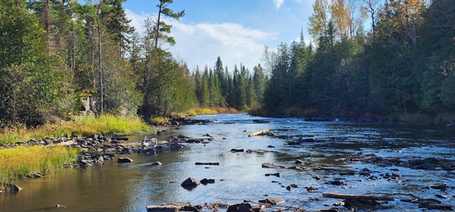
NPS Photo / B. Clayton Grand Portage National MonumentThe significance of this historic portage corridor is the reason for Grand Portage National Monument. Bordered on the north and south by Grand Portage tribal land, on the east by Lake Superior, and on the west by the Pigeon River and Canada, the monument is 710 acres and consists of two districts, which are connected by the Grand Portage trail. The eastern, or lakeshore district, consists of the visitor service area with a reconstructed stockade and grounds containing historic buildings and gardens, and where most interpretation occurs. The western, or Fort Charlotte district, is named for historic Fort Charlotte, which today is a camping area with primitive campsites, a point of debarkation for modern canoe travelers, and a destination for hikers from the lakeshore. A small monument made of river stones marks the location of the historic fort. From Fort Charlotte, canoers embark on the Grand Portage trail, which is the culmination of an incredible canoe voyage and portage experience beginning at the Boundary Waters Canoe Area Wilderness (BWCAW) and the Quetico and La Verendrye provincial parks (together known as the Superior-Quetico complex). At the end of this trip, canoers portage their supplies the final 8.5 miles to reach Lake Superior. 
NPS Photo / GM Spoto Isle Royale National ParkFor the Grand Portage Band, Minong (Isle Royale) is traditional cultural property, a place to connect and practice their traditional heritage that has included hunting and trapping, maple sugaring, fishing, plant gathering, and spiritual practice. Grand Portage National Monument is near Isle Royale National Park, which is visible from the Heritage Center. The Monument supports Isle Royale management by providing direction to an embarkation point for boat transportation, supporting operations logistics to the island, providing select administrative functions including participation in the Tribal Self-Governance Act agreement with the Grand Portage Band, and providing museum and archeological assistance. This has resulted in a close, cooperative relationship between the two parks. Articles about History and Culture
|
Last updated: January 23, 2026


