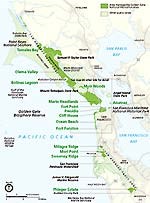
Golden Gate National Recreation Area Now you can obtain a copy of our official map and guide online. Pick up a copy of our web edition now prior to your visit to the park (updated August 2018). Click here to download a copy of the GGNRA Official Map & Guide (Web Edition). Click here to download a zipped file of the audio described Golden Gate NRA Brochure onto your computer; once it has downloaded, extract the files in your file browser. 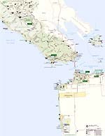
NPS / HFC This is a close-up map of the Golden Gate National Parks, featuring sites specific to the general San Francisco Bay Area. Sites include: Alcatraz, Muir Woods National Monument, Fort Point National Historic Site, Marin Headlands, Point Bonita Lighthouse, NIKE Missile Site, Fort Baker, Fort Mason, Presidio of San Francisco, Cliff House, Lands End, Ocean Beach, China Beach, Baker Beach, and even Fort Funston. 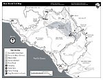
NPS Trail Map of Muir Woods 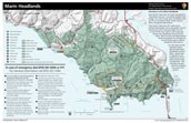
Marin Headlands/Fort Baker Color Map Trail map of the Marin Headlands. Includes features such as Point Bonita Lighthouse, NIKE Missile Site, Cavallo Point-The Lodge at Golden Gate, Institute at the Golden Gate, the Marine Mammal Center, Bay Area Discovery Museum, Fort Baker, Tennessee Valley, and Fort Cronkhite. The insets on the back give zoomed-in detail for Fort Cronkhite to Fort Barry and south to Point Bonita, and all of Fort Baker. NOTE: Marin Headlands trails can be accessed off of Highway 101 from Rodeo Avenue Exit and Trailhead, and Spencer Avenue Exit at Morning Sun Trailhead. Access is prohibited from Wolfback Ridge Road, which is private.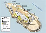
Alcatraz Island MapMap of Alcatraz Island, providing additional information about locations, buildings, audio tour, paths and trail. 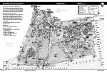
Presidio of San Francisco Pad Map 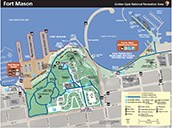
Map of Fort MasonIncludes features such as Fort Mason Center, Black Point Battery, Hosteling International, Park Headquarters for Golden Gate National Recreation Area, and Golden Gate National Parks Conservancy.
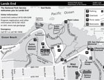
NPS Map of Lands End
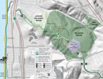
Milagra Ridge Trail Map Trail Map of Milagra Ridge in Pacifica, California, in San Mateo County south of San Francisco. 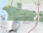
Mori Point Trail Map Trail Map of Mori Point, in Pacifica, California, in San Mateo County south of San Francisco. 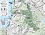
Sweeney Ridge Trail Map Trail map of Sweeney Ridge in Pacifica, California, in San Mateo County south of San Francisco. 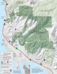
Rancho Corral de Tierra Trail Map Trail map of Rancho Corral de Tierra, near Montara, California, in San Mateo County, south of San Francisco. 
Phleger Estate Map Trail map of the Phleger Estate located in Woodside, California located in San Mateo County. |
Last updated: August 18, 2025

