Ghosts of the Golden GateThe Golden Gate National Recreation Area is rich in cultural and natural history. Our goal with Ghosts of the Golden Gate is to tell the park's story by matching beautiful and fascinating archival photographs with photos from today. Join us as we reveal the hidden history of familiar locations. The galleries of this collection showcase images from a vast range of lands in San Francisco and the history of the diverse people that occupied them. 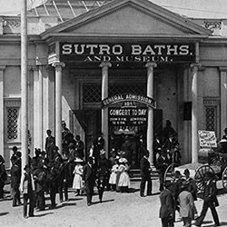
Lands End / Sutro BathsSince 1863, visitors have flocked to San Francisco’s western shore to enjoy sweeping ocean views. The concrete ruins just north of the Cliff House are the remains of the grand Sutro Baths. You can find these historic sites on the north end of Ocean Beach, where Geary Boulevard and the Great Highway converge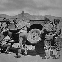
Crissy FieldFrom 1921 to 1936 Crissy Army Airfield was the center of West Coast military aviation. During these years of explosive advances in air power, pilots from Crissy performed maneuvers and mock battles, flew endurance flights, surveyed the west by air, and scouted for forest fires. A major restoration of the airfield area was completed in 2001.
Alcatraz IslandTo those that only know the Hollywood version, the rich history of Alcatraz is surprising. Civil War fortress, infamous federal prison, bird sanctuary, first lighthouse on the West Coast, and the birthplace of the American Indian Red Power movement are just a few of the fascinating stories of the Rock. Alcatraz Island is a designated National Historic Landmark for its significant contribution to the nation's history.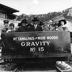
Muir WoodsWalk among old growth coast redwoods, cooling their roots in the fresh water of Redwood Creek and lifting their crowns to reach the sun and fog. Federally protected as a National Monument since 1908, this primeval forest is both refuge and laboratory, revealing our relationship with the living landscape. 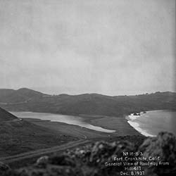
Marin HeadlandsThe Marin Headlands houses an amazing richness of history and biological diversity due to the variety of habitats and unique geology of the area. A crown jewel of the Golden Gate National Parks abounding with places of natural wonder and beauty (Rodeo Lagoon/Valley, Gerbode Valley, Hawk Hill, Tennessee Valley) and remarkable historic sites (Point Bonita Lighthouse, Fort Cronkhite, Nike Missile Site, Battery Townsley). It’s hard to believe such a vast, beautiful, and diverse wilderness is so close to a major metropolitan area.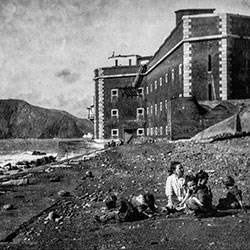
Fort PointOriginally established as Castillo de San Joaquin by the Spaniards in 1794, Fort Point was abandoned after Mexican independence in 1821. The United States claimed the promontory in 1846 as part of the "Bear Flag" rebellion to liberate California from Mexican control. The fort was first garrisoned by the United States in 1861 and despite becoming quickly obsolete as a defensive position due to advances in military technology, it served various Army purposes through the end of World War II.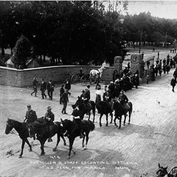
The PresidioThe Presidio has a rich history spanning back to the time of the native Ohlone people. The Spanish arrived in 1776 to establish the northernmost outpost of their empire in western North America. It fell under Mexican rule for 24 years before the U.S. Army took control in 1846. The Army transformed the Presidio grounds from mostly windswept dunes and scrub to a verdant, preeminent military post. Since 1994, the Presidio has been a part of the Golden Gate National Recreation Area.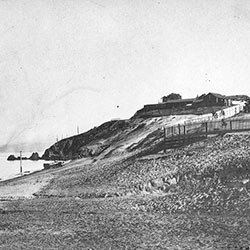
Fort MasonNamed Punta Medanos by the Spaniards in 1797, and then Black Point by early American settlers, the point was first occupied by the U.S. Army in 1863. It served an important role in the defense of San Francisco Bay from the Civil War through the Spanish-American War. The post became the center of the Army's Pacific Administration after the 1906 earthquake and was turned over to the National Park Service in 1972.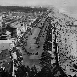
Ocean BeachOcean Beach, the five mile long stretch of shoreline south of the Cliff House, has been a destination for San Franciscans and visitors since the 1850s. Ocean Beach became even more popular with the advent of public transportation and new roads provided an easy way from downtown over the vast sand dunes that once covered the Richmond and Sunset districts.
If you have any questions or additional information on the historic images, please contact the Park Archives and Records Center’s reference archivist at 415-561-2807 or Contact Us. This collection, curated and photographed by Ted Barone.
|
Last updated: July 9, 2024
