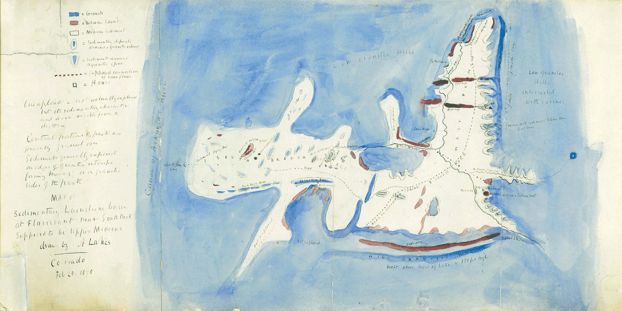
Florissant Fossil Beds National Monument; Arthur Lakes Geologists make special geologic maps that show geologic features to help them identify rocks while in the field. Different rock units are shown with different colors and/or symbols to show where they are exposed at the surface. In order to make a geologic map, geologists have to go out into the field and search for exposed rock layers and contacts where those different rock types or units meet. You will need:
Arthur Lakes first mapped the Florissant valley in 1877. A year later he made a watercolor map named "Map of sedimentary lacustrine basin at Florissant near South Park, supposed to be Upper Miocene". Today we know that the Florissant Formation is actually from the end of the Eocene rather than the Miocene. Lakes' watercolor map showed the locations of the fossil rich beds and other rock units including granite, volcanic lavas, and sediments. He also added landmarks such as the homes of local residents and families. This made it easier for others to orient the map and where they were according to it. InstructionsStep One:Find the Mapping Florissant Fossil Beds video on our website and play it. Follow the Ranger to an outlook where you can see Florissant Valley. Step Two:Pause the video so you can see the view of Florissant Valley and paint your own geologic map of the valley. Remember to include a north arrow and something like a road or the Hornbeck Homestead to help orient your map. You can draw these in with your pencil.
Visit our keyboard shortcuts docs for details
Follow Geoscientists in the Parks intern Nichole on the Geologic Trail to an outlook where you can make your own geologic map of the valley. New Words!
|
Last updated: August 16, 2022
