Part of a series of articles titled Beach and Coastal Landforms.
Next: Sandy Coast Landforms
Article

NPS Photo.
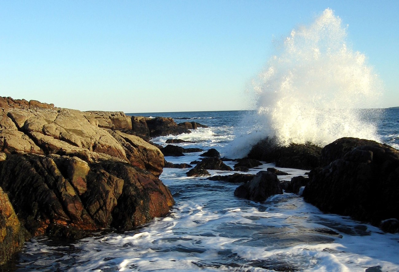
The pounding surf and breaking waves found on rocky coasts have inspired ocean lovers for generations. Erosion characterizes these high-energy environments, which are typically located on active margins with narrow continental shelves (on account of subduction). Rocky coasts may be composed of any rock type (i.e., sedimentary, igneous, or metamorphic) and are usually the site of complex tectonic landforms such as faults, folds, and igneous intrusions and extrusions. Bedrock composition, climate, and wave patterns dictate the profile of rocky coasts. Resistant bedrock combined with high-energy wind and wave activity will create a steep profile, whereas easily erodible rocks in low-energy environments will create a more gradual profile, for example, the high cliffs of Kalaupapa National Historical Park (Hawaii) versus the gently sloping rocky coastline of Dry Tortugas National Park (Florida). In addition, glacial activity may produce steep, rocky coasts through the production of fjords and talus slopes. Carbonate coasts, dominated by skeletal and shelly materials, may form eolianite dunes—calcium carbonate beach dune deposits that are lithified and may be eroded to form steep cliffs and bluffs.
Rocky coastlines have many spectacular features. Waves cut arches and sea stacks that jut into the water. Bluffs, cliffs, and terraces form as rock is eroded. Fjords are made when glacial valleys are filled with water when sea level rises.
Between 1.8 million to 10,000 years ago, Pleistocene glaciers carved steep valleys that were eventually drowned by rising sea levels. The inundated valleys created by glacier movement are called fjords. Kenai Fjords National Park in Alaska provides excellent examples of rocky coasts along fjords. Also see U-Shaped Valleys, Fjords, and Hanging Valleys as part of Glaciers & Glacial Landforms.
Headlands and pocket beaches of Channel Islands National Park in California are distinctively shown in aerial photographs. Waves are refracted around the headlands, increasing erosion at seaward positions on the islands in the park. The protected embayments, where wave action is subdued between headlands, are often transformed into sandy pocket beaches. In lower-energy pocket beaches, sediment transport is not able to carry sediment downshore except during increased wave, wind, and storm activity. Pocket beaches may be ephemeral and change seasonally, or even disappear, on account of increased energy events.
The headlands on rocky coasts are exposed to intense wave, wind, and storm action. Eventually sea caves may form in less resistant, easily erodible bedrock located on promontories. These caves are distinctive environments that are particularly suited for bryozoans, sponges, barnacles, tubeworms, and some species of shade-tolerant red algae. Sea caves are popular with recreational boaters and divers. Also see Sea and Littoral Caves as part of NPS—Caves and Karst.
The constant erosion of rocky headlands may produce a variety of particular geomorphic structures, including sea arches and sea stacks. These isolated remnants of the headland have been detached from the mainland. With prolonged erosion, sea arches may collapse to form sea stacks—steep pillars of rock a short distance from the mainland. Both sea stacks and sea arches are impermanent features that will eventually disappear with continued erosion. Hundreds of these beautiful features have been observed along the coastline of Olympic National Park, Washington.
The shape and appearance of sea cliffs depends on the stratigraphy, geologic structures, angle of deposition, and lithology of the bedrock material in which the cliffs are formed. Massive rocks, such as granite, will normally erode in a uniform manner, whereas layered sedimentary rocks may erode in a step-wise fashion. Because of increased wave activity found in the midlatitudes, numerous steep cliff slopes exist there, as compared to the high and low latitudes. Na Pali—“sea cliffs”—rise thousands of feet above the peninsula and ocean within Kalaupapa National Historical Park in Hawaii. Recognized as a significant remaining example of sea cliffs in our nation’s natural heritage, this area was designated as the North Shore Cliffs National Natural Landmark in 1972.
Tidewater or tidal glaciers terminate at the sea or within a fjord. These glaciers are some of the best-studied glaciers because of easy access to their termini or snouts. Depending on climate, topography, and amount of snowfall over time, tidewater glaciers may periodically experience rapid retreat, creating many large icebergs. If icebergs drift into nearby shipping lanes—especially those containing oil tankers, for example, in Alaska—such recession can be catastrophic. Tidewater glaciers are usually bright whitish-blue due to ice density and the tendency of calving (breaking into the sea). Glacier Bay National Park and Preserve in Alaska hosts many tidewater glaciers. Also see U-Shaped Valleys, Fjords, and Hanging Valleys as part of Glaciers & Glacial Landforms
Part of a series of articles titled Beach and Coastal Landforms.
Next: Sandy Coast Landforms
Last updated: March 20, 2019