|
This page contains samples of backpacking trips that leave from Tioga Road west of May Lake. If you're interested in high country backpacking, remember to also consider trails from Tuolumne Meadows. 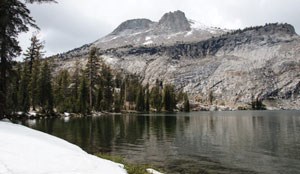
May LakeHighlights: Lakes Distance: 2 miles (3.2 km) round trip Elevation Gain: 400 feet (120 m) Permit Demand: Very High Trailhead: May Lake May Lake is north of the Tioga Road, near Tenaya Lake. The lake sits at the foot of Mt. Hoffmann, the geographic center of the park. There is a backpackers campground as well as a High Sierra Camp. Great for new backpackers, this is the shortest backpacking trip in Yosemite. It is also used to access an unofficial, unmarked spur trail that leads to the summit of Mt. Hoffmann. 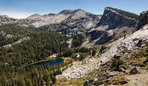
Ten LakesHighlights: Lakes Distance: 11.8 miles (18.3 km) round trip Elevation Gain: 1,500 feet (460 m) Permit Demand: Medium Trailhead: Ten Lakes The Ten Lakes Basin is perched above the Grand Canyon of the Tuolumne River. Hikers ascend through forests to the panoramic Ten Lakes Pass before descending to the lakes. 
Ten Lakes to Tenaya LakeHighlights: Lakes, High Country Distance: 20.4 miles / 32.8 km one way Elevation Gain: 4350 feet / 1325 M Permit Demand: Medium Trailhead: Ten Lakes This hike goes through the scenic Ten Lakes Basin, hooks around Tuolumne Peak, and ends at Tenaya Lake (the reverse is also possible, starting at Sunrise Lakes trailhead). Hikers travel through old forests, over panoramic passes, and into the quiet South Fork of Cathedral Creek. There are views of the Grand Canyon of the Tuolumne, the northern mountains of Yosemite, and Tuolumne Meadows. 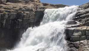
Grand Canyon of the TuolumneHighlights: Waterfalls Distance: 30.8 miles (49.6 km) one way Elevation Gain: 5,350 feet (1,630 m) Permit Demand: Medium Trailhead: White Wolf Starting at White Wolf, the hike begins with a steep descent to Pate Valley and a loss of 4,000 feet (1,200 m) in elevation. From Pate Valley, the trail climbs over the Muir Gorge and past the canyon’s largest waterfalls—Waterwheel, Le Conte, and California. Glen Aulin is the final place to camp before exiting to Tuolumne Meadows. (Public transportation may be available to help you travel between starting and ending trailheads.) (This hike is also possible in reverse, starting at the Glen Aulin trailhead.) 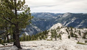
North DomeHighlights: Valley Views Distance: 10.4 miles (16.7 km) round trip Elevation Gain: 1,100 feet (335 m) Permit Demand: Medium Trailhead: Porcupine Creek The trail descends through pine forests to the top of North Dome on the northern rim of Yosemite Valley. There are views of Indian Rock, Half Dome, Tenaya Canyon, and Yosemite Valley. 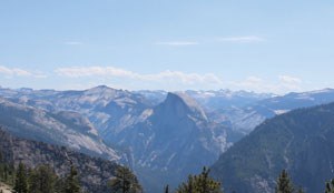
El Capitan from Tamarack CreekHighlights: Valley Views Distance: 21.6 miles / 20.2 km out and back Elevation Gain: 1700 feet / 520 M Permit Demand: Low Trailhead: Tamarack Creek Starting at Tioga Road, hikers travel through vast forests and over small creeks to reach the summit of El Capitan. Once at the summit, there are expansive views of Yosemite Valley and the high country. |
Last updated: August 14, 2023
