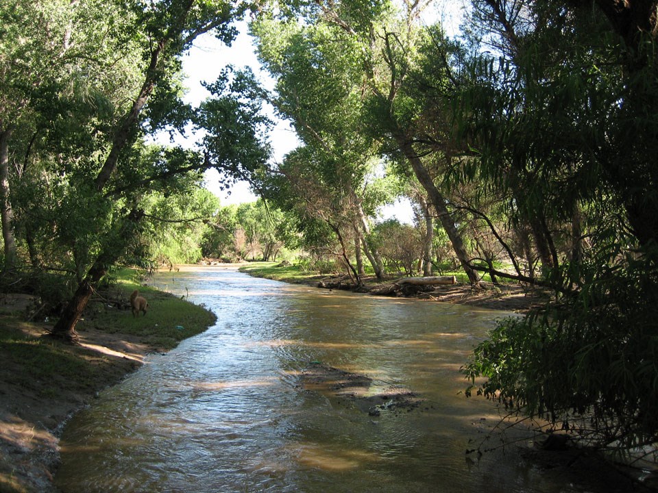
Anza Trail Coalition of Arizona The hydrology of the Santa Cruz River reveals the nature of and circulation of water on the earth's surface, below the ground and in the atmosphere. Learning about hydrological changes over time helps us understand how the river supported life at the Tumacácori mission in centuries past, and the challenges we face now in maintaining its ability to support life in this region today. 
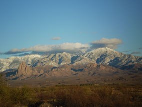
NPS Photo GeologyThe river is located in the Basin and Range geological province of southern Arizona and northern Sonora, Mexico. Near Tumacácori, the river flows through a sediment-filled valley bordered by mountains. The San Cayetano mountains lie to the east, the Santa Ritas to the northeast, and the Tumacácori mountains to the west. Below lies a surface geologic structure of sand, gravel, silt and clay sediments that have been eroding from surrounding mountains since the Holocene Epoch (about 11,700 years ago.) To the south, Tumacácori's sister historical mission sites of Calabazas and Guevavi are surrounded by sedimentary and igneous rocks from the Tertiary Period (66 million to 2.6 million years ago) and Mesozoic Era (approximately 251 million to 66 million years ago). Human CivilizationPrior to European colonization, water flowed on the surface throughout the year in many places, including in the stretch of the river from near Rio Rico to Tubac. These areas where ground water flowed into the channel at the surface, or "gaining reaches" of the river, were ideal for supporting human communities, and also provided water for a wide variety of plants and animals adapted to the specific hydrologic features of this area. Water flow was lower or intermittent during part of the year that had little rainfall, and was higher during intense summer monsoon precipitation. Human inhabitants adapted their agriculture to these conditions. The Spanish ArriveSpanish colonizers arriving in the 17th and 18th centuries used this traditional connection between hydrology and settlement to determine the best locations for building new mission communities. Although having groundwater so close to the surface was ideal for easier access to water for community life and construction of mission buildings, it also created conditions for groundwater to seep into adobe buildings when the water table was high. More significantly, new uses of water and ways of life brought by colonizing peoples began to impact the region's water supply. Changing Land UseGrazing and agricultural production increased along with extractive industries like mining. The increased demand led to lower water tables in the late 19th century. Ground water pumping was used to supply Arizona's growing population. Storm events began to create arroyos as soil surfaces succumbed to erosion. In past times, the river vegetation and flood plain would have slowed flow and increased filtration. However, new channels began to chisel below adjacent terraces as early as the late 1800s. Flooding increased. 
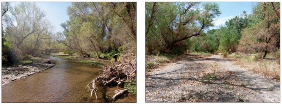
NPS Photo Current ConditionsThe hydrology of the Santa Cruz has continued to change enormously. The demands of expanding human use, flooding, drought and climate change continue. Housing development, industry, mining, and agriculture have all affected the quantity and quality of the hydrologic flow. Increasingly over the past century, groundwater levels have diminished and no longer discharge regularly at springs along the river. Once the water table fell below a certain level, the lush habitats sustained on and near the river such as the ciénegas, the cottonwood-willow riparian environments, and the mesquite bosques began to decline as the plants, insects, amphibians, fish, reptiles, birds, and mammals that depended on their hydrology began to be threatened. For example, Fremont cottonwoods (Populus fremontii), need groundwater to remain at approximately two meters below the surface or they will begin to shed leaves under stress from lack of water. Climate ChangeThe American southwest has endured a drought for more than a decade. Reduced precipitation decreases flow in the Santa Cruz as well as groundwater levels. Higher temperatures increase the rate of evaporation. Climate change is expected to make weather events more extreme and unpredictable and to increase temperatures over time. This would lead to additional stress on water resources, flood risk to property, and many other impacts. Treated Effluent to the RescueBy 1950, the river near Tumacácori was ephemeral or intermittent. However, currently, this stretch of the river now flows year-round due to a fortuitious irony. Treated effluent which in times past would have been considered "waste water" is released upstream, increasing water flow and groundwater recharge. Despite challenges from Escherichia coli (E. coli) and other contaminants, this water is essential for recharging the aquifer and supporting rare riparian ecosystems. The quality of the water, and consequently the health of aquatic life, improved after upgrades were made in 2009. Continued flow of effluent is necessary for the future survival of the Santa Cruz; however, with the need for water continuing to increase on both sides of the border, its future is not assured. Water Rights (and Fights)As the water table has declined over the last one hundred and forty or so years, various groups and interests have had to negotiate disputes and cooperation over water rights and usage. While western water law is largely based on a philosophy of water as an economic commodity, many indigenous communities contribute the view of water as a gift belonging to the Creator with humans acting as stewards. The O'odham people, whose historical landbase extended from central Arizona to Sonora, Mexico, and from the San Pedro River to the Gulf of California, have continued to assert their legal and historical claim to water rights in the nation, resulting in the Southern Arizona Water Rights Settlement Act of 1982 and the Arizona Water Settlements Act of 2004. More recently, water claim discussions have focused on how governments will meet these water obligations for future generations as current levels of water usage in Arizona are becoming increasingly unsustainable. 
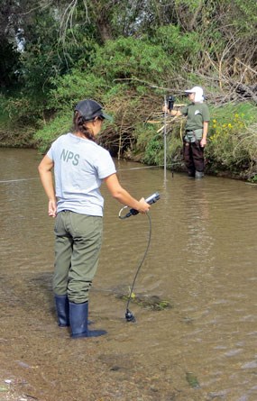
NPS Photo Monitoring and AssessmentCooperative assessment, monitoring, education, legal and restoration efforts are all important in creating the next chapter of the upper Santa Cruz River's hydrological history. Along with many community groups, the Sonoran Desert Network and Tumacácori National Historical Park monitor broad-scale changes in water quality, streamflow, channel morphology (the shape and composition of the streambed), riparian vegetation, and macroinvertebrate communities. The continued presence of longfin dace (Agosia chrysogaster,) and dramatic return of the federally endangered Gila topminnow (Poeciliopsis occidentalis,) are positive indicators of recent improved water quality. |
Last updated: May 6, 2025
