The legend says: Plan of the Presidio of Fronteras, dependent upon the government of Sonora and located at 31 degrees and 17 minutes of latitude north, and 253 degrees and 24 minutes of longitude from the Tenerife meridian. Explanation: A.Captain's house; B.Guardhouse; C.Church: D. First Plaza; E. Second Plaza; F. Mill. Note: All of these buildings are made of adobes. Scale: two hundred fathoms. Joseph de Urrutia The map shows two roads to Cuquiárachi and one each to Guchuta and Janos. It also shows the “Irrigation ditches for irrigating.” Courtesy British Library 
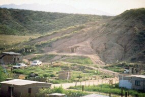
The ruins of the Presidio of Santa Rosa de Corodéguachi, commonly called "Fronteras" can be visited today by crossing the international border at Douglas, Arizona / Agua Prieta, Sonora and proceeding south to the town of Fronteras. The ruins are at the point of the hill on the west side of town past the town hall. |
Last updated: May 6, 2025
