Trip Idea

Explore World War II Buildings and Structures on Amaknak Island and Unalaska Island

Multiple Parks

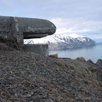
a concrete structure sticking out of a hill
Duration Full Day
Topic(s) Coastal Defenses, Military, Wars and Conflicts, World War II, US Navy, US Army, Maritime - Military more »
Activities Scenic Driving
Type Kid Friendly, Solitary/Remote, Educational, Outdoors, Road Trip, Group Friendly more »
Parks Aleutian Islands World War II National Historic Area

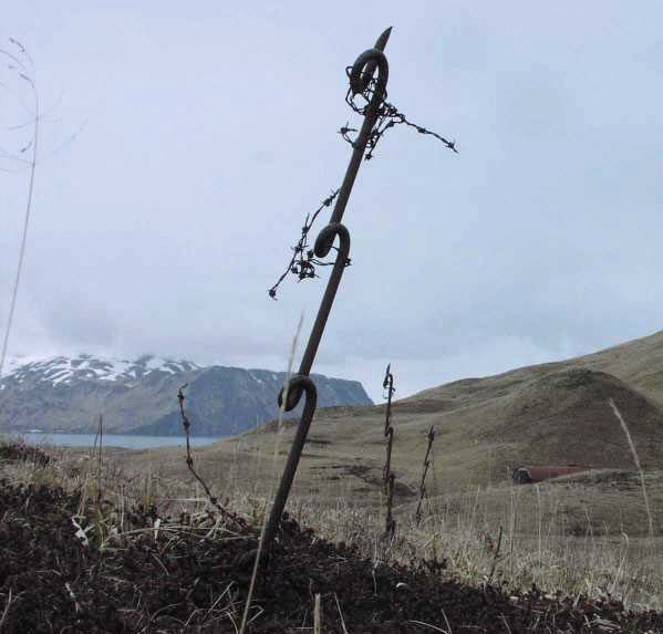
twisted metal bar in grass

Before You Begin...

Ounalashka Corporation Land-Use Permit
All visitors planning to walk or hike anywhere beyond the City of Unalaska road system must obtain an Ounalashka Corporation Land-Use Permit. This permit can be purchased at the Visitors Center or at the Ounalashka Corporation Office.

Weather Safety
Aleutian weather is unpredictable. Within minutes, conditions can change from sunny and calm to strong wind and driving rain. Always carry a jacket and a hat, and dress in layers.

Souvenirs
Collecting souvenirs such as stone tools, ivory, eagle feathers, bones, or any World War II-era artifacts, including shell casings or nails, is illegal.
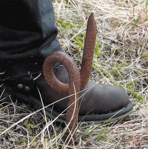
a twisted bar of metal in grass
Hazards

Anti-personnel stakes (also known as screw pickets or Rommel stakes) were installed throughout Amaknak and Unalaska islands during World War II in anticipation of a ground assault by enemy troops. Double and sometimes triple rows of these sharpened iron spikes were planted in the ground: the first 4-foot-high row was strung with barbed wire; another parallel (offset) row of stakes was placed in front. The tops of the stakes in the second row protruded only 4 to 6 inches above ground, hidden by tall grass. Many of these stakes are still in the ground.

WATCH WHERE YOU STEP

Mile 0: Aleutian World War II Visitor Center

Aerology Operations Building (1941)
The former Aerology Operations Building, now the Aleutian World War II Visitors Center, is shown on each of the route maps as the designated starting point for the six driving tours. During World War II, the upstairs of the building housed meteorological equipment used to provide navy pilots and ship captains with weather forecasts, including information on wind speed and direction, impending storms, and the height of ocean swells.  The Naval Air Transport Service operated on the first floor.
 
Windows on the octagonal upper floor allowed radio operators a 360-degree view of Mount Ballyhoo to the north, Dutch Harbor to the east, the airfield to the west, and Fort Mears and Unalaska Bay to the southeast. After the naval base was decommissioned, the City of Unalaska used the Aerology Operations Building as an airport terminal until 1985. 

The National Park Service, in cooperation with the land owner, Ounalashka Corporation, has restored the exterior of the Aerology Operations Building to its original 1940s-era appearance, and rehabilitated the interior as an interpretive center. The Aleutian World War II Visitors Center was dedicated in July 2002. 

Torpedo Bombsight and Utility Shop (1942)
Several yards directly west of the Aerology Operations Building is the former Torpedo Bombsight and Utility Shop. This two-story steel-frame structure, measuring approximately 80 feet by 120 feet, was where torpedoes were given a final check before loading, and repaired if necessary.  A parachute loft and packing room were located upstairs.

map of Unalaska island and Amaknak Island showing general location of 6 driving routes
Driving Guides
  • Aleutian Islands World War II National Historic Area

    East Point Loop Road

    • Activity Fee: No (Entrance fees may apply)
    • Reservations: No
    • Activity: Scenic Driving
    • Pets: Yes
    • Time of Day: Day
    a concrete structure overlooks a harbor

    Starting at the Aleutian World War II visitor center, this route follows the East Point Loop Road and highlights 8 military sites along the way.

    View Details
  • Aleutian Islands World War II National Historic Area

    Airport Beach Road (North)

    • Activity Fee: No (Entrance fees may apply)
    • Reservations: No
    • Activity: Scenic Driving
    • Pets: Yes
    • Time of Day: Day
    a concrete structure overlooks a harbor

    Starting at the Aleutian World War II visitor center, this route follows the Airport Beach Route (north) and highlights 5 military sites along the way.

    View Details
  • Aleutian Islands World War II National Historic Area

    Airport Beach Road (South)

    • Activity Fee: No (Entrance fees may apply)
    • Reservations: No
    • Activity: Scenic Driving
    • Pets: Yes
    • Time of Day: Day
    a concrete structure overlooks a harbor

    Starting at the Aleutian World War II visitor center, this route follows the Airport Beach Route (south) and highlights 5 military sites along the way.

    View Details
  • Aleutian Islands World War II National Historic Area

    Unalaska Town Site

    • Activity Fee: No (Entrance fees may apply)
    • Reservations: No
    • Activity: Scenic Driving
    • Pets: Yes
    • Time of Day: Day
    a concrete structure overlooks a harbor

    Starting at the Aleutian World War II visitor center, this route crosses the river to Unalaska Island and highlights 5 military sites in the town site.

    View Details
  • Aleutian Islands World War II National Historic Area

    Upper Unalaska Valley

    • Activity Fee: No (Entrance fees may apply)
    • Reservations: No
    • Activity: Scenic Driving
    • Pets: Yes
    • Time of Day: Day
    a concrete structure overlooks a harbor

    Starting at the Aleutian World War II visitor center, this route follows the Unalaska Valley road and highlights 4 military sites along the way.

    View Details
  • Aleutian Islands World War II National Historic Area

    Summer Bay Road

    • Activity Fee: No (Entrance fees may apply)
    • Reservations: No
    • Activity: Scenic Driving
    • Pets: Yes
    • Time of Day: Day
    a concrete structure overlooks a harbor

    Starting at the Aleutian World War II visitor center, this route follows along Iliuliuk Bay and along the Summer Bay road including 6 military sites along the way. This route includes the distinctive looking Base End Station remains.

    View Details

Last updated: October 6, 2020