Filter Your Results
- Lesson Plan (508)
- Field Trips (99)
- Student Activities (65)
- Distance Learning (61)
- Traveling Trunk (28)
- Teacher Reference Materials (24)
- Other Education Materials (19)
- Primary Sources (17)
- Field Schools & Institutes (7)
- Guest Speakers (7)
- Teacher Workshops & Other Programs (4)
- Media for Loan (2)
- Teacher-Ranger-Teacher (2)
- Science Labs (1)
- Cowpens National Battlefield (43)
- Acadia National Park (39)
- New Orleans Jazz National Historical Park (22)
- Carl Sandburg Home National Historic Site (21)
- Cane River Creole National Historical Park (17)
- President William Jefferson Clinton Birthplace Home National Historic Site (16)
- Andersonville National Historic Site (15)
- Castillo de San Marcos National Monument (15)
- Glacier National Park (15)
- Show More ...
- Literacy and Language Arts (718)
- Social Studies (686)
- Science (258)
- Math (131)
- Upper Elementary: Third Grade through Fifth Grade (351)
- Middle School: Sixth Grade through Eighth Grade (306)
- High School: Ninth Grade through Twelfth Grade (96)
- Lower Elementary: Pre-Kindergarten through Second Grade (72)
- Adult Education (5)
- Graduate Level (Masters (2)
- PhD) (2)
- College Undergraduate Level (1)
Showing 833 results for Map literacy ...
Frederick Douglass National Historic Site
Frederick Douglass and the Power of Literacy
- Type: Distance Learning
- Grade Levels: Upper Elementary: Third Grade through Fifth Grade

This 20-30 minute program works with students to discover why reading was so powerful for Douglass as a slave and then as an abolitionist.
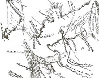
Cedar Creek & Belle Grove National Historical Park
Sketches & Maps
- Type: Guest Speakers
- Grade Levels: Middle School: Sixth Grade through Eighth Grade

Students will have an opportunity to demonstrate creativity in sketching an image as a war correspondent or creating their own version of a civil war map, based on the methods that original map makers and sketch artists used.
Rocky Mountain National Park
Maps to the Rescue!
- Type: Distance Learning
- Grade Levels: Upper Elementary: Third Grade through Fifth Grade

Maps are important tools that help us understand the world we live in and help us communicate important information about the past and present. During this program, students will discover the importance of maps for visitors and rangers in Rocky Mountain National Park by becoming Search and Rescue rangers, using maps and clues in a scenario to find a missing hiker.
Florissant Fossil Beds National Monument
Geologic Maps
- Type: Lesson Plan
- Grade Levels: Upper Elementary: Third Grade through Fifth Grade

Students will make their own interpretive map of the Florissant valley using either watercolor paint or whatever else is available to them. The students will create their maps using a video filmed at the overlook point on the geologic trail to provide them with a large view of the valley. They will use Arthur Lakes’ 1878 watercolor map of the Florissant valley as a reference.
Haleakalā National Park
Map Analysis
- Type: Lesson Plan
- Grade Levels: Middle School: Sixth Grade through Eighth Grade

Haleakalā National Park protects the biodiversity of endemic species. This activity will introduce students to the boundaries and topography of Haleakalā National Park.
Acadia National Park
Sound Mapping
- Type: Student Activities ... Other Education Materials
- Grade Levels: Upper Elementary: Third Grade through Fifth Grade

Students learn that scientists make observations using a variety of senses. Students practice the skill of observation through listening to collect data in their local environment.
Dayton Aviation Heritage National Historical Park
Mapping a Neighborhood
- Type: Field Trips
- Grade Levels: Middle School: Sixth Grade through Eighth Grade

Students will be able to recognize, identify, and draw significant landmarks on a map.
Tumacácori National Historical Park
Mapping Tumacácori
- Type: Lesson Plan
- Grade Levels: Middle School: Sixth Grade through Eighth Grade

Students will be able to differentiate between three different types of maps.
- Type: Lesson Plan
- Grade Levels: Upper Elementary: Third Grade through Fifth Grade

Students will participate in a web quest and create an interactive map of the battle that shows the placement of and information about the different troops and their leaders.
Cowpens National Battlefield
Location and Map Reading
- Type: Student Activities
- Grade Levels: Upper Elementary: Third Grade through Fifth Grade
No image provided
Abraham Lincoln Birthplace National Historical Park
Where in the World: Maps
- Type: Lesson Plan
- Grade Levels: Lower Elementary: Pre-Kindergarten through Second Grade
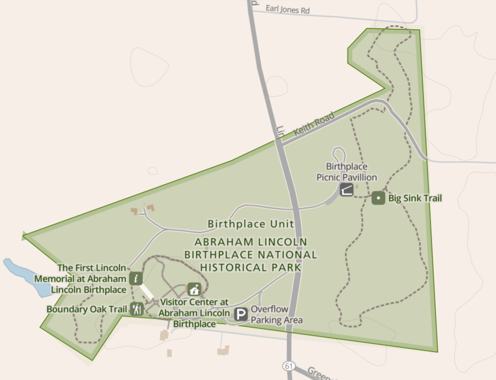
Students will identify geographic features of Abraham Lincoln Birthplace National Park and the importance of the different features by using a map, photos and other tools to locate these places during their visit at the park. Meets Kentucky Second Grade Science Standards. This lesson was created by Kentucky teachers as a part of the History and Science Explore Project.
Lewis and Clark National Historical Park
Stepping Off the Map
- Type: Lesson Plan
- Grade Levels: Upper Elementary: Third Grade through Fifth Grade
Map making was an important part of the Lewis and Clark expedition. Maps of the era were often just best guesses as to what could possibly lie in the middle of the continent. In this lesson your students will learn about the maps of the expedition and even make one of their own based on descriptions.
Fort Scott National Historic Site
A Map Changed by Destiny
- Type: Lesson Plan
- Grade Levels: Upper Elementary: Third Grade through Fifth Grade
Students become characters on a map of the western US in the 1840s as Fort Scott soldiers help to bring about rapid westward expansion
Acadia National Park
Acadia Rocks Story Map
- Type: Primary Sources ... Student Activities
- Grade Levels: Middle School: Sixth Grade through Eighth Grade

Story maps are visual explorations of challenging concepts. Explore the coast of Acadia National Park with a focus on the geologic processes. Learn the rock types, observe erosion and weathering in progress, and discover the wonders of Acadia's Great Head trail.
Cumberland Island National Seashore
Dungeness Map Scavenger Hunt
- Type: Lesson Plan
- Grade Levels: Upper Elementary: Third Grade through Fifth Grade

In this activity, students will have an opportunity to practice their map reading skills while exploring the Cumberland Island Dungeness ruins.
Acadia National Park
"Eastings and Northings" A Mapping Activity
- Type: Student Activities
- Grade Levels: Middle School: Sixth Grade through Eighth Grade

The lesson builds up slowly to read Map Grid References for later learning and practice orienteering. Orienteering is a navigation and sport activity that incorporates walking or jogging, determining directions, and map reading. The object of the activity is to use a map and compass to locate specific points in each area.
Saratoga National Historical Park
The Crucial Hour: Mapping Activity
- Type: Student Activities
- Grade Levels: Upper Elementary: Third Grade through Fifth Grade
This activity is intended to be a simple exercise in analyzing and understanding how geography influenced decision making by both American and British armies in the Battles of Saratoga. It was originally planned for class use while visiting the battlefield, but it could also be used pre-visit in conjunction with the Saratoga National Historical Park virtual tour, or as a stand-alone activity.
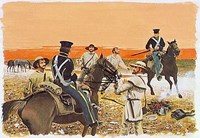
Cedar Creek & Belle Grove National Historical Park
Battle of Cedar Creek Map Activity
- Type: Guest Speakers
- Grade Levels: Upper Elementary: Third Grade through Fifth Grade

Students learn about the sequence of events related to the October 19, 1864, Battle of Cedar Creek through a hands-on interactive map activity led by a park ranger. Students will move wooden pegs around a map while the battle is explained to them by a park ranger.
Zion National Park
Earth's Features: Interpreting Patters with Topographic Maps
- Type: Lesson Plan
- Grade Levels: Upper Elementary: Third Grade through Fifth Grade

Students will identify a landform around them and create their own topographic map. They will also build a mountain out of playdough and divide the mountain into sections, which they will use to make a topographic map that shows contour lines, elevation changes, and gradients.
- Type: Lesson Plan
- Grade Levels: Middle School: Sixth Grade through Eighth Grade

How do maps show the impact of the Blackstone Canal on Worcester over time?