Watersheds

From Peak to Sea...

When rain or snow become water on the ground (surface water) it will flow downhill over the land in distinct areas called watersheds. These watersheds, also known as catchments or drainage basins, collect surface runoff and deliver it to progressively larger streams and rivers.
An aerial view of a stream emerging from a glacier high up in the mountains
Little Bremner Glacier feeds into the Little Bremner River, part of the Alaskan Region watershed.

NPS / Jacob W. Frank

Watersheds can vary in size from the very small (a few hundred square feet) to many thousands of square miles. Most large watersheds are made up of many small ones. Headwaters (where rivers start) can be found at the highest point in the watershed. Many times headwaters originate in mountainous regions and drain into lower regions.
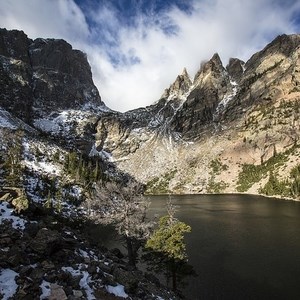
View of glacial lake in mountains.
Rocky Mountain National Park

NPS Photo/Jacob W. Frank

Watersheds and National Parks

A Continental Divide

Rocky Mountain National Park straddles the continental divide; water on the west side of this park flows into the upper Colorado River ultimately to the Pacific Ocean, water on the east side flows into the South Platte (through numerous smaller streams), ultimately into the Mississippi and on to the Gulf of America.
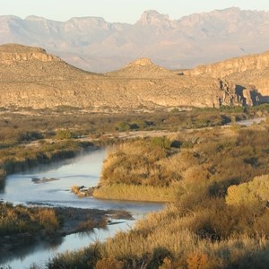
River flowing through canyon.
Big Bend National Park

NPS Photo

A Watershed All to Itself

In Big Bend National Park, southwest Texas, water flows into the Rio Grande River through numerous creeks and washes and on to The Gulf of America. This park is situated entirely within the Rio Grande Watershed.
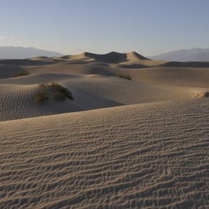
Sand dunes at dawn
Death Valley National Park

NPS Photo/ D. Pate

No Escape, Only Evaporation

Death Valley National Park is a special case. A large part of this park in the Badwater Basin watershed, which is called a closed basin. Water that flows to the lower portions of this watershed (the lowest elevation in the US) does not leave except by evaporation.

Find Your Watershed

Which watershed does your favorite National Park belong to?


Interacting with the Environment

Watersheds supply surface runoff to streams and river systems. As water moves, it interacts with forests, farms, communities and other various landscapes. As water moves through these features it can pick up sediment, contaminants and other constituents.

As humans, our activities in the watershed have the potential to impact waters. Choosing land use activities with the health of an entire watershed in mind, will help to preserve and protect natural waters.

From the Field

Showing results 1-10 of 20

    • Locations: Cumberland Gap National Historical Park
    • Offices: Cumberland Piedmont Inventory & Monitoring Network, Inventory and Monitoring Division, Natural Resources Stewardship & Science
    A person crouches to collect water from a small stream in a vial.

    In 2008, scientists from the Cumberland Piedmont Network found a concerning trend: E. coli levels were too high. The source needed to be identified and addressed for the health and safety of the thousands of humans and animals that enjoyed the park. The network's long-term water quality monitoring program not only helped to identify the issue, but it also provided the tools to evaluate the solution.

    • Locations: Rocky Mountain National Park
    • Offices: Continental Divide Research Learning Center
    Moraine Park beaver dam

    Learn more about the impacts of fire on beaver ponds and watershed resilience.

    • Locations: Antietam National Battlefield, Catoctin Mountain Park, George Washington Memorial Parkway, Harpers Ferry National Historical Park, Manassas National Battlefield Park,
    A person with a backpack and a water monitor walks across a stream away from the viewer.

    Freshwater salinization is a growing threat to aquatic life in streams of the National Capital Region. Learn more about the factors influencing salinization and the actions parks can take to help reduce salt pollution.

    • Locations: Chesapeake Bay
    A dog in a kayak on a stream.

    Plan a day filled with kayaking at the three trails of the Corsica River! With plenty of places to kayak, rest, play, and see wildlife, you can spend a whole day on the water in Queen Anne’s County!

    • Locations: Chesapeake Bay
    A snapping turtle sunning on a rock.

    Experience paddling the Susquehanna River while marveling at beautiful rock formations known as the Conowingo Islands! As long as you come prepared and educated, paddlers of all experience levels can enjoy the river!

    • Locations: Rocky Mountain National Park
    • Offices: Continental Divide Research Learning Center
    An alpine lake with jagged rock outcroppings in the background.

    Explore Long Term Data from the Loch Vale Watershed

    • Locations: North Cascades National Park
    • Offices: North Coast and Cascades Research Learning Center
    People with heavy equipment looking out over a washed out section of road

    Climate models project average warming in the Pacific Northwest of 2.1 °C by the 2040s and 3.8 °C by the 2080s. Warmer temperatures will influence precipitation patterns in the northern Cascades by shifting many watersheds from snow to rain dominated systems. These shifts will result in more autumn/winter floods, higher peak flows, and lower summer flows.

    • Locations: Point Reyes National Seashore
    • Offices: San Francisco Bay Area Inventory & Monitoring Network
    Students focus their attention on their instructor as she points to a watershed drawing.

    Every year, Watershed Stewards Program (WSP) Corpsmembers teach an educational series on watershed stewardship and environmental science in local classrooms. The Wonders of Watersheds (WOW!) curriculum provides Title I 2nd-6th grade classrooms with quality lessons to help students understand their local environments.

    • Locations: Valles Caldera National Preserve
    A narrow stream meanders through a grassy valley surrounded by evergreen trees and rock spires.

    Valles Caldera National Preserve is an important fishery and watershed protection area. Fish population surveys help scientists monitor the recovery of streams and wetlands in the Jemez Mountains after 150 years of commercial grazing, timber harvesting, mining, and road construction.

    • Locations: Golden Gate National Recreation Area, Muir Woods National Monument, Point Reyes National Seashore
    • Offices: San Francisco Bay Area Inventory & Monitoring Network
    Two young people standing in waders in the middle of a rushing creek beneath towering trees.

    A partnership between the California Conservation Corps, AmeriCorps, and California Volunteers, the Watershed Stewards Program (WSP) is dedicated to improving watershed health. Since 1994, WSP has partnered Corpsmembers with placement sites at the local, state, and federal level throughout the state of California. And since 2012, the San Francisco Bay Area Network fisheries crew at Point Reyes National Seashore has been one of the sites hosting Corpsmembers.

Last updated: February 25, 2025