Coastal Trail Sections

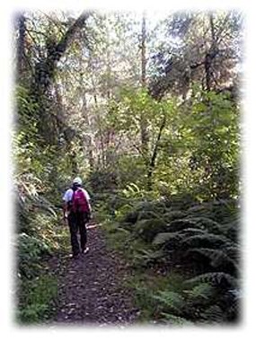
Hiker walking along the Coastal Trail.
Sitka spruce, red alder, and salmonberry lines the Coastal Trail.

Walking along a coastal bluff, gulls and sea lions cry amidst the sound of crashing breakers. A gray whale spouts occasionally in the vast blue waters below and wind whistles through the alders. Trails lead down to secluded beaches where the driftwood piles and ancient rocks hide crabs and sea stars.

Although the parks are best known for redwoods, 70 miles (142 km) of Coastal Trail offers the adventurous hiker a different experience. Delicate tidepool creatures, sandy beaches, and the jagged Pacific coastline await your exploration.

Day hikes and longer backpack trips may be done on the Coastal Trail. Permits are required at all backcountry camps and are available at the park visitor centers.

The Coastal Trail is nearly continuous in the parks; the one major detour is the Highway 101 bridge over the Klamath River. Several access points and five backcountry camps are within an easy day's walk of each other.


Crescent Beach Section

  • Location: Redwood National Park
  • Trailhead: Crescent Beach picnic area on Enderts Beach Road off Hwy 101.
  • Mileage: 3.5
  • Difficulty Level: Easy, flat
  • Description: This is a flat, meandering, kid-friendly trail that leads to a pleasant stretch of beach, perfect for beachcombing or an extended walk. Colossal Sitka spruce highlight the walk, and Roosevelt elk regularly graze in the open prairie areas adjacent to the beach. Please remember that elk are wild and can get defensive if threatened.

Last Chance Section (bikes allowed - on trail only, not at the beach)
This section of trail is often impacted by landslides. Please check with park rangers or the
current conditions page to ensure it is open.

  • Location: Redwood National Park and Del Norte Coast Redwoods State Park.
  • Trailhead: Marked north trailhead is at the end of Enderts Beach Road, 3 miles south of Crescent City. Marked south trailhead is at Hwy 101 mile marker 15.6. Look for signs marked CT.
  • Mileage: 6
  • Difficulty Level: Strenuous, numerous steep grades with switchbacks
  • Description: Starts out strenuous and then levels off on the old coast highway road. Ocean vistas greet you in the first mile; side route to Enderts Beach allows tidepool exploration (no bikes on beach). Check at the visitor center or at the trailhead bulletin board for low tide schedule. Trails ascends through red alder and Sitka spruce and meets old-growth redwood forest. Junction with Damnation Creek Trail exists at milepost 16.0.
 

DeMartin Section

  • Location: Del Norte Coast Redwoods State Park and Redwood National Park. All trees blocking the trail have been cleared.
  • Trailhead: Marked north trailhead is off Hwy 101 at mile marker 15.6. Look for signs marked CT. Marked south trailhead is at Hwy 101 mile marker 12.8. If you plan to access the trail from the south, park at the Wilson Creek picnic area and proceed cautiously across Hwy 101.
  • Mileage: 6
  • Difficulty Level: Moderate, some steep grades and switchbacks
  • Description: This hike travels through grand old-growth Sitka spruce, western hemlock, Douglas-fir, and redwoods. Climb through the forest to 10 backcountry sites with toilets. Descend to prairie bald spots and sweeping ocean panoramas. With all the berries, look out for bears!
 

Klamath Section

  • Location: Redwood National Park
  • Trailhead: Marked north trailhead begins at Wilson Creek Picnic Area off Hwy 101. Marked south trailhead begins at the Klamath River Overlook on Requa Road.
  • Mileage: 5.5
  • Difficulty Level: Moderate, some steep grades and switchbacks
  • Description: From Wilson Creek and False Klamath Cove, hike south approximately 2 miles and take a short spur to Hidden Beach and tidepools. (Check for low tide times at the visitor center). Go back to the main trail and ramble up to Klamath River Overlook where whale-watching is famous. Along the way, experience far-reaching ocean views along a mixed Sitka spruce and red alder forest path. Check out the off-shore seastacks covered with thousands of seabirds: murres, cormorants, pigeon guillemots, and more!
 

Flint Ridge Section

  • Location: Redwood National Park
  • Trailhead: Marked west trailhead is on the Coastal Drive, off Klamath Beach Road. Marked east trailhead is off Alder Camp Road, near the Old Douglas Memorial Bridge.
  • Mileage: 4.5
  • Difficulty Level: Strenuous, steep grades and switchbacks
  • Description: This hike starts at a pond and climbs through redwoods to ocean vistas. For those interested in backpacking, the Flint Ridge camp is available ¼ mile in from Coastal Drive on the western side. Expect solitude and a steep climb through one of the finest old-growth redwood forests in the parks. Marshall Pond was actually a mill pond during the logging days, but the birds don't mind!
 

Gold Bluffs Beach Section

  • Location: Prairie Creek Redwoods State Park
  • Trailhead: Marked north trailhead is on Coastal Drive 1.5 miles from Newton B. Drury Scenic Parkway junction. Marked south trailhead is on Davison Road just past the Gold Bluffs Beach entrance station.
  • Mileage: 4.8
  • Difficulty Level: Steep down to beach, then easy, level hike
  • Description: This route traverses downhill to Carruthers Cove, a secluded stretch of beach. (Check for low tide times). Backpacking is possible at Ossagon Camp. Discover 30-foot walls of ferns at Fern Canyon, a ¼-mile walk (seasonal bridges available only in the summer). Experience vast coastal prairies, elk watching, spring lupine, and seastacks jammed with seabirds. Walk the road to Gold Bluffs Beach campground.
 

Skunk Cabbage Section

  • Location: Redwood National Park
  • Trailhead: Marked north trailhead is on Davison Road just past Gold Bluffs Beach entrance station. Marked south trailhead is on Hwy 101 at mile marker 122.69.
  • Mileage: 5.25
  • Difficulty Level: Moderate, some steep grades with switchbacks
  • Description: From the beach, this trail rises through wind-sheared shrubs to the steep banks of Skunk Cabbage Creek, blanketed with ferns and lined with the heavy limbs of big-leaf maple. The trail crosses grassy hillsides bedecked with seasonal wildflowers and emerges at an overlook. It then descends into the creek drainage where you will experience the pungent smell of the creek's namesake, skunk cabbage. The trail passes massive redwoods, spruce, and western hemlocks. As you go by high canyon walls, notice the huge remnant spruce stumps. Sitka spruce was used to make WW II airplanes. The trail ends after passing through second-growth forest whose young trees grow so close together they are called "dog hair."

Last updated: November 9, 2023

Park footer

Contact Info

Mailing Address:

1111 Second Street
Crescent City, CA 95531

Phone:

707 464-6101

Contact Us