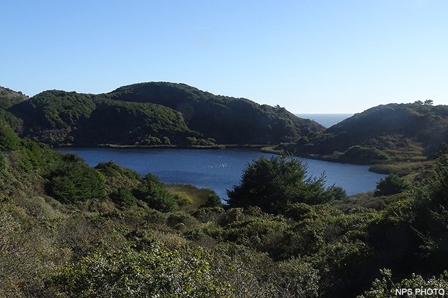
Open-water habitat, such as ponds, lakes, lagoons, and stock ponds, are characterized by standing water and are typically devoid of vegetation. Most of the ponds and lakes of Point Reyes were constructed by former landowners for stock watering or development. In 2004, Point Reyes contained more than 75 impoundments. These ponds, such as the one at Five Brooks, are now part of the "natural" landscape and support populations of songbirds, waterbirds, and amphibians, such as California red-legged frog, a species that has been displaced in other regions. Within the Olema Creek valley, a number of naturally occurring sag ponds associated with the San Andreas Fault provide unique aquatic habitat. Hike the Rift Zone Trail to find some of these sag ponds. The southwestern part of Point Reyes near Double Point is dotted with ponds and lakes derived from massive slope failure events. These naturally occurring water bodies include Bass, Crystal, Ocean, Pelican, and Wildcat Lakes. Hike from Palomarin to Wildcat Campground/Beach along the Coast Trail to view some of these lakes. Some lagoons, such as Abbotts Lagoon and Horseshoe Lagoon, have periodic saltwater intrusion with higher high tides; have open, freshwater vegetation characteristics; and provide wildlife habitat like large ponds. River otters, white pelicans, wintering waterbirds—such as ruddy duck, American coot, bufflehead, and mallard—and many gull species may be observed along the short hike to Abbotts Lagoon. Bolinas Lagoon has regular tidal influence and a broader spectrum of saltwater to freshwater habitats. Bolinas Lagoon provides shelter and haul-out sites for harbor seals. It also provides habitat for a host of migrating and wintering birds. The text above is adapted from the Coastal watershed assessment for Golden Gate National Recreation Area and Point Reyes National Seashore. ReferencePawley, A. and M. Lay. 2013. Coastal watershed assessment for Golden Gate National Recreation Area and Point Reyes National Seashore. Natural Resource Report NPS/PWR/NRR—2013/641. National Park Service, Fort Collins, Colorado. Available at https://irma.nps.gov/DataStore/Reference/Profile/2194043. (accessed 7 January 2023) Horseshoe Pond Restoration Project

Left image
Right image
In 2004, Point Reyes National Seashore proposed the restoration of natural hydrologic and shoreline process to the Horseshoe Pond area of the historic D Ranch. Horseshoe Pond is a former 35-acre coastal lagoon situated on the north side of Drakes Beach between the Kenneth C. Patrick Visitor Center and the mouth of Drakes Estero. For hundreds of years, the Horseshoe Pond area functioned as a lagoon, controlled by the sand-dominated outlet to the west side of the beach interface. Horseshoe Pond was constructed as a road access to the hunting blind at the mouth of Drakes Estero in the late 1940s by filling across the sandy beach lagoon interface with upland fill. The facility has undergone major maintenance and modification since construction, including realignment in the 1970s and the installation of a cement spillway in the late 1980s. The pond was part of the D-Ranch dairy operation acting as a water source and ultimate destination for much of the dairy waste. Constant maintenance of the dam facility was required as high seas constantly eroded and breached the dam facility. The pond breached in January 2002. The brackish waterbody was heavily influenced by tidal overwash into the pond area, as well as freshwater runoff. The configuration of the remaining dam structure prevented natural shoreline and hydrologic process from occurring at the site. The objectives of the Horseshoe Pond Restoration Project were:
|
Last updated: October 17, 2024
