Ohanapecosh

 
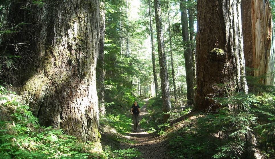
A hiker on a forested trail is dwarfed by huge old-growth tree trunks on either side of the trail.
Hike through old-growth forest along the Eastside Trail.

NPS/C. Roundtree

Located in the southeast corner of the park, Ohanapecosh, named for a Taidnapam (Upper Cowlitz) Indian habitation site along the river, is thought to mean “standing at the edge.” Situated among Douglas-firs, western red cedars, and western hemlocks, visitors to Ohanapecosh can experience the beauty and complexity of an old-growth forest. The east side of the park is also somewhat drier and sunnier than the west side, making it a good destination when Paradise and Longmire are wet and foggy. Ohanapecosh is not accessible in winter. Ohanapecosh is located 3 miles (4.8 km) north of the park boundary on State Route 123 and 42 miles ( 68 km) east of the Nisqually Entrance. Check road status for current conditions.

The article,
Ohanapecosh: Treasure of the Deep Forest, provides an overview of the history of the area.

You might also consider visiting other areas of the park like Longmire, Paradise, Carbon River-Mowich, and Sunrise.


Ohanapecosh Campground Closure in Summer 2025

The Ohanapecosh Campground rehabilitation project will provide significant upgrades to the popular campground located in the southeast corner of the park. This effort will rehabilitate the campground’s 185 campsites and nine bathrooms, replace the aging wastewater collection system, upgrade electrical and water systems, and support improvements to campground accessibility.

The project will be completed during the 2025 visitor season. The Ohanapecosh Campground and all associated structures including the visitor center, bathrooms, picnic area and amphitheater will remain closed to visitors for the duration of construction. However, the improved campground will reopen to visitors in time for the 2026 camping season.

More information is available on the Park Construction FAQs page.
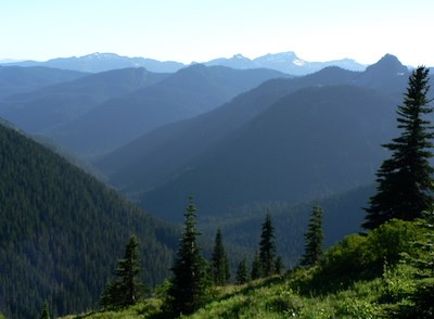
 
A forested valley and rows of rolling forested hills.
The Ohanapecosh River Valley seen from the Naches Peak Loop Trail near Tipsoo Lake.

Steve Redman

Services

See Operating Hours and Seasons for current information about these facilities.

The Ohanapecosh Visitor Center, open from June to early October, offers exhibits, guided interpretive programs, and book sales. Closed for the summer in 2025.


Camping

The Ohanapecosh Campground and picnic area is located on the banks of the peaceful Ohanapecosh River, within a majestic old-growth forest. Like the visitor center, the campground is open from late May to early October. Closed for the summer in 2025.

Fishing

Streams in the Ohanapecosh watershed are open for fishing from the first Saturday in June until October 31st. Learn more about fishing regulations.


Roadside Attractions

Box Canyon - Located on Stevens Canyon Road 12 miles (19 km) west of Ohanapecosh. From the bridge, gaze 180 feet (55 meters) below at water rushing through a narrow slot canyon carved by the Muddy Fork of the Cowlitz River.

Reflection Lakes - Drive west 19 miles (30.6 km) from Ohanapecosh on Stevens Canyon Road for a possible glimpse of Mount Rainier's reflection in these subalpine lakes.

Inspiration Point - This large pullout is 20 miles (32 km) west of Ohanapecosh on Stevens Canyon Road. It offers spectacular views of Mount Rainier and the Tatoosh Range.


Hiking

Grove of the Patriarchs Trail (1.1 mi/1.8km)
The Grove is just west of Stevens Canyon Entrance on the Ohanapecosh River. Walk the trail along the river to an island of ancient western red cedar, Douglas-fir, and western hemlock. NOTE: The Grove of the Patriarchs is CLOSED to all public entry due to flooding in November 2021 which caused significant damage to the suspension bridge that provides the only safe access to the area (News Release, 11/17/21). The Grove of the Patriarchs Trail will remain closed until the bridge can be replaced, which will first require a series of environmental evaluations and engineering work to reevaluate the bridge design. During the closure, the Grove of the Patriarchs parking lot and restrooms have normal seasonal access, along with the Eastside and Silver Falls Trails. Construction to replace the bridge is scheduled to begin summer 2027. Summers represent the only viable construction season in the park due to the heavy snow that blankets the park from roughly November through May.

Hot Springs Nature Trail (0.4 mi/0.6 km)
Around the Ohanapecosh Visitor Center, this self-guided natural trail winds through old-growth forest and the site of an early hot springs resort.

Box Canyon Loop Trail (0.5 mi/0.8 km)
Hike the loop trail around a deep, river carved gorge. Box Canyon is located 12 miles (19 km) west of Ohanapecosh.

Silver Falls Trail
Three trails varying in length lead to this spectacular waterfall:

  • State Route 123 (0.6 mi/1 km) - Begins 1.6 miles (2.6 km) north of Ohanapecosh, with parking at the pullout on the west side of the road.
  • Stevens Canyon Road (1.2 mi/1.9 km) - Begins west of Stevens Canyon Entrance, across from the Grove of the Patriarchs trailhead.
  • Ohanapecosh Campground (2.7 mi/4.3 km) - Access trail from the far end of Loop "B" of the Ohanapecosh Campground.

Indian Bar Trail (14.5 mi/23.3 km roundtrip)
Starting from Box Canyon, this trail steadily climbs as you pass Nickle Creek and continue up to the crest of the Cowlitz Divide. Upon arrival at the 5914 ft knoll with excellent views of Mount Rainier, the trail drops into Indian Bar where the Ohanapecosh River divides the large green meadow. If transportation can be arranged, Indian Bar can be combined with hiking the Summerland Trail for a beautiful one-way trip of 17 miles.

Shriner Peak Trail (8 mi/12.9 km roundtrip)
Trailhead located 3.5 miles north of the Stevens Canyon Entrance on State Route 123. This trail climbs through forest, into an old burn area, and finished with a steep ascent to the top of the ridge. Once on top of the ridge, hikers enjoy commanding views of Mount Rainier, the Ohanapecosh Valley, and the Cascade Range from the historic Shriner Peak Fire Lookout.

Three Lakes Trail (12mi /19.3 km roundtrip)
Start at Laughingwater Creek Trailhead one mile north of Ohanapecosh on State Route 123. This trail is a gentle grade as it follows Laughingwater Creek through the forest. Stop to enjoy the loud and soothing sound of the creek from its bank before the trail ascends steeply to the top of the ridge. Enjoy three mountain lakes and make your way past the third lake for splendid views of Mount Rainier.

Eastside Trail (26.2 mi/42.1 km roundtrip)
Stretching from Chinook Pass to Ohanapecosh, the full length of this trail is long. However, it can be accessed from several locations for shorter day hiking, either as an out-and-back or as a through hike by using two vehicles. The northern section of the trail by Chinook Pass features subalpine meadows and views of Mount Rainier. As you travel south, descend into old-growth forest as the trail follows the Ohanapecosh River, passing many waterfalls along the way. A spur trail connects to the popular Grove of the Patriarchs.

Enjoy further day hikes in the Ohanapecosh area, or learn about more Trails of Mount Rainier.

 
Visit our keyboard shortcuts docs for details
Duration:
6 minutes, 15 seconds

There are many ways to experience Mount Rainier National Park. One such experience is along the Eastside Trail. Along this trail, follow a snow-fed river interspersed by waterfalls through an old-growth forest. Without distracting views of the mountain, discover some of the wonders of the forest!


Last updated: November 20, 2024

Park footer

Contact Info

Mailing Address:

55210 238th Avenue East
Ashford, WA 98304

Phone:

360 569-2211

Contact Us