An official website of the United States government
Here's how you know
Official websites use .gov A
.gov website belongs to an official government
organization in the United States.
Secure .gov websites use HTTPS A
lock (
) or https:// means you've safely connected to
the .gov website. Share sensitive information only on official,
secure websites.
The Mount Rainier Wilderness, a designated wilderness area, currently encompasses approximately 228,400 acres, or 97% of Mount Rainier National Park. Located in west-central Washington on the western slopes of the Cascade Range, the wilderness includes the tallest and most prominent peak in the Cascade Range and is 65 miles southeast of the Seattle-Tacoma metropolitan area. It was congressionally designated as wilderness on November 16, 1988, by Title III of the Washington Park Wilderness Act, which required that the land be protected and managed in accordance with the Wilderness Act of 1964.
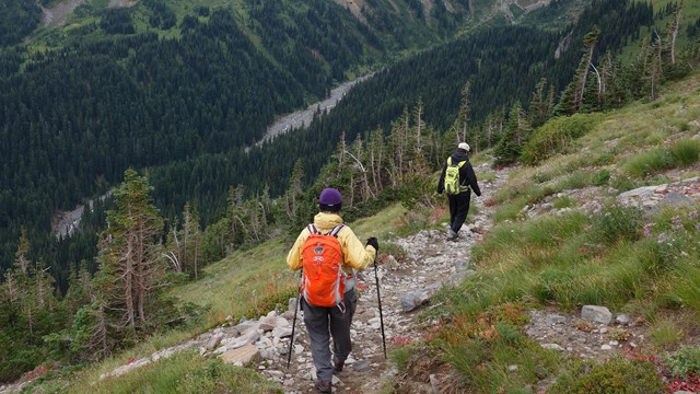
Three hikers on the paved trail at Paradise.
NPS photo
Life flourishes throughout the Mount Rainier Wilderness. In addition to the glaciers and iconic mountain summit for which the park is known, the wilderness preserves powerful meteorological and geologic processes, diverse ecologies and species, evidence of a long human history, and a laboratory for discovery. These features are at the root of the land’s wilderness character, defining its vital spirit and inspiring visitors.
Dynamic weather systems and geologic processes continually transform the landscape. Tempestuous storms bring wind, clouds, and heavy precipitation to Mount Rainier National Park; these storms provide water in every form as snow, ice, frost, rain, fog, mist, dew, and steam. Mount Rainier is a stratovolcano enveloped in glaciers and is subject to lahars, avalanches, earthquakes, debris flows, and floods. The geologic processes in the Mount Rainier Wilderness create a dynamic landscape with constantly changing terrain.
This interplay of weather and geology produces diverse ecological zones. In turn, these zones give life to diverse plant and animal species. The wilderness encompasses three distinct elevational zones: the forest, subalpine, and alpine. The zones contain rare, outstanding habitats including old growth forests where owls can breed, meadows where wildflowers can blossom, and cold-water ecosystems where aquatic species can thrive. These diverse zones afford safe refuge from logging and development on lands surrounding the Mount Rainier Wilderness.
Mount Rainier provides a refuge for visitors as well. Because the park is close to heavily populated metropolitan areas, the wilderness is an accessible retreat in which visitors can disconnect from the modern world and engage with a natural one. As a revered icon of the Pacific Northwest, the scenic grandeur of the wild peaks can be appreciated from roadsides, parking areas, and, when the weather clears, for hundreds of miles throughout the region.
Projectile point found by an ice climber, possibly used to hunt goats.
NPS photo
The wilderness is a traditional use area for indigenous tribes. Six federally recognized tribes, theCowlitz, Muckleshoot, Nisqually, Puyallup, Squaxin Island, and Yakama, have associations with the land because of its traditional and spiritual significance. The land that now composes Mount Rainier National Park was ceded through treaties such as the Treaty of Medicine Creek, Treaty of Point Elliot, and Treaty with the Yakama, or taken through colonization in the mid-1800s. The land itself serves as a time capsule of artifacts, slowly revealing remnants of human history, providing opportunities for discovery and learning that enhance our connection to past generations and ancestors.
These natural and historical features make the wilderness a focal point for research. It offers abundant opportunities to study everything from glaciers to plant and animal diseases. Given the threats posed by climate change, the ability to research the effects of warming temperatures on glaciers, disturbance regimes, and fragile habitats in Mount Rainier’s natural laboratory has global significance.
When visiting Mount Rainier Wilderness, it is important to come prepared for minor injuries, sudden weather changes, and delays to your trip itinerary. Always carry the 10 essentials when visiting the park and wilderness:
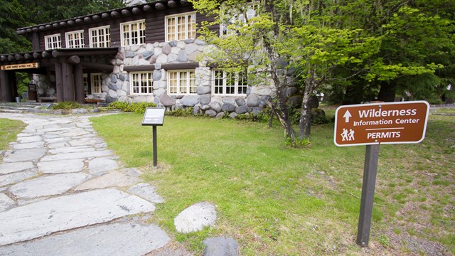
Camping and Climbing Permits
Wilderness camping permits are required year-round for camping overnight in any area of the park’s backcountry. Climbing permits are required year-round for any day or overnight travel on glaciers or above 10,000 feet in elevation, including Little Tahoma. The climbing permit also serves as the wilderness camping permit for overnight trips. A climbing permit requires the purchase of an annual climbing pass for each member of the party. Find out more about permits and requirements.
Wilderness Map
Download the Wilderness Trip Planner for additional information about the Mount Rainier Wilderness, including a wilderness map.
Leave No Trace
When traveling in the wilderness of Mount Rainier National Park and the rest of the Pacific Northwest you should be prepared to Leave No Trace, or only minimal signs of your visit. The National Park Service is a cooperating agency in the Leave No Trace national educational program. Please incorporate Leave No Trace ideas and practices into your planning and travel in the Northwest's wilderness area.